- Population
- 89,060
- 89.1K
- Elevation
- 127 m
- above sea level
- Local time
- UTC+00:00
- Europe/London · UTC+00:00
- Airports
- LBA Leeds Bradford Airport16 km
- MME Teesside International Airport58 km
About Harrogate
Harrogate is a town. Location: Harrogate District, North Yorkshire. Population: 89,060. Elevation: 127 m.
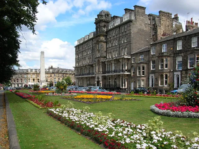
Harrogate () is a spa town and civil parish in North Yorkshire, England, historically part of the West Riding of Yorkshire. It developed as a spa resort after the discovery of its mineral waters in the 16th century, becoming a fashionable destination during the Georgian era. Its historic spa heritage remains an important part of the town's identity, alongside its gardens, architecture and cultural attractions. In the 17th century, Harrogate grew out of two smaller settlements, High Harrogate and Low Harrogate.
Source: Wikipedia · CC BY-SA 4.0
Photos of Harrogate
-

Director General of the Ordnance Survey, UK · Public domain -

Martin Dawes · CC BY-SA 2.0 -

Jennifer Petrie · CC BY-SA 2.0 -

Derek Harper · CC BY-SA 2.0 -

David Rogers · CC BY-SA 2.0


Travel notes for Harrogate
From Wikivoyage
Harrogate is an attractive Regency / Victorian spa town in North Yorkshire, with fine public gardens, and on the edge of the Yorkshire Dales. Its spa hotels have morphed into conference and "wellness" centres, and it's well stocked with good eating places, including the famous Betty's Tea Rooms. In 2024 the population was 164,100.
Understand+
In Old Norse hǫrgr gata indicates a street to a heap of stones. It was a cluster of separate villages until its spa waters became fashionable in the 17th century, and accommodation and amusements were built for its visitors. (Those amusements were essential, as the waters are cold and pungent.) Harrogate's heyday was 19th century Regency / Victorian, so it was already past its best when Agatha Christie fled here in 1926. Meanwhile it was becoming industrial, and a commuter town for nearby Leeds. However the local council realised the value of protecting Harrogate's old centre, so this retains its period charm with relatively few modern intrusions.
Get in+
By plane:
1 Leeds-Bradford International Airport (LBA IATA). This is actually more accessible from Harrogate than it is from Leeds or Bradford, as it lies north of those cities and you dodge most of the traffic on the approach; so flying to London (by BA to Heathrow LHR5) can beat the train. LBA has good connections from western Europe, e.g. Dublin, Amsterdam, Düsseldorf, Paris and Brussels, as well as domestic flights from Southampton, Exeter and Belfast. The budget carrier Jet2 is based here. Bus 737 connects LBA to Harrogate town centre. (updated Apr 2024)
From beyond western Europe, use Manchester Airport (MAN IATA). It has global connections, competitive fares, and an hourly train from Leeds.
Flying into any of the London airports involves a one-hour journey into London Kings Cross, then a 3-hour train ride north.
By train:
2 Harrogate station stands on a loop of line from Leeds (35 minutes) to York (40 minutes via Knaresborough). Direct trains from London Kings Cross run every two hours, taking 3 hours via Stevenage, Grantham, Doncaster, Wakefield and Leeds.
From other destinations change at Leeds or York for the loop train, which runs every 30 min. At Leeds this is shown as going to Poppleton, a small halt just outside York, to avoid travellers for York going the long way round. Similarly at York, it's shown as going to Burley Park in the Headingley / University quarter of Leeds.
Harrogate station is central in town and has a staffed ticket office and machines. There are toilets, a waiting room, a cafe and ATMs. There is step-free access to all platforms. Plusbus tickets are available for this station.
By road:
Source: Wikivoyage · CC BY-SA 4.0 · abridged
Climate of Harrogate
Best months for sightseeingBest months for sightseeing: June–August.
This month · November
A cold month
Day 9° · Night 3° · Rain 78 mm
- Hottest month
- July (day 20°)
- Coldest month
- January (night 1°)
- Wettest month
- December (87 mm)
- Driest month
- July (53 mm)
Bars: average monthly low and high temperature. Below: precipitation. Monthly averages for 1970–2000 at about 18 km resolution, adjusted for elevation. Highlighted months are mild and relatively dry. Source: WorldClim 2.1 (CC BY 4.0).
Show values as a table
| Month | Jan | Feb | Mar | Apr | May | Jun | Jul | Aug | Sep | Oct | Nov | Dec |
|---|---|---|---|---|---|---|---|---|---|---|---|---|
| Average high (°C) | 6° | 6° | 8° | 11° | 15° | 17° | 20° | 19° | 16° | 13° | 9° | 7° |
| Average low (°C) | 1° | 1° | 2° | 3° | 6° | 9° | 11° | 11° | 9° | 6° | 3° | 2° |
| Precipitation (mm) | 86 | 61 | 65 | 58 | 56 | 64 | 53 | 66 | 67 | 74 | 78 | 87 |
How to get to Harrogate
The nearest airport is Leeds Bradford Airport (LBA), 16 km to the southwest as the crow flies. The nearest large city is Leeds, 22 km to the south.
Airports
- Leeds Bradford Airport (LBA) Leeds, West Yorkshire 16 kmsouthwest
- Teesside International Airport (MME) Darlington, Durham 58 kmnorth
- Manchester Airport (MAN) Manchester, Greater Manchester 87 kmsouthwest
Nearby large cities
- Leeds Population: 536.3K 22 kmsouth
- Bradford Population: 366.2K 26 kmsouthwest
- York Population: 156.1K 30 kmeast
- Wakefield Population: 109.8K 34 kmsouth
- Huddersfield Population: 149K 41 kmsouthwest
Straight-line distances; road distances are longer. Airport data: OurAirports.
Day trips from Harrogate
Within 100 km: 654 historic and cultural sites, 1,170 natural sites, 207 lakes, rivers and coasts.
0–25 km99 places
- The Island Island 13 kmNE
- The Island Island 20 kmE
- Lud Stream Islands Island 23 kmW
- Beanlands Island Island 19 kmW
25–60 km579 places
- Great Britain Island 30 kmW
- The Island Island 29 kmN
- Bird Island Island 57 kmW
- The Island Island 41 kmE
60–100 km1,353 places
- Seaton Carew Beach Beach 78 kmN
- Redcar Beach Beach 76 kmNE
- Whitby Beach Beach 81 kmNE
- North Beach Beach 90 kmE
Straight-line distances.
Harrogate and similar cities
Side by side with cities of similar size in the same country: population, elevation and climate.
| Measure | Harrogate | Hartlepool | Grays | Chester |
|---|---|---|---|---|
| Population | 89.1K | 88.9K | 89.8K | 90.5K |
| Elevation | 127 m | 11 m | 13 m | 34 m |
| Summer day (hottest month) | 20° | 20° | 22° | 20° |
| Winter night (coldest month) | 1° | 2° | 2° | 1° |
| Annual rainfall | 815 mm | 751 mm | 645 mm | 695 mm |
| Best months | Jun–Aug | Jun–Sep | Jun–Aug | Jun–Aug |
| Distance | — | 80 km | 307 km | 126 km |
Climate values are 1970–2000 monthly averages; straight-line distance.
Nearby attractions & nature
Everything nearby-
Almsford Bridge Landmark, Harrogate District3 km SE
-
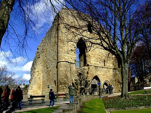 Knaresborough Castle Historic site, Knaresborough4.8 km E
-
Walton Head Whin Mountain, Kirkby Overblow5 km S
-
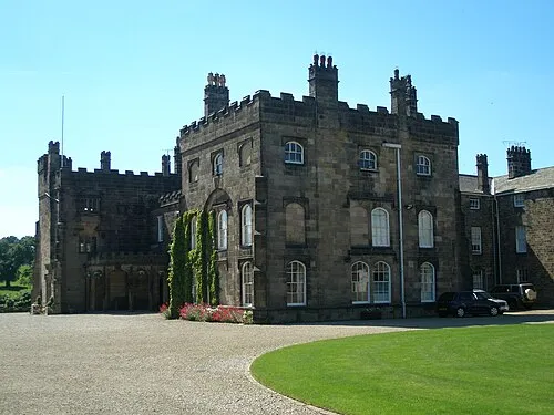 Ripley Castle Historic site, Ripley5.9 km N
-
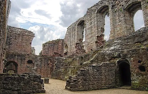 Spofforth Castle Historic site, Spofforth with Stockeld6.9 km SE
-
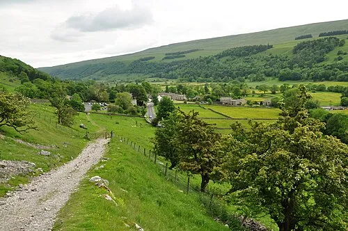 Wharfedale Natural site, England13 km SE
-
Great Alms Cliff Mountain, North Rigton7.1 km SW
-
Almscliff Crag Mountain, Stainburn7.1 km SW
Other cities and towns in Harrogate District
-
Knaresborough Town, Knaresborough5 km NE
-
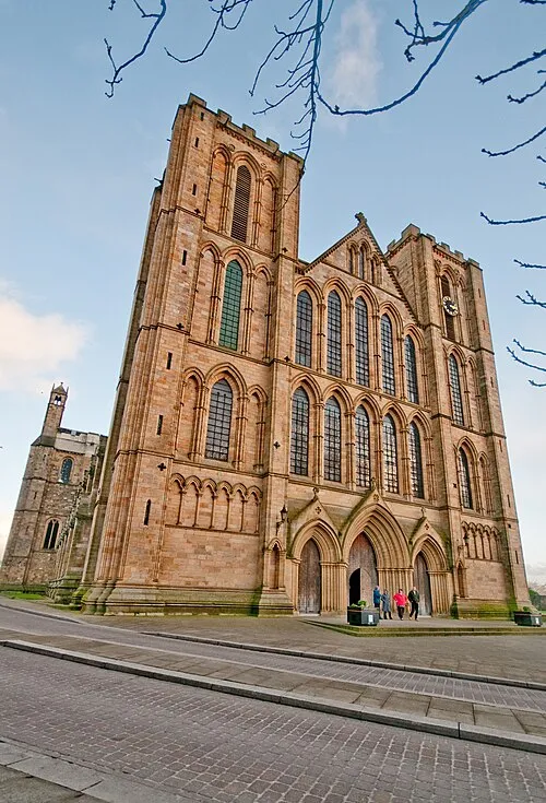 Ripon Town, Ripon16 km N
Sources & licences
Data last updated: · 2 independent sources