How Hill
Located in Markington with Wallerthwaite, Harrogate District Coordinates: 54°05′55″ N 1°34′46″ W
- Elevation
- 175 m
- above sea level
- Local time
- UTC+00:00
- Europe/London · UTC+00:00
- Airports
- LBA Leeds Bradford Airport26 km
- MME Teesside International Airport47 km
About How Hill
How Hill is a mountain. Location: Markington with Wallerthwaite, Harrogate District. Elevation: 175 m. The best months to visit are June–August. The nearest airport is Leeds Bradford Airport (26 km). Nearby sights include Clip'd Thorn Hill and Horse Hill.
Photos of How Hill
-
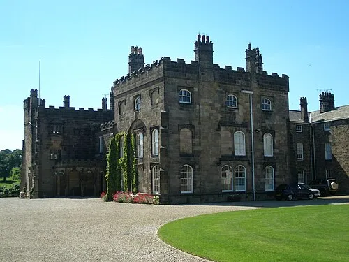
Ripley Castle Dposte46 · Public domain

Climate of How Hill
Best months for sightseeingBest months for sightseeing: June–August.
This month · November
A cold month
Day 9° · Night 3° · Rain 74 mm
- Hottest month
- July (day 19°)
- Coldest month
- January (night 0°)
- Wettest month
- December (80 mm)
- Driest month
- April (54 mm)
Bars: average monthly low and high temperature. Below: precipitation. Monthly averages for 1970–2000 at about 18 km resolution, adjusted for elevation. Highlighted months are mild and relatively dry. Source: WorldClim 2.1 (CC BY 4.0).
Show values as a table
| Month | Jan | Feb | Mar | Apr | May | Jun | Jul | Aug | Sep | Oct | Nov | Dec |
|---|---|---|---|---|---|---|---|---|---|---|---|---|
| Average high (°C) | 6° | 6° | 8° | 10° | 14° | 17° | 19° | 19° | 16° | 12° | 9° | 7° |
| Average low (°C) | 0° | 0° | 2° | 3° | 5° | 8° | 11° | 10° | 9° | 6° | 3° | 1° |
| Precipitation (mm) | 78 | 55 | 61 | 54 | 54 | 61 | 54 | 67 | 65 | 71 | 74 | 80 |
How to get to How Hill
The nearest airport is Leeds Bradford Airport (LBA), 26 km to the south as the crow flies. The nearest large city is Leeds, 34 km to the south.
Airports
- Leeds Bradford Airport (LBA) Leeds, West Yorkshire 26 kmsouth
- Teesside International Airport (MME) Darlington, Durham 47 kmnorth
- Manchester Airport (MAN) Manchester, Greater Manchester 95 kmsouthwest
Nearby large cities
- Leeds Population: 536.3K 34 kmsouth
- Bradford Population: 366.2K 36 kmsouth
- York Population: 156.1K 36 kmsoutheast
- Wakefield Population: 109.8K 47 kmsouth
- Huddersfield Population: 149K 52 kmsouth
Straight-line distances; road distances are longer. Airport data: OurAirports.
Day trips from How Hill
Within 100 km: 697 historic and cultural sites, 1,244 natural sites, 237 lakes, rivers and coasts.
0–25 km92 places
- The Island Island 16 kmN
- The Island Island 8 kmE
- The Island Island 23 kmE
- Lud Stream Islands Island 23 kmSW
25–60 km588 places
- Great Britain Island 30 kmW
- Bird Island Island 56 kmW
- The Island Island 47 kmSE
- Beal Island Island 49 kmSE
60–100 km1,498 places
- Seaton Carew Beach Beach 67 kmN
- Redcar Beach Beach 67 kmNE
- Whitby Beach Beach 75 kmNE
- North Beach Beach 92 kmE
Straight-line distances.
Nearest towns and villages
-
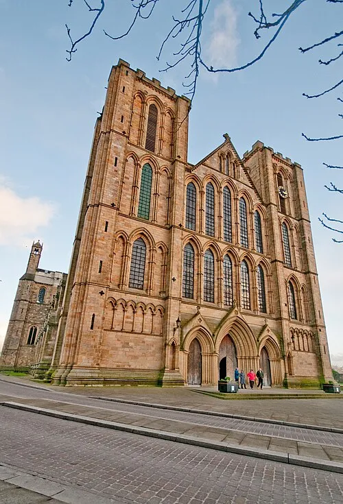 Ripon Town, Ripon5.3 km NE
-
Fountains Abbey Village, Markington with Wallerthwaite1.1 km NW
-
Ingerthorpe Village, Markington with Wallerthwaite2.1 km SE
-
Markington Village, Markington with Wallerthwaite2.5 km SE
-
Aldfield Village, Aldfield2.6 km N
-
Markingfield Hall Village, Harrogate District2.4 km E
Nearby attractions & nature
Everything nearby-
Clip'd Thorn Hill Mountain, Aldfield3.1 km NW
-
Horse Hill Mountain, Markington with Wallerthwaite3.4 km S
-
Fountains Abbey Historic site, Lindrick with Studley Royal and Fountains1.2 km N
-
Markington Historic site, Markington with Wallerthwaite2.7 km SE
-
River Skell River, England4.3 km NE
-
Hollin Head Wood Mountain, North Stainley with Sleningford6.2 km N
-
Brimham Rocks Mountain, Hartwith cum Winsley7.3 km W
-
River Laver River, England5.6 km NE
Sources & licences
Data last updated: