Belford Westhall Motte
Located in Belford, Northumberland Coordinates: 55°35′58″ N 1°50′17″ W
- Local time
- UTC+00:00
- Europe/London · UTC+00:00
- Elevation
- 61 m
- above sea level
- Airports
- NCL Newcastle International Airport63 km
- EDI Edinburgh Airport104 km
About Belford Westhall Motte
Belford Westhall Motte is a historic site. Location: Belford, Northumberland. The best months to visit are June–September. The nearest airport is Newcastle International Airport (63 km). Nearby sights include Belford Westhall Tower and Newland Tower.
Photos of Belford Westhall Motte
-
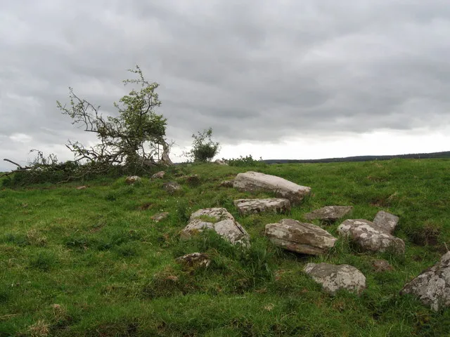
Fenham Castle Norman MacKillop · CC BY-SA 2.0

Climate of Belford Westhall Motte
Best months for sightseeingBest months for sightseeing: June–September.
This month · November
A cold month
Day 8° · Night 2° · Rain 79 mm
- Hottest month
- July (day 19°)
- Coldest month
- January (night 0°)
- Wettest month
- November (79 mm)
- Driest month
- April (52 mm)
Bars: average monthly low and high temperature. Below: precipitation. Monthly averages for 1970–2000 at about 18 km resolution, adjusted for elevation. Highlighted months are mild and relatively dry. Source: WorldClim 2.1 (CC BY 4.0).
Show values as a table
| Month | Jan | Feb | Mar | Apr | May | Jun | Jul | Aug | Sep | Oct | Nov | Dec |
|---|---|---|---|---|---|---|---|---|---|---|---|---|
| Average high (°C) | 6° | 6° | 9° | 11° | 14° | 17° | 19° | 19° | 16° | 13° | 8° | 6° |
| Average low (°C) | 0° | 0° | 1° | 3° | 5° | 8° | 10° | 10° | 8° | 6° | 2° | 1° |
| Precipitation (mm) | 78 | 57 | 59 | 52 | 56 | 56 | 58 | 75 | 63 | 76 | 79 | 74 |
Other places to visit in this season: June July August September
How to get to Belford Westhall Motte
The nearest airport is Newcastle International Airport (NCL), 63 km to the south as the crow flies. The nearest large city is Newcastle upon Tyne, 71 km to the south.
Airports
- Newcastle International Airport (NCL) Newcastle upon Tyne, Tyne and Wear 63 kmsouth
- Edinburgh Airport (EDI) Ingliston, Edinburgh 104 kmnorthwest
- Dundee Airport (DND) Dundee 120 kmnorthwest
Nearby large cities
- Newcastle upon Tyne Population: 300.1K 71 kmsouth
- Sunderland Population: 170.1K 83 kmsouth
- Edinburgh Population: 515K 94 kmnorthwest
- Dundee Population: 148.2K 120 kmnorthwest
- Middlesbrough Population: 142.7K 120 kmsouth
Straight-line distances; road distances are longer. Airport data: OurAirports.
Day trips from Belford Westhall Motte
Within 100 km: 486 historic and cultural sites, 1,167 natural sites, 319 lakes, rivers and coasts.
0–25 km252 places
- Cocklawburn Beach Beach 16 kmNW
- Cheswick Sands Beach 15 kmNW
- Longhoughton Beach Beach 24 kmSE
- South Wamses Island 14 kmE
25–60 km486 places
- Coquet Island Island 35 kmSE
- Wooden Anna Island 37 kmW
- Carr's Island Island 35 kmS
- Great Haugh Island 25 kmW
60–100 km1,234 places
- Portobello Beach Beach 89 kmNW
- Gullane Beach Beach 80 kmNW
- Seacliff Beach Beach 71 kmNW
- Saint Mary’s Island Island 64 kmSE
Straight-line distances.
Nearby attractions & nature
Everything nearby-
Belford Westhall Tower Landmark, Belford<0.1 km SW
-
Newland Tower Landmark, Belford2.1 km SE
-
Easington Grange Landmark, Easington2.4 km NE
-
Detchant Tower Landmark, Middleton3 km NW
-
Elwick 1 Landmark, Middleton3.1 km NE
-
Outchester Tower Landmark, Easington3.8 km E
-
Long Hills Mountain, Easington3 km E
-
Hazelrigg Tower Landmark, Chatton4.7 km W
Nearest towns and villages
Sources & licences
Data last updated: · 2 independent sources