Field Mill
Located in Mansfield District, Nottinghamshire Coordinates: 53°08′17″ N 1°12′03″ W

- Local time
- UTC+00:00
- Europe/London · UTC+00:00
- Elevation
- 118 m
- above sea level
- Airports
- EMA East Midlands Airport35 km
- HUY Humberside Airport75 km
About Field Mill
Field Mill is a landmark. Location: Mansfield District, Nottinghamshire.
Field Mill, currently known as One Call Stadium for sponsorship reasons, is a football ground in Mansfield, Nottinghamshire, England, and the home of Mansfield Town Football Club. It is the oldest ground in the Football League, hosting football since 1861, although some reports date it back as far as 1850. The stadium has a capacity of 10,000 when fully open, but due to safety restrictions and the closure of the North stand, it can presently hold just 7,276.
Source: Wikipedia · CC BY-SA 4.0
At a glance
- Opened
- 1861
Source: Wikidata
Photos of Field Mill
-

Neil Theasby · CC BY-SA 2.0 -

Neil Theasby · CC BY-SA 2.0 -

David Hallam-Jones · CC BY-SA 2.0 -

David Hallam-Jones · CC BY-SA 2.0 -

Rileyandco · CC BY-SA 4.0


Climate of Field Mill
Best months for sightseeingBest months for sightseeing: June–August.
This month · November
A cold month
Day 9° · Night 3° · Rain 68 mm
- Hottest month
- July (day 21°)
- Coldest month
- February (night 1°)
- Wettest month
- December (74 mm)
- Driest month
- July (52 mm)
Bars: average monthly low and high temperature. Below: precipitation. Monthly averages for 1970–2000 at about 18 km resolution, adjusted for elevation. Highlighted months are mild and relatively dry. Source: WorldClim 2.1 (CC BY 4.0).
Show values as a table
| Month | Jan | Feb | Mar | Apr | May | Jun | Jul | Aug | Sep | Oct | Nov | Dec |
|---|---|---|---|---|---|---|---|---|---|---|---|---|
| Average high (°C) | 6° | 7° | 9° | 12° | 15° | 19° | 21° | 21° | 17° | 13° | 9° | 7° |
| Average low (°C) | 1° | 1° | 2° | 3° | 6° | 9° | 11° | 11° | 9° | 6° | 3° | 2° |
| Precipitation (mm) | 70 | 54 | 58 | 54 | 53 | 62 | 52 | 59 | 61 | 66 | 68 | 74 |
How to get to Field Mill
The nearest airport is East Midlands Airport (EMA), 35 km to the south as the crow flies. The nearest large city is Mansfield, 1 km to the south.
Airports
- East Midlands Airport (EMA) Nottingham, Leicestershire 35 kmsouth
- Humberside Airport (HUY) Grimsby, Lincolnshire 75 kmnortheast
- Manchester Airport (MAN) Manchester, Greater Manchester 76 kmwest
Nearby large cities
- Mansfield Population: 172K 1 kmsouth
- Chesterfield Population: 113.1K 19 kmnorthwest
- Nottingham Population: 323.6K 21 kmsouth
- Derby Population: 270.5K 30 kmsouthwest
- Sheffield Population: 556.5K 32 kmnorthwest
Straight-line distances; road distances are longer. Airport data: OurAirports.
Day trips from Field Mill
Within 100 km: 575 historic and cultural sites, 671 natural sites, 124 lakes, rivers and coasts.
0–25 km95 places
- Bolehill Mountain 25 kmW
- Newtonwood Lane Mountain 8 kmW
- Bilberry Knoll Mountain 23 kmW
- Bessalone Mountain 21 kmSW
25–60 km437 places
- Newark Island Island 26 kmE
- Horninglow island Island 46 kmSW
- Don Island Island 34 kmN
- Torksey Island Island 35 kmNE
60–100 km838 places
- Sunk Island Island 95 kmNE
- Read's Island Island 75 kmNE
- Spurn Island Island 100 kmNE
- Whitton Island Island 73 kmNE
Straight-line distances.
Nearby attractions & nature
Everything nearby-
Mansfield Woodhouse Colliery Mountain, Mansfield District2.9 km N
-
Mansfield Hill Mountain, Mansfield District4.1 km E
-
Clipstone Mediumwave Transmitter Landmark, Clipstone6.1 km NE
-
Kirkby in Ashfield Castle Hill Camp Historic site, Ashfield District6.4 km SW
-
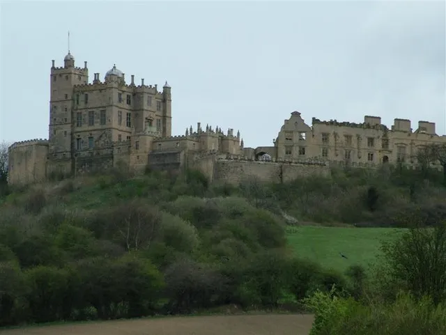 Bolsover Castle Historic site, Old Bolsover12 km NW
-
Robin Hood's Hills Mountain, Ashfield District5.2 km SW
-
Clipstone Historic site, Clipstone8 km NE
-
Wynns Castle Historic site, South Normanton8.4 km SW
Nearest towns and villages
-
Mansfield City, Mansfield District0.5 km S
-
Mansfield Woodhouse Town, Mansfield District3 km N
-
 Sutton in Ashfield Town, Ashfield District4.3 km W
-
Bleak Hills Neighbourhood, Mansfield District1.3 km SW
Sources & licences
Data last updated: · 2 independent sources