- Population
- 81,964
- 82K
- Elevation
- 73 m
- above sea level
- Local time
- UTC+00:00
- Europe/London · UTC+00:00
- Airports
- BHX Birmingham Airport20 km
- EMA East Midlands Airport33 km
About Tamworth
Tamworth is a town. Location: Tamworth District, Staffordshire. Population: 81,964. Elevation: 73 m.
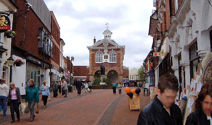
Tamworth (, ) is a market town and borough in Staffordshire, England, 14 miles (23 km) north-east of Birmingham. The town borders North Warwickshire to the east and south, and the Lichfield District to the north, southwest and west. The town takes its name from the River Tame, which flows through it. The population of Tamworth borough (2025) was 81,392. The wider urban area had a population of 81,964.
Source: Wikipedia · CC BY-SA 4.0
Photos of Tamworth
-

John Carver · CC BY-SA 2.0 -

Chris' Buet · CC BY-SA 2.0 -

Chris' Buet · CC BY-SA 2.0 -
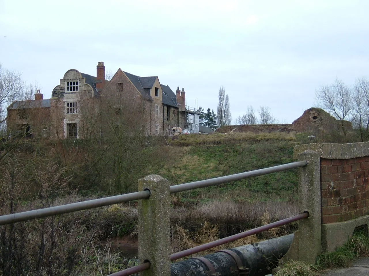
Kingsbury Hall David Godfrey · CC BY-SA 2.0


Travel notes for Tamworth
From Wikivoyage
Tamworth is a town in Staffordshire in the English Midlands, with a population of 78,700 in 2021. It has a medieval castle, and a series of leisure facilities and nature parks along the valley of the River Tame.
Understand+
When the Romans left England in 409 AD, it split into 7 Anglo-Saxon kingdoms. Mercia was the strongest of these and began to absorb the others, and in so far as Anglo-Saxon rulers had fixed capitals, that of Mercia was Tomworðig, "the open meadow by the River Tame". When the Normans arrived they converted Tamworth's wooden royal stronghold into a stone castle which still stands, or at least teeters. The town thereafter was a quiet provincial place, occasionally enlivened by fire, plague, civil war and any other Riders of the Apocalypse, until the 18th century Industrial Revolution. Coal was mined hereabouts, and canals were constructed to take this and other heavy goods to where they would earn a profit. The Peel family became wealthy in the textile trade and Sir Robert Peel (1788-1850) was the local MP and twice Prime Minister: his "Tamworth Manifesto" founded the UK Conservative Party, and he reformed the police service.
Tamworth grew further from the 1950s as overspill housing for Birmingham, and as an industrial centre. "Reliant" cars were made here until 1998, including the three-wheeled Robin.
Get in+
By plane:
Birmingham Airport (BHX IATA) 17 miles south has a good range of flights within Europe. Take the train from the airport to Birmingham New Street and change for the Cross Country train to Tamworth. By road take M42 north to Junction 10.
East Midlands Airport (EMA IATA) 27 miles northeast has budget flights to the Med and a few other popular destinations. Join A42 southbound onto M42 to Junction 10.
Manchester Airport (MAN IATA) has an excellent range of medium and long-haul flights. Take the train to Manchester Piccadilly then south via Crewe.
By train:
1 Tamworth station has two lines criss-crossing. The lower level is on the West Coast Main Line, with hourly trains from London Euston taking 90 min via Milton Keynes, Rugby, Nuneaton and Atherstone. These continue north to Lichfield, Rugeley, Stafford and Crewe (another 45 min) - change there for Manchester, Liverpool, North Wales and Preston.
The upper level is on the Cross Country Main Line. Trains run hourly from Penzance via Exeter, Plymouth, Bristol and Birmingham, continuing north to Derby, Nottingham, Sheffield, Leeds, York, Newcastle upon Tyne and Edinburgh. Trains also run from Cardiff every hour or two, via Newport, Chepstow, Gloucester, Cheltenham Spa and Birmingham. Trains between Birmingham and Tamworth are four times an hour, taking 20 min, and you can reach Tamworth from London in two hours by changing there.
The station is north side of town centre. It has a ticket office and machines, and toilets, but the waiting room is closed ufn. There is normally step-free access to all platforms, but the lift to Platform 3 (towards Derby and Sheffield) is out of action ufn.
Wilncote is a platform halt two miles south of Tamworth station. It has hourly trains from Birmingham heading to Derby and Nottingham.
By road:
From Birmingham head north on M42, leave at Jcn 10 and follow A5 into town.
By bus:
Long-distance coaches don't visit Tamworth, change in Birmingham for the local bus.
Source: Wikivoyage · CC BY-SA 4.0 · abridged
Climate of Tamworth
Best months for sightseeingBest months for sightseeing: June–August.
This month · November
A cold month
Day 10° · Night 4° · Rain 66 mm
- Hottest month
- July (day 21°)
- Coldest month
- February (night 1°)
- Wettest month
- December (68 mm)
- Driest month
- February (48 mm)
Bars: average monthly low and high temperature. Below: precipitation. Monthly averages for 1970–2000 at about 18 km resolution, adjusted for elevation. Highlighted months are mild and relatively dry. Source: WorldClim 2.1 (CC BY 4.0).
Show values as a table
| Month | Jan | Feb | Mar | Apr | May | Jun | Jul | Aug | Sep | Oct | Nov | Dec |
|---|---|---|---|---|---|---|---|---|---|---|---|---|
| Average high (°C) | 7° | 7° | 10° | 12° | 16° | 18° | 21° | 21° | 18° | 14° | 10° | 8° |
| Average low (°C) | 1° | 1° | 2° | 4° | 6° | 9° | 12° | 11° | 9° | 6° | 4° | 2° |
| Precipitation (mm) | 66 | 48 | 51 | 48 | 52 | 62 | 50 | 64 | 60 | 61 | 66 | 68 |
How to get to Tamworth
The nearest airport is Birmingham Airport (BHX), 20 km to the south as the crow flies. The nearest large city is Sutton Coldfield, 11 km to the southwest.
Airports
- Birmingham Airport (BHX) Birmingham, West Midlands 20 kmsouth
- East Midlands Airport (EMA) Nottingham, Leicestershire 33 kmnortheast
- Manchester Airport (MAN) Manchester, Greater Manchester 89 kmnorthwest
Nearby large cities
- Sutton Coldfield Population: 109.9K 11 kmsouthwest
- Burton-on-Trent Population: 122.2K 20 kmnorth
- Walsall Population: 172.1K 20 kmwest
- Birmingham Population: 1.2M 22 kmsouthwest
- West Bromwich Population: 103.1K 24 kmsouthwest
Straight-line distances; road distances are longer. Airport data: OurAirports.
Day trips from Tamworth
Within 100 km: 778 historic and cultural sites, 972 natural sites, 129 lakes, rivers and coasts.
0–25 km89 places
- Horninglow island Island 20 kmN
- Crescent Wood Island Island 21 kmS
- Brown's Island Island 10 kmN
- Chasewater Lake 18 kmW
25–60 km499 places
- Barton Island Island 44 kmNE
- The Islands Island 44 kmE
- Holme Nook Island 38 kmNE
- Holmes's Islands Island 42 kmN
60–100 km1,291 places
- Alney Island Island 94 kmSW
- Newark Island Island 76 kmNE
- Park Island Island 97 kmE
- Glover's Island Island 62 kmS
Straight-line distances.
Tamworth and similar cities
Side by side with cities of similar size in the same country: population, elevation and climate.
| Measure | Tamworth | Scunthorpe | Halifax | Weston-super-Mare |
|---|---|---|---|---|
| Population | 82K | 81.6K | 82.6K | 82.9K |
| Elevation | 73 m | 46 m | 150 m | 13 m |
| Summer day (hottest month) | 21° | 21° | 20° | 21° |
| Winter night (coldest month) | 1° | 1° | 1° | 2° |
| Annual rainfall | 696 mm | 603 mm | 1,157 mm | 901 mm |
| Best months | Jun–Aug | Jun–Sep | Jun–Aug | Jun–Aug |
| Distance | — | 126 km | 121 km | 168 km |
Climate values are 1970–2000 monthly averages; straight-line distance.
Nearby attractions & nature
Everything nearby-
Tamworth Castle Historic site, Tamworth District0.4 km S
-
The Lamb Ground Landmark, Tamworth District0.8 km SE
-
River Anker River, England2.1 km SE
-
The Devil's Dressing Room Mountain, Hints4.3 km W
-
Lichfield transmitting station Landmark, Hints4.3 km W
-
Statfold Barn Railway Museum, Shuttington4.5 km NE
-
Pooley Country Park Mountain, Polesworth5 km E
-
Baddesley Colliery Mountain, Dordon6 km SE
Sources & licences
Data last updated: · 2 independent sources