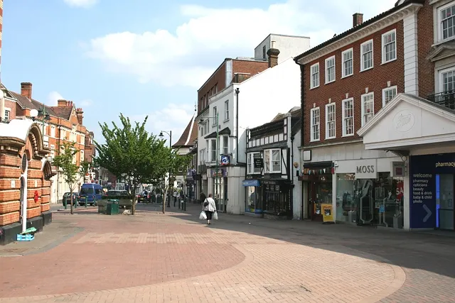
- Population
- 31,489
- 31.5K
- Elevation
- 57 m
- above sea level
- Local time
- UTC+00:00
- Europe/London · UTC+00:00
- Airports
- LHR London Heathrow Airport20 km
- LGW London Gatwick Airport21 km
About Epsom
Epsom is a town. Location: Epsom and Ewell District, Surrey. Population: 31,489. Elevation: 57 m.
Epsom is a town in the borough of Epsom and Ewell in Surrey, England, about 14 miles (22 kilometres) south of central London. The town is first recorded as Ebesham in the 10th century and its name probably derives from that of a Saxon landowner. The earliest evidence of human activity is from the mid-Bronze Age, but the modern settlement probably grew up in the area surrounding St Martin's Church in the 6th or 7th centuries and the street pattern is thought to have become established in the Middle Ages.
Source: Wikipedia · CC BY-SA 4.0
Photos of Epsom
-

Cristian Bortes from Cluj-Napoca, Romania · CC BY 2.0 -

Cristian Bortes from Cluj-Napoca, Romania · CC BY 2.0 -

allen watkin from London, UK · CC BY-SA 2.0 -

Mertbiol · CC0 -

Au Morandarte from Chiswick/Romford, London, England · CC BY-SA 2.0


Travel notes for Epsom
From Wikivoyage
Epsom is a residential town of about 31,500 people (2011) in Surrey, 15 miles (35 km) south west of London, just outside the metropolitan boundary of Greater London. Its racecourse is home to the Epsom Derby, a two-day festival of horse racing dating back to 1780.
Understand+
The compact borough of Epsom and Ewell is mainly residential. Some office space and light industry form a corridor between Epsom town centre and the village of Ewell. East Street in Epsom runs through the heart of this commercial district. The town centre is dominated by the Ashley Centre shopping mall, which contains typical chain outlets such as Boots, H&M, Marks & Spencer, Monsoon, Next, Waitrose and WH Smith.
Epsom borders Reigate and Banstead at Epsom Downs. The Downs are an upland chalk ridge marked by steep slopes rising from the south. This rural enclave takes up a quarter of the borough's land area and is home to the famous Epsom Downs racecourse and grandstand, the venue of the annual Epsom Derby horseracing event in June.
Epsom Council website
Get in+
By road:
Epsom lies just to the southwest of London Metropolitan Area, but inside the M25 orbital motorway. The shortest main road between central London and Epsom is the A3, starting at London Bridge, switching to the A24 at Clapham Common, through to Epsom town centre. The A24 makes barely any diversion from the SSW compass point.
Between London and Epsom this Roman route (built c. 100 AD) cannot be widened because of 19th and later 20th century urbanisation and it hasn't been bypassed except for two short sections around Merton High Street and Ewell village centre. The distance is only 15 miles, but during the daytime and the morning and evening rush hours can take an hour or more to drive.
A faster journey from central London follows the A3 after Clapham Common and turns off onto the A240 spur road at Tolworth junction, to approach Epsom from the northwest. This route follows a two- or three-lane dual carriageway most of the way. The A3 is easily accessible from central London.
The M25 serves Epsom from all other parts of the UK. Leave the motorway at Junction 9 and road signs for Epsom direct you onto the A24 from the south. The distance from the motorway junction is miles.
By train:
Trains from London to 1 Epsom station are slow but are still quicker than the road journey. The average journey time of 36 minutes is unimpressive for an 18-mile (29-km) journey, but at least trains depart frequently. Two timetables combined provide eight trains an hour between London and Epsom from Monday to Saturday, and four an hour on Sundays and Bank Holidays. The fastest times are 33 minutes from London Victoria station (operated by Southern Railway) and 35 minutes from London Waterloo station (operated by South Western Railway). An additional hourly service to Epsom, from London Victoria, takes passengers on a 51-minute circuitous route via West Croydon. Southern Railway also operates a handful of peak-hour commuter trains to London Bridge, which also take 50–55 minutes.
Source: Wikivoyage · CC BY-SA 4.0 · abridged
Places bordering Epsom
- Ewell
Climate of Epsom
Best months for sightseeingBest months for sightseeing: June–August.
This month · November
A cold month
Day 11° · Night 4° · Rain 72 mm
- Hottest month
- July (day 22°)
- Coldest month
- February (night 1°)
- Wettest month
- December (77 mm)
- Driest month
- July (42 mm)
Bars: average monthly low and high temperature. Below: precipitation. Monthly averages for 1970–2000 at about 18 km resolution, adjusted for elevation. Highlighted months are mild and relatively dry. Source: WorldClim 2.1 (CC BY 4.0).
Show values as a table
| Month | Jan | Feb | Mar | Apr | May | Jun | Jul | Aug | Sep | Oct | Nov | Dec |
|---|---|---|---|---|---|---|---|---|---|---|---|---|
| Average high (°C) | 7° | 8° | 10° | 13° | 17° | 20° | 22° | 22° | 19° | 15° | 11° | 8° |
| Average low (°C) | 2° | 1° | 3° | 4° | 7° | 10° | 12° | 12° | 10° | 7° | 4° | 3° |
| Precipitation (mm) | 76 | 50 | 56 | 47 | 51 | 55 | 42 | 54 | 62 | 71 | 72 | 77 |
How to get to Epsom
The nearest airport is London Heathrow Airport (LHR), 20 km to the northwest as the crow flies. The nearest large city is Sutton, 5 km to the northeast.
Airports
- London Heathrow Airport (LHR) London 20 kmnorthwest
- London Gatwick Airport (LGW) London 21 kmsouth
- London City Airport (LCY) London 30 kmnortheast
Nearby large cities
- Sutton Population: 187.6K 5 kmnortheast
- Croydon Population: 173.3K 13 kmnortheast
- Woking Population: 103.9K 20 kmwest
- City of Westminster Population: 247.6K 21 kmnortheast
- London Population: 9M 22 kmnortheast
Straight-line distances; road distances are longer. Airport data: OurAirports.
Day trips from Epsom
Within 100 km: 809 historic and cultural sites, 634 natural sites, 322 lakes, rivers and coasts.
0–25 km406 places
- Holm Island Island 22 kmNW
- Sunbury Court Island 12 kmNW
- Rivermead Island 12 kmNW
- Lot's Ait Island 17 kmN
25–60 km611 places
- White Hart Lane Landmark 33 kmNE
- Spotlites @ Kings Theatre Attraction 56 kmE
- St Nicholas Church Shoreham Attraction 54 kmS
- The Marlipins Museum Museum 55 kmS
60–100 km748 places
- Portsea Island Natural site 81 kmSW
- Isle of Sheppey Island 77 kmE
- Camber Sands Beach 87 kmSE
- Calshot Beach Beach 93 kmSW
Straight-line distances.
Nearby attractions & nature
Everything nearby-
North Looe Mediumwave Transmitter Landmark, Epsom and Ewell District2.4 km E
-
Chessington Castle Hill Historic site, Kingston upon Thames3.4 km NW
-
Nonsuch Park Natural site, Epsom and Ewell District4 km NE
-
Nonsuch Palace Historic site, Epsom and Ewell District4.2 km NE
-
Pot Wood Natural site, Reigate and Banstead District4 km SE
-
Merland Rise Recreational Ground Natural site, Reigate and Banstead District4.1 km SE
-
Telegraph Hill Mountain, Kingston upon Thames4 km W
-
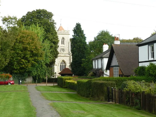 Walton on the Hill Historic site, Reigate and Banstead District5.6 km S
Sources & licences
Data last updated: · 2 independent sources