- Population
- 17,747
- 17.7K
- Elevation
- 59 m
- above sea level
- Local time
- UTC+00:00
- Europe/London · UTC+00:00
- Airports
- LGW London Gatwick Airport14 km
- LHR London Heathrow Airport28 km
About Dorking
Dorking is a town. Location: Holmwood, Mole Valley. Population: 17,747. Elevation: 59 m.
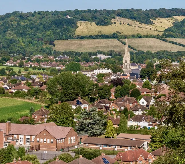
Dorking () is a market town in Surrey in South East England about 21 mi (34 km) south-west of London. It is in Mole Valley District and the council headquarters are to the east of the centre. The High Street runs roughly east–west, parallel to the Pipp Brook and along the northern face of an outcrop of Lower Greensand. The town is bordered on three sides by the Surrey Hills National Landscape and is close to Box Hill and Leith Hill.
Source: Wikipedia · CC BY-SA 4.0
At a glance
- Area
- 6.6 km²
Source: Wikidata
Photos of Dorking
-

Antiquary · CC BY-SA 4.0 -

Ademac · CC BY-SA 4.0 -

Ademac · CC BY-SA 4.0 -

Jim Osley · CC BY-SA 2.0 -

The Saunterer · CC BY-SA 2.0


Travel notes for Dorking
From Wikivoyage
Dorking is a small market town in central Surrey, surrounded by the Surrey Hills. The town is surrounded on three sides by the Surrey Hills Area of Outstanding Natural Beauty and is close to Box Hill and Leith Hill.
Understand+
History:
Dorking appears in Domesday Book of 1086 as the Manor of Dorchinges. It was held by William the Conqueror, who had assumed the lordship in 1075 on the death of Edith of Wessex, widow of Edward the Confessor. A market at Dorking is first recorded in 1240. The town flourished in Tudor times and, in the 1590s, a market house was built between what is now St Martin's Walk and the White Horse Hotel.
In late 1914, Dorking became a garrison town. Empty houses were requisitioned and from January 1915 around 4000 troops were accommodated. Empty houses in the town also provided billets for soldiers during World War II and over 3000 school children were evacuated to the Dorking area in September 1939. Over the course of the war, 77 high-explosive bombs and 60 incendiaries were dropped by the Luftwaffe, however only one incident (in October 1940) resulted in fatalities in the town.
Get in+
By car:
Dorking is at the junction of the A24 (London to Worthing) and the A25 (Maidstone to Guildford) roads.
By train:
Dorking has three railway stations near the town centre:
1 Dorking train station. Served by South Western Railway services to London Waterloo and Southern Railway to London Victoria. (updated Dec 2023)
2 Dorking Deepdene. Served by Great Western Railway services between Gatwick Airport and Reading. (updated Dec 2023)
3 Dorking West. Served by the same Great Western Railway services as Dorking Deepdene, but with fewer trains stopping here. (updated Dec 2023)
4 Box Hill & Westhumble. Nearby Westhumble has its own station served by Southern rail which as you might guess is convenient for getting to Box Hill. (updated Dec 2023)
By bus:
As of Dec 2020:
Route 32. From Dorking to Guildford via Shere and to Redhill via Earlswood is run by Compass Bus. (updated Dec 2023)
Route 93. From Dorking to Horsham via Goodwyns and Holmwood Park is run by Metrobus on behalf of Surrey County Council. (updated Dec 2023)
Route 465. From Dorking to Kingston upon Thames via Leatherhead is run by London United. (updated Dec 2023)
Route 21. The (Epsom – Dorking – Crawley) route is run by Metrobus. (updated Dec 2023)
Route 22. The (Shere – Dorking – Crawley) route is run by Metrobus. (updated Dec 2023)
By bicycle:
National Cycle Route 22 passes through the town centre, and the Surrey Cycleway runs to the east.
On foot:
The Greensand Way, a 108-mi (174-km) long-distance footpath from Haslemere, Surrey to Hamstreet, Kent, passes through the south of Dorking. The route approaches the town centre from the east, passing over The Nower, then crossing the junction between South Street and Horsham Road. It climbs through the Glory Wood, before crossing Deepdene Terrace.
The North Downs Way, between Farnham and Dover, passes approximately 1,000 yd (1 km) to the north of Dorking. Dorking station is the southern terminus of the Mole Gap Trail, which starts at Leatherhead station.
Source: Wikivoyage · CC BY-SA 4.0 · abridged
Climate of Dorking
Best months for sightseeingBest months for sightseeing: June–August.
This month · November
A cold month
Day 11° · Night 4° · Rain 72 mm
- Hottest month
- July (day 22°)
- Coldest month
- February (night 2°)
- Wettest month
- December (76 mm)
- Driest month
- July (42 mm)
Bars: average monthly low and high temperature. Below: precipitation. Monthly averages for 1970–2000 at about 18 km resolution, adjusted for elevation. Highlighted months are mild and relatively dry. Source: WorldClim 2.1 (CC BY 4.0).
Show values as a table
| Month | Jan | Feb | Mar | Apr | May | Jun | Jul | Aug | Sep | Oct | Nov | Dec |
|---|---|---|---|---|---|---|---|---|---|---|---|---|
| Average high (°C) | 7° | 8° | 10° | 13° | 17° | 20° | 22° | 22° | 19° | 15° | 11° | 8° |
| Average low (°C) | 2° | 2° | 3° | 4° | 7° | 10° | 12° | 12° | 10° | 7° | 4° | 3° |
| Precipitation (mm) | 74 | 50 | 56 | 48 | 52 | 54 | 42 | 55 | 63 | 72 | 72 | 76 |
How to get to Dorking
The nearest airport is London Gatwick Airport (LGW), 14 km to the southeast as the crow flies. The nearest large city is Sutton, 16 km to the northeast.
Airports
- London Gatwick Airport (LGW) London 14 kmsoutheast
- London Heathrow Airport (LHR) London 28 kmnorth
- London City Airport (LCY) London 41 kmnortheast
Nearby large cities
- Sutton Population: 187.6K 16 kmnortheast
- Crawley Population: 124K 17 kmsoutheast
- Woking Population: 103.9K 18 kmnorthwest
- Croydon Population: 173.3K 23 kmnortheast
- City of Westminster Population: 247.6K 33 kmnortheast
Straight-line distances; road distances are longer. Airport data: OurAirports.
Day trips from Dorking
Within 100 km: 769 historic and cultural sites, 654 natural sites, 306 lakes, rivers and coasts.
0–25 km189 places
- Sunbury Court Island 20 kmN
- Rivermead Island 20 kmN
- Ravens Ait Island 19 kmN
- Hamhaugh Island Island 19 kmNW
25–60 km815 places
- White Hart Lane Landmark 45 kmNE
- St Nicholas Church Shoreham Attraction 44 kmS
- The Marlipins Museum Museum 45 kmS
- Climping Beach Beach 51 kmS
60–100 km725 places
- Portsea Island Natural site 70 kmSW
- Isle of Wight Island 91 kmSW
- Isle of Sheppey Island 83 kmE
- Spotlites @ Kings Theatre Attraction 62 kmE
Straight-line distances.
Nearby attractions & nature
Everything nearby-
The Terrace Mountain, Mole Valley1.1 km SE
-
Tower Hill Mountain, Mole Valley1.1 km SE
-
Bury Hill Mountain, Mole Valley1.3 km SW
-
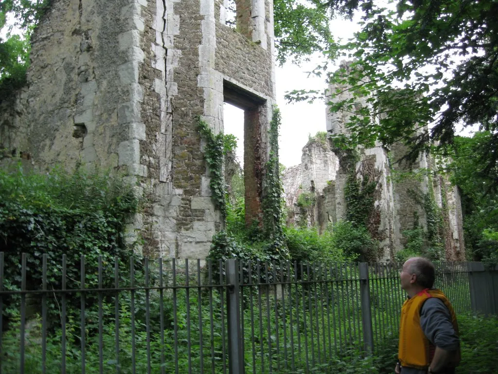 Betchworth Castle Historic site, Brockham2.7 km E
-
Old Fort Box Hill Historic site, Mole Valley2.4 km NE
-
The Whites Natural site, Mickleham2.8 km NE
-
Holmwood Common Wood Natural site, Holmwood3.6 km S
-
Broadwood's Folly Historic site, Mickleham3.1 km NE
Sources & licences
Data last updated: · 2 independent sources