Burton Grove Farm
Located in South Marston, Swindon Coordinates: 51°35′58″ N 1°43′30″ W
- Local time
- UTC+00:00
- Europe/London · UTC+00:00
- Elevation
- 107 m
- above sea level
- Airports
- BRS Bristol Airport73 km
- SOU Southampton Airport77 km
About Burton Grove Farm
Burton Grove Farm is a historic site. Location: South Marston, Swindon. The best months to visit are June–August. The nearest airport is Bristol Airport (73 km). Nearby sights include Blunsdon Mediumwave Transmitter and County Ground.
Climate of Burton Grove Farm
Best months for sightseeingBest months for sightseeing: June–August.
This month · November
A cold month
Day 10° · Night 4° · Rain 65 mm
- Hottest month
- July (day 21°)
- Coldest month
- February (night 1°)
- Wettest month
- December (71 mm)
- Driest month
- April (45 mm)
Bars: average monthly low and high temperature. Below: precipitation. Monthly averages for 1970–2000 at about 18 km resolution, adjusted for elevation. Highlighted months are mild and relatively dry. Source: WorldClim 2.1 (CC BY 4.0).
Show values as a table
| Month | Jan | Feb | Mar | Apr | May | Jun | Jul | Aug | Sep | Oct | Nov | Dec |
|---|---|---|---|---|---|---|---|---|---|---|---|---|
| Average high (°C) | 7° | 7° | 10° | 12° | 16° | 19° | 21° | 21° | 18° | 14° | 10° | 8° |
| Average low (°C) | 1° | 1° | 3° | 4° | 7° | 10° | 12° | 12° | 9° | 7° | 4° | 2° |
| Precipitation (mm) | 67 | 48 | 55 | 45 | 50 | 57 | 45 | 56 | 62 | 62 | 65 | 71 |
How to get to Burton Grove Farm
The nearest airport is Bristol Airport (BRS), 73 km to the west as the crow flies. The nearest large city is Swindon, 6 km to the southwest.
Airports
- Bristol Airport (BRS) Bristol 73 kmwest
- Southampton Airport (SOU) Southampton 77 kmsouth
- London Heathrow Airport (LHR) London 89 kmeast
Nearby large cities
- Swindon Population: 201.7K 6 kmsouthwest
- Oxford Population: 162.1K 37 kmnortheast
- Cheltenham Population: 118.8K 41 kmnorthwest
- Gloucester Population: 132.4K 46 kmnorthwest
- Bath Population: 101.6K 51 kmsouthwest
Straight-line distances; road distances are longer. Airport data: OurAirports.
Day trips from Burton Grove Farm
Within 100 km: 752 historic and cultural sites, 1,006 natural sites, 261 lakes, rivers and coasts.
0–25 km60 places
- Stanford Park Island Island 18 kmE
- Friday Island Island 19 kmW
- Windmill Hill Mountain 20 kmSW
- Whitehorse Hill Mountain 11 kmE
25–60 km453 places
- The Lynch Island 59 kmE
- Alney Island Island 47 kmNW
- Andersey Island Island 32 kmE
- Wargrave Island Island 60 kmE
60–100 km1,506 places
- Avon Beach Beach 97 kmS
- Calshot Beach Beach 92 kmS
- Whale Island Island 97 kmSE
- Holm Island Island 85 kmE
Straight-line distances.
Nearby attractions & nature
Everything nearby-
Blunsdon Mediumwave Transmitter Landmark, Blunsdon St. Andrew4.9 km W
-
County Ground Landmark, Stratton St. Margaret5 km SW
-
Hannington Hill Mountain, Hannington4.1 km NW
-
Blunsdon Hill Mountain, Blunsdon St. Andrew4.9 km W
-
Swindon Mediumwave Transmitter Landmark, Swindon7 km SW
-
Faringdon Castle Historic site, Great Faringdon13 km NE
-
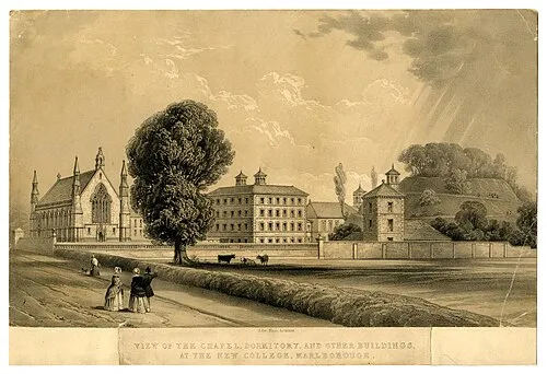 Marlborough Castle Historic site, Marlborough20 km S
-
South Cerney Castle Historic site, South Cerney17 km NW
Nearest towns and villages
-
Highworth Town, Highworth3.6 km N
-
South Marston Village, South Marston1.2 km S
-
Broad Blunsdon Village, Blunsdon St. Andrew4 km NW
-
Sevenhampton Village, Highworth1.7 km E
Sources & licences
Data last updated: