Stourton
Located in Stratford-on-Avon District, Warwickshire Coordinates: 52°01′13″ N 1°33′38″ W
- Elevation
- 123 m
- above sea level
- Local time
- UTC+00:00
- Europe/London · UTC+00:00
- Places inside
- 2
- listed under Stourton
- Airports
- BHX Birmingham Airport50 km
- LTN London Luton Airport84 km
About Stourton
Stourton is a village. Location: Stratford-on-Avon District, Warwickshire. Elevation: 123 m. The best months to visit are June–August. The nearest airport is Birmingham Airport (50 km). Nearby sights include Whichford Castle and Mine Hill.
Photos of Stourton
-
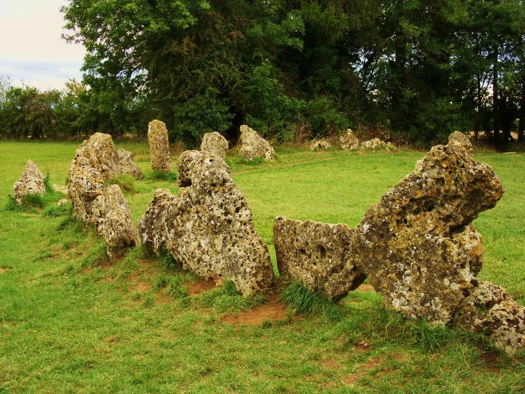
Rollright Stones Midnightblueowl at English Wikipedia · CC BY-SA 3.0

Climate of Stourton
Best months for sightseeingBest months for sightseeing: June–August.
This month · November
A cold month
Day 10° · Night 3° · Rain 60 mm
- Hottest month
- July (day 22°)
- Coldest month
- February (night 1°)
- Wettest month
- December (64 mm)
- Driest month
- February (44 mm)
Bars: average monthly low and high temperature. Below: precipitation. Monthly averages for 1970–2000 at about 18 km resolution, adjusted for elevation. Highlighted months are mild and relatively dry. Source: WorldClim 2.1 (CC BY 4.0).
Show values as a table
| Month | Jan | Feb | Mar | Apr | May | Jun | Jul | Aug | Sep | Oct | Nov | Dec |
|---|---|---|---|---|---|---|---|---|---|---|---|---|
| Average high (°C) | 7° | 7° | 9° | 12° | 16° | 19° | 22° | 21° | 18° | 14° | 10° | 7° |
| Average low (°C) | 1° | 1° | 2° | 3° | 6° | 9° | 11° | 11° | 9° | 6° | 3° | 2° |
| Precipitation (mm) | 62 | 44 | 52 | 47 | 52 | 57 | 47 | 59 | 60 | 58 | 60 | 64 |
How to get to Stourton
The nearest airport is Birmingham Airport (BHX), 50 km to the north as the crow flies. The nearest large city is Oxford, 36 km to the southeast.
Airports
- Birmingham Airport (BHX) Birmingham, West Midlands 50 kmnorth
- London Luton Airport (LTN) Luton, Luton 84 kmeast
- East Midlands Airport (EMA) Nottingham, Leicestershire 92 kmnorth
Nearby large cities
- Oxford Population: 162.1K 36 kmsoutheast
- Cheltenham Population: 118.8K 38 kmwest
- Coventry Population: 345.3K 43 kmnorth
- Solihull Population: 126.6K 46 kmnorth
- Worcester Population: 101.7K 49 kmnorthwest
Straight-line distances; road distances are longer. Airport data: OurAirports.
Day trips from Stourton
Within 100 km: 806 historic and cultural sites, 813 natural sites, 187 lakes, rivers and coasts.
0–25 km72 places
- Edge Hill Mountain 13 kmNE
- Seven Wells Hill Mountain 19 kmW
- Ebrington Hill Mountain 13 kmNW
- South Hill Mountain 6 kmSW
25–60 km471 places
- Alney Island Island 51 kmW
- Andersey Island Island 44 kmSE
- Rose Isle Island 40 kmSE
- Lock Wood Island Island 45 kmSE
60–100 km1,263 places
- The Lynch Island 74 kmSE
- Holm Island Island 96 kmSE
- Windsor Racecourse Island Island 86 kmSE
- Wargrave Island Island 74 kmSE
Straight-line distances.
Places in Stourton
2 placesCities & villages1
- Stourton · Village
Mountains & nature1
- Margett's Hill · Mountain
Nearby attractions & nature
Everything nearby-
Whichford Castle Historic site, Whichford1.5 km SE
-
Mine Hill Mountain, Brailes2.6 km NE
-
Brailes Hill Mountain, Brailes3.2 km N
-
Rollright Stones Historic site, Rollright5.2 km S
-
Brailes Castle Hill Motte Historic site, Brailes4.2 km N
-
Castle Hill Mountain, Brailes4.5 km N
Sources & licences
Data last updated: