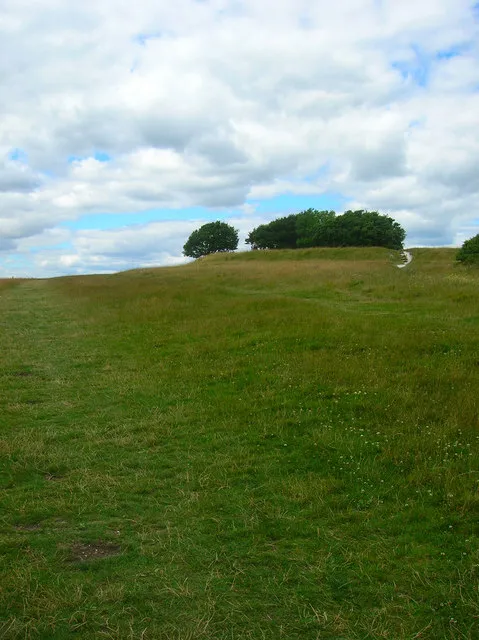
- Elevation
- 81 m
- above sea level
- Local time
- UTC+00:00
- Europe/London · UTC+00:00
- Airports
- LGW London Gatwick Airport40 km
- SOU Southampton Airport65 km
About Highdown Hill
Highdown Hill is a mountain. Location: Ferring, Arun District. Elevation: 81 m.
Highdown Hill is a hill in the South Downs, with a height of 81 metres (266 ft). The summit of the hill and its western slopes lie in the parish of Ferring in the Arun district, while its eastern slopes lie in the borough of Worthing. It is a popular spot for picnickers, dog-walkers and horse riders. It overlooks Littlehampton, Angmering, Ferring and Worthing with views as far east as the Seven Sisters and west to the Isle of Wight. It is the property of the National Trust.
Source: Wikipedia · CC BY-SA 4.0
Climate of Highdown Hill
Best months for sightseeingBest months for sightseeing: June–August.
This month · November
A cold month
Day 10° · Night 3° · Rain 84 mm
- Hottest month
- July (day 21°)
- Coldest month
- January (night 1°)
- Wettest month
- November (84 mm)
- Driest month
- July (40 mm)
Bars: average monthly low and high temperature. Below: precipitation. Monthly averages for 1970–2000 at about 18 km resolution, adjusted for elevation. Highlighted months are mild and relatively dry. Source: WorldClim 2.1 (CC BY 4.0).
Show values as a table
| Month | Jan | Feb | Mar | Apr | May | Jun | Jul | Aug | Sep | Oct | Nov | Dec |
|---|---|---|---|---|---|---|---|---|---|---|---|---|
| Average high (°C) | 7° | 7° | 10° | 13° | 16° | 19° | 21° | 21° | 18° | 14° | 10° | 8° |
| Average low (°C) | 1° | 1° | 2° | 3° | 7° | 9° | 11° | 11° | 9° | 6° | 3° | 2° |
| Precipitation (mm) | 81 | 54 | 57 | 45 | 43 | 49 | 40 | 50 | 66 | 81 | 84 | 84 |
How to get to Highdown Hill
The nearest airport is London Gatwick Airport (LGW), 40 km to the northeast as the crow flies. The nearest large city is Worthing, 5 km to the east.
Airports
- London Gatwick Airport (LGW) London 40 kmnortheast
- Southampton Airport (SOU) Southampton 65 kmwest
- London Heathrow Airport (LHR) London 72 kmnorth
Nearby large cities
- Worthing Population: 113.9K 5 kmeast
- Brighton Population: 283.9K 22 kmeast
- Crawley Population: 124K 37 kmnortheast
- Portsmouth Population: 208.1K 45 kmwest
- Eastbourne Population: 101.7K 52 kmeast
Straight-line distances; road distances are longer. Airport data: OurAirports.
Day trips from Highdown Hill
Within 100 km: 575 historic and cultural sites, 541 natural sites, 239 lakes, rivers and coasts.
0–25 km73 places
- St Nicholas Church Shoreham Attraction 12 kmE
- The Marlipins Museum Museum 12 kmE
- Climping Beach Beach 10 kmW
- Pagham Beach Beach 21 kmW
25–60 km383 places
- Portsea Island Natural site 44 kmW
- Bembridge Beach Beach 47 kmW
- Ventnor Beach Beach 60 kmSW
- Whale Island Island 46 kmW
60–100 km899 places
- Isle of Wight Island 61 kmW
- White Hart Lane Landmark 90 kmN
- Spotlites @ Kings Theatre Attraction 92 kmNE
- Avon Beach Beach 91 kmW
Straight-line distances.
Nearest towns and villages
-
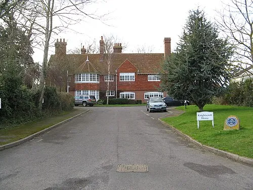 Rustington Town, Rustington4.4 km SW
-
Worthing District Municipality, West Sussex4.5 km E
-
Goring-by-Sea Village, Worthing District2.7 km SE
-
 West Worthing Village, Worthing District4.7 km SE
-
Hangleton Village, Angmering0.7 km SW
-
Worthing City, Worthing District5.4 km E
Nearby attractions & nature
Everything nearby-
Durrington Minature Railway Natural site, England3.2 km E
-
Church Hill Mountain, Findon4.6 km NE
-
Blackpatch Hill Mountain, Clapham5.4 km N
-
Harrow Hill Mountain, Angmering5.8 km N
-
Barpham Hill Mountain, Burpham6.1 km NW
-
Cissbury Ring Mountain, Worthing District6.2 km NE
-
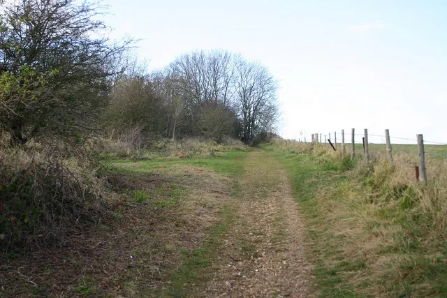 Lancing Ring Mountain, Lancing9.1 km E
-
Steep Down Mountain, Sompting8.3 km E
Sources & licences
Data last updated: · 2 independent sources