- Population
- 51,472
- 51.5K
- Elevation
- 52 m
- above sea level
- Local time
- UTC+00:00
- Europe/London · UTC+00:00
- Airports
- LGW London Gatwick Airport14 km
- LHR London Heathrow Airport46 km
About Horsham
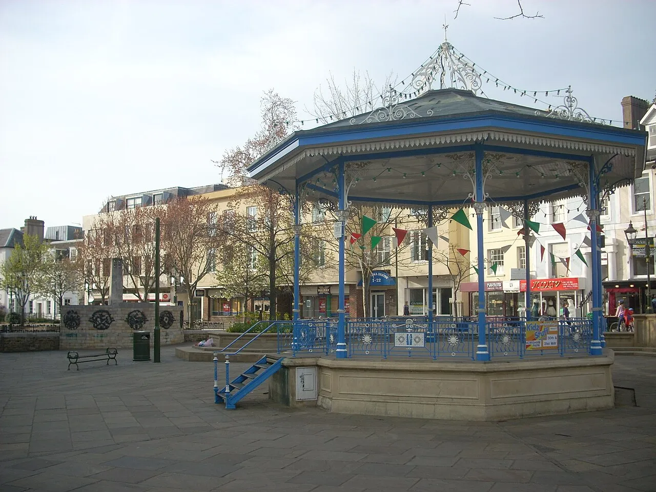
Horsham is a town. Location: Horsham District, West Sussex. Population: 51,472. Elevation: 52 m.
Horsham () is a market town and civil parish on the upper reaches of the River Arun on the fringe of the Weald, in West Sussex, England. The town lies 31 miles (50 km) south-south-west of London, 18.5 miles (30 km) north-west of Brighton and 26 miles (42 km) north-east of the county town of Chichester. Nearby towns include Crawley to the north-east and Haywards Heath and Burgess Hill to the south-east. It is the administrative centre of the Horsham district. In 2018 it had an estimated population of 50,934.
Source: Wikipedia · CC BY-SA 4.0
Photos of Horsham
-

Acabashi · CC BY-SA 4.0 -

Acabashi · CC BY-SA 4.0 -

Matt twam asi · CC BY-SA 4.0


Travel notes for Horsham
From Wikivoyage
Horsham is a traditional English market town in West Sussex.
The first mention of Horsham was in King Eadred's land charter of AD 947. The town had connections to the sale of horses and recent ideas suggest the name might be derived from "Horse Ham", meaning "a settlement where horses are kept".
Today, Horsham is best known or it's bi-weekly markets, as well as for its small breweries and restaurants.
Understand+
Horsham is a market town where people gather for festivities and trade goods in the Carfax on Thursdays and Saturdays in the town's, not-at-all-square, square.
Surprisingly, there is evidence that Horsham's bi-weekly markets have been a feature since the middle ages - These now take place on Thursdays and Saturdays
Horsham has grown significantly in its residential areas, mainly due to its train station and roads allowing for commuting to London and Brighton relatively easily, but still having good access to green areas and woodlands. For this reason it's known as a "commuter town" - a town where people buy or rent property and commute out to London.
Horsham is also a prominent brewery town. King and Barnes Brewery, which was in the town's centre, was closed on merger with Hall & Woodhouse in 2000. King & Barnes was formed in 1906 from the merger of King & Sons, existing from 1850 and G H Barnes & Co., brewers whose origins date back to 1800. The brewery remained in the King family hands until the merger in 2000 when production ceased permanently. However, smaller brewers still operate in the town to this day, of which there are four: Hepworth's is run by a former head brewer at King & Barnes, and Welton's, a company formed in Capel, Surrey have been in Horsham since 2004. Kissingate Brewery just out of town since 2009, and Brolly Brewing formed in 2017.
Horsham is also associated with quite a few grim legal milestones for modern English society:
The last man to be put to death by pressing in the whole of England was John Weekes of Horsham. He was charged with robbing and murdering a woman, along with three accomplices.
The last man to be put to death for homosexuality in England was John Sparshott in Horsham in 1835.
Horsham is one of the last places on Earth to still display its stocks in the town centre. You can see these in the Carfax.
Get in+
By plane:
The closest airport to Horsham is London Gatwick (LGW IATA) which is only 20 minutes by car or train (the station is right in the airport). London Heathrow (LHR IATA) is about an hour by car (depending on traffic) or two and a half hours by train via London, change at Hammersmith and London Victoria. London Stansted (STN IATA) is about an hour and a half by car (depending on traffic) or 2½ hours by train, change at Tottenham Hale and London Victoria.
By train:
Horsham can be reached easily by train. There are four trains per hour from London. Two trains from London Victoria via Croydon and Crawley. There is an hourly service (not Sundays) from London Victoria via Sutton & Dorking and an hourly stopping service from London Bridge. There are two trains an hour from the Sussex coast; Bognor Regis and Chichester. Most coastal trains divide en route so listen carefully to the announcements.
By car:
Horsham can also be easily reached by car as it lies on the junction of three main routes. Follow the A24 from London (SW) via Dorking, the M23/A264 from London (SE) via Crawley, the A23/A281 from Brighton via Cowfold, the A24 from Worthing, the A29 from Chichester or the A281 from Guildford.
Source: Wikivoyage · CC BY-SA 4.0 · abridged
Places bordering Horsham
- Dorking
Climate of Horsham
Best months for sightseeingBest months for sightseeing: June–August.
This month · November
A cold month
Day 11° · Night 4° · Rain 80 mm
- Hottest month
- July (day 22°)
- Coldest month
- February (night 1°)
- Wettest month
- December (85 mm)
- Driest month
- July (41 mm)
Bars: average monthly low and high temperature. Below: precipitation. Monthly averages for 1970–2000 at about 18 km resolution, adjusted for elevation. Highlighted months are mild and relatively dry. Source: WorldClim 2.1 (CC BY 4.0).
Show values as a table
| Month | Jan | Feb | Mar | Apr | May | Jun | Jul | Aug | Sep | Oct | Nov | Dec |
|---|---|---|---|---|---|---|---|---|---|---|---|---|
| Average high (°C) | 7° | 8° | 10° | 13° | 16° | 19° | 22° | 22° | 19° | 15° | 11° | 8° |
| Average low (°C) | 1° | 1° | 3° | 4° | 7° | 10° | 12° | 12° | 10° | 7° | 4° | 2° |
| Precipitation (mm) | 83 | 55 | 59 | 50 | 50 | 56 | 41 | 54 | 65 | 77 | 80 | 85 |
How to get to Horsham
The nearest airport is London Gatwick Airport (LGW), 14 km to the northeast as the crow flies. The nearest large city is Crawley, 12 km to the northeast.
Airports
- London Gatwick Airport (LGW) London 14 kmnortheast
- London Heathrow Airport (LHR) London 46 kmnorth
- London City Airport (LCY) London 56 kmnortheast
Nearby large cities
- Crawley Population: 124K 12 kmnortheast
- Worthing Population: 113.9K 27 kmsouth
- Brighton Population: 283.9K 29 kmsoutheast
- Woking Population: 103.9K 33 kmnorthwest
- Sutton Population: 187.6K 33 kmnorth
Straight-line distances; road distances are longer. Airport data: OurAirports.
Day trips from Horsham
Within 100 km: 668 historic and cultural sites, 615 natural sites, 279 lakes, rivers and coasts.
0–25 km116 places
- St Nicholas Church Shoreham Attraction 25 kmS
- Rookery Island Island 24 kmSW
- Ardingly Reservoir Lake 16 kmE
- Hedgecourt Lake Lake 21 kmNE
25–60 km795 places
- Portsea Island Natural site 60 kmSW
- The Marlipins Museum Museum 26 kmS
- Climping Beach Beach 34 kmSW
- Pagham Beach Beach 44 kmSW
60–100 km651 places
- Isle of Wight Island 80 kmSW
- Isle of Sheppey Island 89 kmNE
- White Hart Lane Landmark 63 kmN
- Spotlites @ Kings Theatre Attraction 70 kmNE
Straight-line distances.
Horsham and similar cities
Side by side with cities of similar size in the same country: population, elevation and climate.
| Measure | Horsham | Bridgend | Hamilton | Barry |
|---|---|---|---|---|
| Population | 51.5K | 49.6K | 54.5K | 54.7K |
| Elevation | 52 m | 23 m | 68 m | 25 m |
| Summer day (hottest month) | 22° | 21° | 19° | 21° |
| Winter night (coldest month) | 1° | 3° | 1° | 2° |
| Annual rainfall | 755 mm | 1,290 mm | 1,363 mm | 1,019 mm |
| Best months | Jun–Aug | Jun–Aug | Jun–Aug | Jun–Aug |
| Distance | — | 232 km | 578 km | 210 km |
Climate values are 1970–2000 monthly averages; straight-line distance.
Nearby attractions & nature
Everything nearby-
Chennells Brook Farm Historic site, North Horsham3 km NE
-
Warnham Park Natural site, Warnham2.4 km NW
-
Sedgwick Castle Historic site, Nuthurst3.7 km S
-
Hampshire Hill Mountain, Nuthurst3.9 km SE
-
Farlington Strood Park Natural site, Warnham3.8 km NW
-
Sharpenhurst Hill Mountain, Itchingfield4.3 km SW
-
Owls Historic site, Rusper4.3 km NE
-
Saint Leonards Forest Natural site, England5.5 km E
Sources & licences
Data last updated: · 2 independent sources