Sedgwick Castle
Located in Nuthurst, Horsham District Coordinates: 51°01′48″ N 0°19′07″ W
- Local time
- UTC+00:00
- Europe/London · UTC+00:00
- Elevation
- 78 m
- above sea level
- Airports
- LGW London Gatwick Airport16 km
- LHR London Heathrow Airport50 km
About Sedgwick Castle
Sedgwick Castle is a historic site. Location: Nuthurst, Horsham District.
Sedgwick Castle is a ruined medieval castle in Nuthurst, West Sussex, England. The castle dates to 1258 AD. The remains consist of wall fragments and earthworks. The site also includes two concentric ditches, ponds, and an outer enclosure. S. E. Winbolt led excavations at the castle in 1923 and 1924. Sedgwick Castle was established as a scheduled monument in 1933.
Source: Wikipedia · CC BY-SA 4.0
At a glance
- Heritage designation
- scheduled monument
Source: Wikidata
Photos of Sedgwick Castle
-
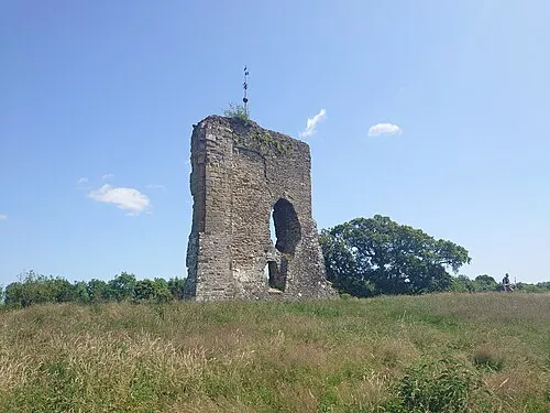
Knepp Castle Richard Nevell · CC BY-SA 4.0

Climate of Sedgwick Castle
Best months for sightseeingBest months for sightseeing: June–August.
This month · November
A cold month
Day 10° · Night 4° · Rain 80 mm
- Hottest month
- July (day 22°)
- Coldest month
- February (night 1°)
- Wettest month
- December (85 mm)
- Driest month
- July (41 mm)
Bars: average monthly low and high temperature. Below: precipitation. Monthly averages for 1970–2000 at about 18 km resolution, adjusted for elevation. Highlighted months are mild and relatively dry. Source: WorldClim 2.1 (CC BY 4.0).
Show values as a table
| Month | Jan | Feb | Mar | Apr | May | Jun | Jul | Aug | Sep | Oct | Nov | Dec |
|---|---|---|---|---|---|---|---|---|---|---|---|---|
| Average high (°C) | 7° | 8° | 10° | 13° | 16° | 19° | 22° | 22° | 18° | 15° | 10° | 8° |
| Average low (°C) | 1° | 1° | 2° | 4° | 7° | 10° | 12° | 12° | 9° | 7° | 4° | 2° |
| Precipitation (mm) | 83 | 55 | 59 | 50 | 50 | 56 | 41 | 54 | 65 | 77 | 80 | 85 |
How to get to Sedgwick Castle
The nearest airport is London Gatwick Airport (LGW), 16 km to the northeast as the crow flies. The nearest large city is Crawley, 13 km to the northeast.
Airports
- London Gatwick Airport (LGW) London 16 kmnortheast
- London Heathrow Airport (LHR) London 50 kmnorth
- London City Airport (LCY) London 59 kmnortheast
Nearby large cities
- Crawley Population: 124K 13 kmnortheast
- Worthing Population: 113.9K 24 kmsouth
- Brighton Population: 283.9K 26 kmsoutheast
- Woking Population: 103.9K 36 kmnorthwest
- Sutton Population: 187.6K 37 kmnorth
Straight-line distances; road distances are longer. Airport data: OurAirports.
Day trips from Sedgwick Castle
Within 100 km: 646 historic and cultural sites, 581 natural sites, 268 lakes, rivers and coasts.
0–25 km114 places
- St Nicholas Church Shoreham Attraction 21 kmS
- The Marlipins Museum Museum 22 kmS
- Rookery Island Island 23 kmSW
- Hawk Island Island 25 kmE
25–60 km741 places
- Portsea Island Natural site 59 kmSW
- Climping Beach Beach 32 kmSW
- Pagham Beach Beach 41 kmSW
- Whale Island Island 60 kmSW
60–100 km640 places
- Isle of Wight Island 79 kmSW
- Isle of Sheppey Island 90 kmNE
- White Hart Lane Landmark 66 kmN
- Spotlites @ Kings Theatre Attraction 71 kmNE
Straight-line distances.
Nearby attractions & nature
Everything nearby-
Hampshire Hill Mountain, Nuthurst1.1 km E
-
Knepp Castle Historic site, Shipley6.3 km S
-
Chennells Brook Farm Historic site, North Horsham6.3 km N
-
Sharpenhurst Hill Mountain, Itchingfield4.4 km W
-
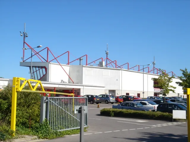 Broadfield Stadium Landmark, Crawley District12 km NE
-
Owls Historic site, Rusper7.3 km N
-
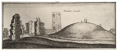 Bramber Castle Historic site, Bramber16 km S
-
Warnham Park Natural site, Warnham6.1 km N
Nearest towns and villages
-
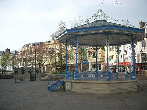 Horsham Town, Horsham District3.7 km N
-
Southwater Town, Southwater2.4 km W
-
Nuthurst Village, Nuthurst1.5 km SE
-
Copsale Village, Nuthurst2.3 km SW
Sources & licences
Data last updated: · 2 independent sources