Ballydarrog
Located in Causeway Coast and Glens, Northern Ireland Coordinates: 55°00′00″ N 6°59′00″ W
- Elevation
- 155 m
- above sea level
- Local time
- UTC+00:00
- Europe/London · UTC+00:00
- Airports
- LDY City of Derry Airport12 km
- BFS Belfast International Airport62 km
About Ballydarrog
Ballydarrog is a village. Location: Causeway Coast and Glens, Northern Ireland. Elevation: 155 m. The best months to visit are June–August. The nearest airport is City of Derry Airport (12 km). Nearby sights include Roe Valley Country Park and Loughermore.
Climate of Ballydarrog
Best months for sightseeingBest months for sightseeing: June–August.
This month · November
A wet month
Day 9° · Night 4° · Rain 163 mm
- Hottest month
- July (day 18°)
- Coldest month
- January (night 2°)
- Wettest month
- November (163 mm)
- Driest month
- May (86 mm)
Bars: average monthly low and high temperature. Below: precipitation. Monthly averages for 1970–2000 at about 18 km resolution, adjusted for elevation. Highlighted months are mild and relatively dry. Source: WorldClim 2.1 (CC BY 4.0).
Show values as a table
| Month | Jan | Feb | Mar | Apr | May | Jun | Jul | Aug | Sep | Oct | Nov | Dec |
|---|---|---|---|---|---|---|---|---|---|---|---|---|
| Average high (°C) | 7° | 7° | 9° | 11° | 14° | 16° | 18° | 18° | 15° | 12° | 9° | 7° |
| Average low (°C) | 2° | 2° | 3° | 4° | 6° | 9° | 11° | 11° | 9° | 7° | 4° | 3° |
| Precipitation (mm) | 157 | 120 | 127 | 93 | 86 | 92 | 98 | 121 | 133 | 158 | 163 | 162 |
How to get to Ballydarrog
The nearest airport is City of Derry Airport (LDY), 12 km to the northwest as the crow flies. For international flights: Belfast International Airport (BFS) (62 km). The nearest large city is Belfast, 82 km to the southeast.
Airports
- City of Derry Airport (LDY) Derry, Derry and Strabane 12 kmnorthwest
- Belfast International Airport (BFS) Belfast 62 kmsoutheast
- George Best Belfast City Airport (BHD) Belfast 83 kmsoutheast
Nearby large cities
- Belfast Population: 348K 82 kmsoutheast
- Dublin Population: 1M 192 kmsouth
- Glasgow Population: 626.4K 198 kmnortheast
- Edinburgh Population: 515K 262 kmnortheast
- Limerick Population: 102.3K 281 kmsouthwest
Straight-line distances; road distances are longer. Airport data: OurAirports.
Day trips from Ballydarrog
Within 100 km: 90 historic and cultural sites, 752 natural sites, 623 lakes, rivers and coasts.
0–25 km94 places
- Benone Beach Beach 20 kmN
- Portstewart Strand Beach 23 kmNE
- Lough Inn Lake 24 kmNW
- Lake Fad Lake 24 kmNW
25–60 km396 places
- Island Roy Island 56 kmNW
- Portstewart Beach Beach 25 kmNE
- Lisfannon Beach Beach 34 kmW
- The Skerries Island 34 kmNE
60–100 km975 places
- West Maiden Island 80 kmE
- Texa Island Island 87 kmNE
- Sheep Island Island 96 kmE
- Sanda Island Island 95 kmE
Straight-line distances.
Nearby attractions & nature
Everything nearby-
Roe Valley Country Park Natural site, Northern Ireland4 km NE
-
Loughermore Mountain, Derry City and Strabane6.5 km W
-
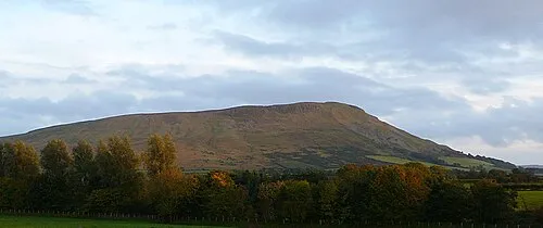 Benbradagh Mountain, Causeway Coast and Glens9.4 km SE
-
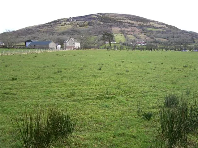 Keady Mountain Mountain, Causeway Coast and Glens10 km NE
-
Cnoc na hEarcola Mountain, Causeway Coast and Glens9.2 km E
-
Craiggore Mountain, Causeway Coast and Glens11 km E
Other cities and towns in Causeway Coast and Glens
-
 Castlerock Village, Causeway Coast and Glens21 km NE
-
Lislane Village, Causeway Coast and Glens6.4 km E
-
Bovevagh Village, Causeway Coast and Glens6.4 km SE
-
Ardmore Village, Causeway Coast and Glens6.7 km E
-
Drumsurn Village, Causeway Coast and Glens6.7 km E
-
Tullyverry Village, Causeway Coast and Glens7.4 km NW
Sources & licences
Data last updated: