Enniskillen
Located in Fermanagh and Omagh, Northern Ireland Coordinates: 54°20′46″ N 7°38′29″ W
- Population
- 14,472
- 14.5K
- Elevation
- 52 m
- above sea level
- Local time
- UTC+00:00
- Europe/London · UTC+00:00
- Airports
- LDY City of Derry Airport84 km
- CFN Donegal Airport90 km
About Enniskillen
Enniskillen is a city. Location: Fermanagh and Omagh, Northern Ireland. Population: 14,472. Elevation: 52 m.
Enniskillen ( EN-iss-KIL-ən, from Irish: Inis Ceithleann [ˈɪnʲɪʃ ˈcɛlʲən̪ˠ], 'Ceithlenn's island') is the largest town in County Fermanagh, Northern Ireland. It is in the middle of the county, between the Upper and Lower sections of Lough Erne. It had a population of 14,086 at the 2021 census. Enniskillen Castle was built in the 15th century as a stronghold of the Maguires, before coming under English control in the early 17th century. The castle and town were expanded during the Plantation of Ulster.
Source: Wikipedia · CC BY-SA 4.0
Photos of Enniskillen
-

Kenneth Allen · CC BY-SA 2.0 -

Kenneth Allen · CC BY-SA 2.0 -
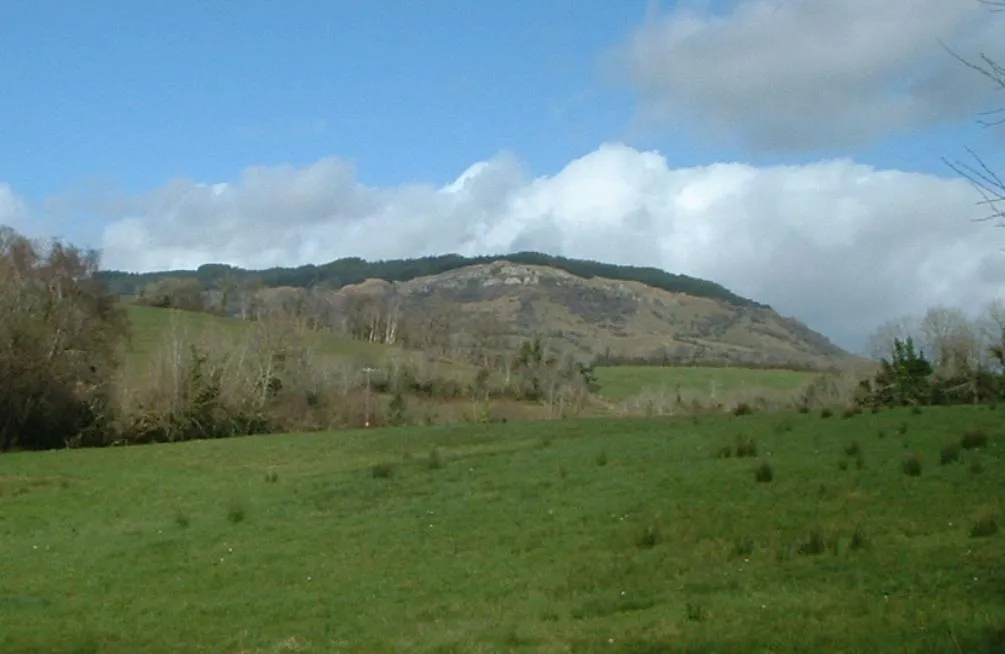
Belmore Mountain Wikimedia Commons · CC BY-SA 3.0


Travel notes for Enniskillen
From Wikivoyage
Enniskillen (Inis Ceithleann, "Ceithlenn's island") is the county town of County Fermanagh at the western edge of Northern Ireland. The town grew up on an island in the River Erne, which connects Upper and Lower Lough Erne and is navigable; boating and angling are major pastimes here. In 2021 Enniskillen had a population of about 14,000.
Understand+
Time was, every British schoolchild was taught (though swiftly forgot) about the Battle of Herrings (1429) and War of Jenkins' Ear (from 1739). They never heard of the Battle of the Ford of the Biscuits (1594) though in a sense it continues to affect British and Irish identities. The northwest of Ireland was the last part to come under London control, and the Nine Years War was a Gaelic resurgence. An English column were marching to lift the siege of Enniskillen Castle, but were ambushed. They lost 56 killed, 69 wounded, wagonloads of biscuits, and their military reputation. Their losses would have been greater had the Irish pursued, instead of gorging themselves on the biscuits.
The castle fell to the besiegers and the garrison were massacred, but England in the long term prevailed. In the 17th century the Gaelic chieftains fled into exile, Derry was walled against future uprisings, and Ulster was colonised with loyal Protestant settlers. Enniskillen became a garrison town, guarding the land route between the two Erne lakes. Its castle was kept in good repair against future troubles, including Napoleonic France. By 1921 the land east of the River Erne was majority Protestant, the west was mixed. At Partition all of County Fermanagh became part of Northern Ireland, while Donegal, Cavan and Monaghan joined the nascent Republic. Enniskillen brooded over a divided community, and during "The Troubles" lay near the porous border. There were 11 deaths from the Troubles up to 1987, then a bomb at a Remembrance Day Parade killed 12; the last victim lay in a coma until 2000.
Industry and investment fled and has been slow to return with the peace accord. The silver lining is that there has been little industry or modern development, and the town retains its pleasant 19th-century appearance.
You'll see signage in Irish, but English is the universal language here.
Visitor information is based in the castle.
Get in+
By road from Belfast take M1 onto A4, maybe 1 hour 40 min.
By road from Dublin take M3 / N3 through Cavan, becoming A509 at the border, and reckon just over two hours.
Goldline Express 261 runs from Belfast Grand Central via Lurgan and Dungannon, taking 2 hr 20 min. It's hourly M-F and every two hours Sa Su.
Bus Éireann 30 / X30 runs from Dublin Busaras and airport via Virginia and Cavan, taking 2 hr 40 min to Enniskillen, and continuing to Belleek, Ballyshannon and Donegal Town. It runs daily every couple of hours. Some buses run via Belturbet.
Bus Éireann 458 runs every couple of hours daily from Ballina to Enniscrone, Sligo, Glencar, Manorhamilton, Belcoo and Enniskillen.
Ulsterbus 94 takes just over an hour from Omagh. There are six M-F, two Sa and one Sunday.
Ulsterbus 95 takes an hour from Clones via Lisnaskea. There are five M-F and three Saturday.
Ulsterbus 194 (a-j) runs north 3-4 times M-Sa to the hospital, Ballinamallard, Irvinestown, Lisnarick and Kesh, with one bus a day continuing to Pettigo and Ballyshannon.
1 Enniskillen bus station is on Wellington Road in town centre.
Enniskillen is on the navigable River Erne, linked by waterways to the rest of Ireland. With your own boat you could even get here from Dublin, Waterford, Limerick and Athlone, but there are limits on how far you may take a hired boat.
Source: Wikivoyage · CC BY-SA 4.0 · abridged
Climate of Enniskillen
Best months for sightseeingBest months for sightseeing: June–August.
This month · November
A wet month
Day 10° · Night 4° · Rain 147 mm
- Hottest month
- July (day 19°)
- Coldest month
- January (night 2°)
- Wettest month
- November (147 mm)
- Driest month
- April (76 mm)
Bars: average monthly low and high temperature. Below: precipitation. Monthly averages for 1970–2000 at about 18 km resolution, adjusted for elevation. Highlighted months are mild and relatively dry. Source: WorldClim 2.1 (CC BY 4.0).
Show values as a table
| Month | Jan | Feb | Mar | Apr | May | Jun | Jul | Aug | Sep | Oct | Nov | Dec |
|---|---|---|---|---|---|---|---|---|---|---|---|---|
| Average high (°C) | 7° | 8° | 10° | 12° | 15° | 17° | 19° | 19° | 16° | 13° | 10° | 8° |
| Average low (°C) | 2° | 2° | 3° | 5° | 7° | 10° | 12° | 12° | 9° | 7° | 4° | 3° |
| Precipitation (mm) | 140 | 103 | 111 | 76 | 80 | 82 | 90 | 110 | 122 | 145 | 147 | 142 |
How to get to Enniskillen
The nearest airport is City of Derry Airport (LDY), 84 km to the north as the crow flies. For international flights: Ireland West Airport Knock (NOC) (91 km). The nearest large city is Belfast, 115 km to the east.
Airports
- City of Derry Airport (LDY) Derry, Derry and Strabane 84 kmnorth
- Donegal Airport (CFN) Donegal 90 kmnorthwest
- Ireland West Airport Knock (NOC) Charlestown 91 kmsouthwest
Nearby large cities
- Belfast Population: 348K 115 kmeast
- Dublin Population: 1M 145 kmsoutheast
- Limerick Population: 102.3K 198 kmsouth
- Glasgow Population: 626.4K 274 kmnortheast
- Cork Population: 224K 278 kmsouth
Straight-line distances; road distances are longer. Airport data: OurAirports.
Day trips from Enniskillen
Within 100 km: 198 historic and cultural sites, 734 natural sites, 1,217 lakes, rivers and coasts.
0–25 km64 places
- Inishteige Island 21 kmW
- Tuam Island Island 19 kmW
- Upper Lough Erne Lake 14 kmSE
- Ross Lough Lake 10 kmW
25–60 km871 places
- Station Island Island 33 kmNW
- Inchmore Island 59 kmS
- Rooney’s Island Island 45 kmNW
- Portned Island Island 57 kmNW
60–100 km1,214 places
- Island Roy Island 94 kmN
- Pollboy Bridge Landmark 99 kmSE
- Strandhill Beach Beach 64 kmW
- Lisfannon Beach Beach 84 kmN
Straight-line distances.
Nearby attractions & nature
Everything nearby-
Portora, Enniskillen Historic site, Fermanagh and Omagh0.8 km NW
-
Enniskillen Mediumwave Transmitter Landmark, Fermanagh and Omagh1.4 km N
-
RUINS on DEVENISH ISLAND LOUGH ERNE Historic site, Fermanagh and Omagh2.7 km N
-
Sillees River River, Northern Ireland1.5 km S
-
Drumgay Lough Lake, Fermanagh and Omagh3.6 km N
-
Belmore Mountain Mountain, Fermanagh and Omagh9.8 km W
-
Mullyknock Mountain, Fermanagh and Omagh7.9 km E
-
Lough Erne, Fermanagh Historic site, Fermanagh and Omagh8.4 km NW
Sources & licences
Data last updated: · 2 independent sources