Tamlaght
Located in Fermanagh and Omagh, Northern Ireland Coordinates: 54°19′00″ N 7°34′00″ W
- Elevation
- 73 m
- above sea level
- Local time
- UTC+00:00
- Europe/London · UTC+00:00
- Airports
- LDY City of Derry Airport85 km
- NOC Ireland West Airport Knock93 km
About Tamlaght
Tamlaght is a village. Location: Fermanagh and Omagh, Northern Ireland. Elevation: 73 m. The best months to visit are June–August. The nearest airport is City of Derry Airport (85 km). Nearby sights include Mullyknock and Sillees River.
Climate of Tamlaght
Best months for sightseeingBest months for sightseeing: June–August.
This month · November
A wet month
Day 10° · Night 4° · Rain 124 mm
- Hottest month
- July (day 19°)
- Coldest month
- January (night 2°)
- Wettest month
- October (125 mm)
- Driest month
- April (68 mm)
Bars: average monthly low and high temperature. Below: precipitation. Monthly averages for 1970–2000 at about 18 km resolution, adjusted for elevation. Highlighted months are mild and relatively dry. Source: WorldClim 2.1 (CC BY 4.0).
Show values as a table
| Month | Jan | Feb | Mar | Apr | May | Jun | Jul | Aug | Sep | Oct | Nov | Dec |
|---|---|---|---|---|---|---|---|---|---|---|---|---|
| Average high (°C) | 7° | 8° | 10° | 12° | 15° | 17° | 19° | 19° | 16° | 13° | 10° | 8° |
| Average low (°C) | 2° | 2° | 3° | 5° | 7° | 10° | 12° | 11° | 9° | 7° | 4° | 3° |
| Precipitation (mm) | 121 | 89 | 95 | 68 | 70 | 71 | 78 | 100 | 103 | 125 | 124 | 119 |
How to get to Tamlaght
The nearest airport is City of Derry Airport (LDY), 85 km to the north as the crow flies. For international flights: Ireland West Airport Knock (NOC) (93 km). The nearest large city is Belfast, 111 km to the east.
Airports
- City of Derry Airport (LDY) Derry, Derry and Strabane 85 kmnorth
- Ireland West Airport Knock (NOC) Charlestown 93 kmsouthwest
- Donegal Airport (CFN) Donegal 95 kmnorthwest
Nearby large cities
- Belfast Population: 348K 111 kmeast
- Dublin Population: 1M 140 kmsoutheast
- Limerick Population: 102.3K 197 kmsouth
- Glasgow Population: 626.4K 273 kmnortheast
- Cork Population: 224K 276 kmsouth
Straight-line distances; road distances are longer. Airport data: OurAirports.
Day trips from Tamlaght
Within 100 km: 221 historic and cultural sites, 722 natural sites, 1,192 lakes, rivers and coasts.
0–25 km78 places
- Tuam Island Island 23 kmW
- Upper Lough Erne Lake 10 kmS
- Ross Lough Lake 15 kmW
- Lough Macnean Upper Lake 24 kmW
25–60 km799 places
- Inishteige Island 26 kmW
- Station Island Island 38 kmNW
- Inchmore Island 56 kmS
- Rooney’s Island Island 51 kmNW
60–100 km1,258 places
- Island Roy Island 98 kmN
- Pollboy Bridge Landmark 94 kmSE
- Strandhill Beach Beach 68 kmW
- Lisfannon Beach Beach 86 kmN
Straight-line distances.
Nearby attractions & nature
Everything nearby-
Mullyknock Mountain, Fermanagh and Omagh5.5 km NE
-
Sillees River River, Northern Ireland4.7 km NW
-
Portora, Enniskillen Historic site, Fermanagh and Omagh6.7 km NW
-
Enniskillen Mediumwave Transmitter Landmark, Fermanagh and Omagh6.8 km NW
-
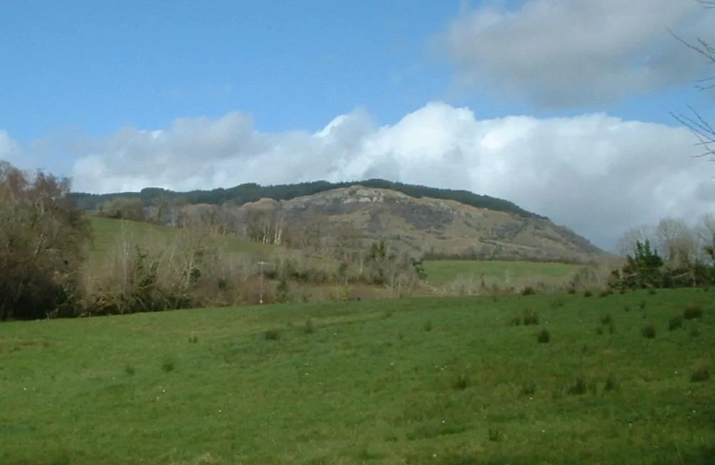 Belmore Mountain Mountain, Fermanagh and Omagh14 km W
-
Drumgay Lough Lake, Fermanagh and Omagh7.7 km NW
Sources & licences
Data last updated: