- Local time
- UTC+00:00
- Europe/London · UTC+00:00
- Airports
- BHD George Best Belfast City Airport64 km
- BFS Belfast International Airport69 km
About Kilkeel River
Kilkeel River is a river. Location: Northern Ireland, United Kingdom. The best months to visit are June–August. The nearest airport is George Best Belfast City Airport (64 km). Nearby sights include Kilkeel Bay and Knockchree.
Climate of Kilkeel River
Best months for sightseeingBest months for sightseeing: June–August.
This month · November
A wet month
Day 8° · Night 2° · Rain 128 mm
- Hottest month
- July (day 19°)
- Coldest month
- January (night 0°)
- Wettest month
- January (139 mm)
- Driest month
- May (77 mm)
Bars: average monthly low and high temperature. Below: precipitation. Monthly averages for 1970–2000 at about 18 km resolution, adjusted for elevation. Highlighted months are mild and relatively dry. Source: WorldClim 2.1 (CC BY 4.0).
Show values as a table
| Month | Jan | Feb | Mar | Apr | May | Jun | Jul | Aug | Sep | Oct | Nov | Dec |
|---|---|---|---|---|---|---|---|---|---|---|---|---|
| Average high (°C) | 6° | 7° | 9° | 12° | 15° | 18° | 19° | 19° | 16° | 12° | 8° | 6° |
| Average low (°C) | 0° | 1° | 2° | 3° | 6° | 9° | 11° | 10° | 8° | 6° | 2° | 1° |
| Precipitation (mm) | 139 | 103 | 115 | 86 | 77 | 83 | 81 | 107 | 111 | 132 | 128 | 134 |
How to get to Kilkeel River
The nearest airport is George Best Belfast City Airport (BHD), 64 km to the north as the crow flies. For international flights: Belfast International Airport (BFS) (69 km). The nearest large city is Belfast, 61 km to the north.
Airports
- George Best Belfast City Airport (BHD) Belfast 64 kmnorth
- Belfast International Airport (BFS) Belfast 69 kmnorth
- Dublin Airport (DUB) Dublin 72 kmsouth
Nearby large cities
- Belfast Population: 348K 61 kmnorth
- Dublin Population: 1M 82 kmsouth
- Blackpool Population: 145K 194 kmeast
- Birkenhead Population: 325.3K 209 kmeast
- Liverpool Population: 496.8K 211 kmeast
Straight-line distances; road distances are longer. Airport data: OurAirports.
Day trips from Kilkeel River
Within 100 km: 191 historic and cultural sites, 296 natural sites, 395 lakes, rivers and coasts.
0–25 km79 places
- Silent Valley Reservoir Lake 9 kmN
- Lough Shannagh Lake 13 kmN
- Lough Island Reavy Lake 21 kmN
- Eagle Mountain Mountain 12 kmNW
25–60 km169 places
- Rockabill Island 50 kmS
- Reagh Island Island 56 kmNE
- Guns Island Island 39 kmNE
- Castle Island Island 40 kmNE
60–100 km634 places
- Pollboy Bridge Landmark 64 kmSW
- Sandymount Strand Beach 81 kmS
- Portmarnock Beach Beach 71 kmS
- West Maiden Island 99 kmN
Straight-line distances.
Nearest towns and villages
-
Kilkeel Town, Newry Mourne and Down1.9 km NW
-
Ballymartin Village, Newry Mourne and Down4.2 km NE
-
Annalong Village, Newry Mourne and Down8.5 km NE
-
Brackenagh Village, Newry Mourne and Down5.7 km N
-
Moyad Village, Newry Mourne and Down6.5 km NW
-
Lisnacree Village, Newry Mourne and Down6.8 km W
Nearby attractions & nature
Everything nearby-
Kilkeel Bay Natural site, Newry Mourne and Down0.5 km NW
-
Knockchree Mountain, Newry Mourne and Down6.4 km NW
-
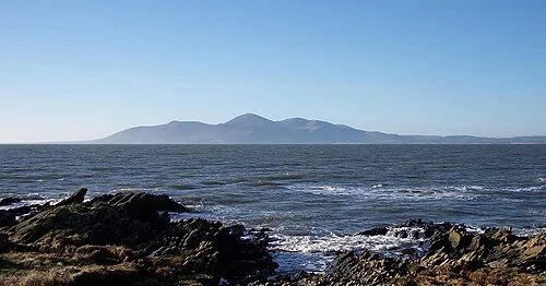 Mourne Mountains Mountain, Northern Ireland15 km NW
-
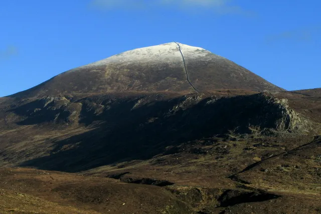 Slieve Donard Mountain, Newry Mourne and Down15 km N
-
Silent Valley Reservoir Lake, Northern Ireland9.3 km N
-
Mill Bay Natural site, Newry Mourne and Down7.6 km W
-
Broinn Bhinneain Mountain, Newry Mourne and Down9.4 km N
-
Slieve Binnian East Top Mountain, Newry Mourne and Down10 km N
Sources & licences
Data last updated: