
- Population
- 8,572
- 8.6K
- Elevation
- 67 m
- above sea level
- Local time
- UTC+00:00
- Europe/London · UTC+00:00
- Airports
- ABZ Aberdeen International Airport3 km
- DND Dundee Airport96 km
About Bucksburn
Bucksburn is a village. Location: Aberdeen City, Scotland. Population: 8,572. Elevation: 67 m.
Bucksburn is a suburb of Aberdeen, Scotland, named after the stream that flows through it. The stream is called Bucks Burn. Bucksburn was formerly a market village before being swallowed up by the spread of the city. The area is bordered by countryside, in particular Kirkhill Forest and the land surrounding Brimmond Hill. Bucksburn was one of the first established villages in Aberdeen, in the time of the Harrying of Buchan in 1308, when Robert the Bruce was present in Aberdeen.
Source: Wikipedia · CC BY-SA 4.0
Photos of Bucksburn
-
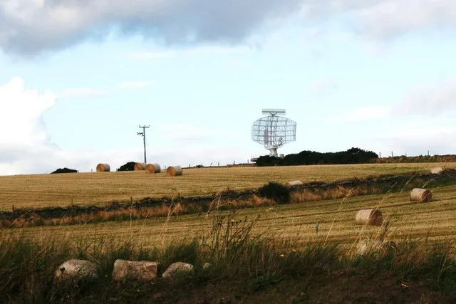
Perwinnes Hill Andrew Wood · CC BY-SA 2.0 -
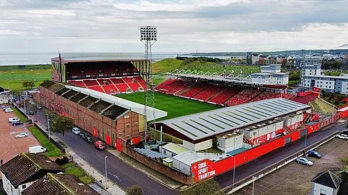
Pittodrie Stadium Lewismccabe · CC BY-SA 4.0 -
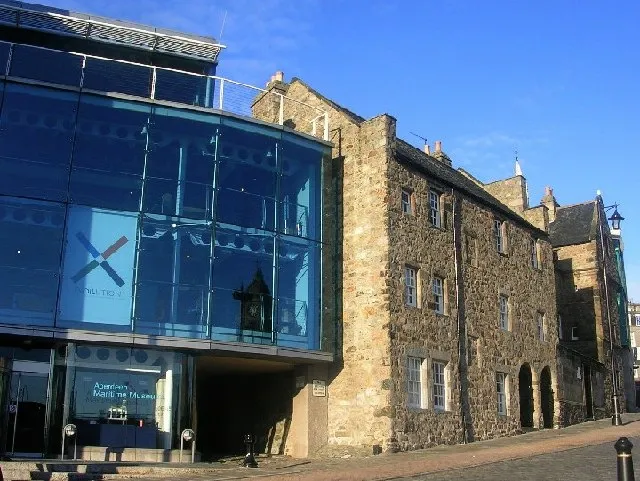
Aberdeen Maritime Museum Richard Slessor · CC BY-SA 2.0


Climate of Bucksburn
Best months for sightseeingBest months for sightseeing: June–September.
This month · November
A cold month
Day 9° · Night 2° · Rain 83 mm
- Hottest month
- July (day 19°)
- Coldest month
- January (night 0°)
- Wettest month
- November (83 mm)
- Driest month
- May (54 mm)
Bars: average monthly low and high temperature. Below: precipitation. Monthly averages for 1970–2000 at about 18 km resolution, adjusted for elevation. Highlighted months are mild and relatively dry. Source: WorldClim 2.1 (CC BY 4.0).
Show values as a table
| Month | Jan | Feb | Mar | Apr | May | Jun | Jul | Aug | Sep | Oct | Nov | Dec |
|---|---|---|---|---|---|---|---|---|---|---|---|---|
| Average high (°C) | 6° | 7° | 9° | 11° | 14° | 16° | 19° | 18° | 16° | 12° | 9° | 7° |
| Average low (°C) | 0° | 0° | 2° | 3° | 5° | 8° | 10° | 10° | 8° | 6° | 2° | 1° |
| Precipitation (mm) | 79 | 55 | 60 | 55 | 54 | 56 | 62 | 66 | 73 | 82 | 83 | 74 |
Other places to visit in this season: June July August September
How to get to Bucksburn
The nearest airport is Aberdeen International Airport (ABZ), 3 km to the north as the crow flies. The nearest large city is Aberdeen, 7 km to the southeast.
Airports
- Aberdeen International Airport (ABZ) Aberdeen 3 kmnorth
- Dundee Airport (DND) Dundee 96 kmsouthwest
- Inverness Airport (INV) Inverness, Highland 119 kmwest
Nearby large cities
- Aberdeen Population: 198.6K 7 kmsoutheast
- Dundee Population: 148.2K 92 kmsouthwest
- Edinburgh Population: 515K 150 kmsouthwest
- Glasgow Population: 626.4K 194 kmsouthwest
- Newcastle upon Tyne Population: 300.1K 248 kmsouth
Straight-line distances; road distances are longer. Airport data: OurAirports.
Day trips from Bucksburn
Within 100 km: 69 historic and cultural sites, 1,439 natural sites, 248 lakes, rivers and coasts.
0–25 km158 places
- Balbithan Island Island 11 kmNW
- Newburgh Seals Beach Beach 19 kmNE
- Aberdeen Beach Beach 7 kmSE
- Inch Geck Island 21 kmNE
25–60 km593 places
- Keith Inch Island 44 kmNE
- The Donnons Island 34 kmNE
- Dundonnie Island 40 kmNE
- Logg Island Island 45 kmNW
60–100 km1,005 places
- Findlays Seat Mountain 75 kmNW
- Lossiemouth East Beach Beach 89 kmNW
- Sunnyside Beach Beach 67 kmNW
- Island of Dundurcas Island 72 kmNW
Straight-line distances.
Nearby attractions & nature
Everything nearby-
Dovecot Wood Natural site, Scotland4 km N
-
Brimmond Hill Mountain, Aberdeen City3.3 km W
-
Gillahill Mountain, Aberdeen City3.3 km SW
-
Stewart Park Natural site, Aberdeen City3.4 km E
-
Stoneyhill Wood Natural site, Scotland3 km NE
-
Elrick Hill Mountain, Aberdeen City4 km W
Other cities and towns in Aberdeen City
-
Bridge of Don Village, Aberdeen City5 km E
-
Newhills Village, Aberdeen City1.4 km W
-
Heathryfold Neighbourhood, Aberdeen City1.6 km SE
-
Craibstone Village, Aberdeen City1.7 km NW
-
Northfield Neighbourhood, Aberdeen City2 km SE
-
 Kittybrewster Neighbourhood, Aberdeen City4.6 km SE
Sources & licences
Data last updated: · 2 independent sources