- Elevation
- 134 m
- above sea level
- Local time
- UTC+00:00
- Europe/London · UTC+00:00
- Airports
- ABZ Aberdeen International Airport46 km
- INV Inverness Airport100 km
About Walkerhill
Walkerhill is a mountain. Location: Aberdeenshire, Scotland. Elevation: 134 m. The best months to visit are June–August. The nearest airport is Aberdeen International Airport (46 km). Nearby sights include Hill of Brackans and Hill of Fishrie.
Climate of Walkerhill
Best months for sightseeingBest months for sightseeing: June–August.
This month · November
A cold month
Day 8° · Night 2° · Rain 71 mm
- Hottest month
- July (day 18°)
- Coldest month
- January (night 0°)
- Wettest month
- November (71 mm)
- Driest month
- February (48 mm)
Bars: average monthly low and high temperature. Below: precipitation. Monthly averages for 1970–2000 at about 18 km resolution, adjusted for elevation. Highlighted months are mild and relatively dry. Source: WorldClim 2.1 (CC BY 4.0).
Show values as a table
| Month | Jan | Feb | Mar | Apr | May | Jun | Jul | Aug | Sep | Oct | Nov | Dec |
|---|---|---|---|---|---|---|---|---|---|---|---|---|
| Average high (°C) | 6° | 6° | 8° | 10° | 13° | 16° | 18° | 18° | 15° | 12° | 8° | 6° |
| Average low (°C) | 0° | 0° | 1° | 3° | 5° | 8° | 10° | 10° | 8° | 5° | 2° | 0° |
| Precipitation (mm) | 66 | 48 | 53 | 49 | 50 | 56 | 57 | 64 | 70 | 70 | 71 | 62 |
How to get to Walkerhill
The nearest airport is Aberdeen International Airport (ABZ), 46 km to the south as the crow flies. The nearest large city is Aberdeen, 54 km to the south.
Airports
- Aberdeen International Airport (ABZ) Aberdeen 46 kmsouth
- Inverness Airport (INV) Inverness, Highland 100 kmwest
- Wick John O'Groats Airport (WIC) Wick 104 kmnorthwest
Nearby large cities
- Aberdeen Population: 198.6K 54 kmsouth
- Dundee Population: 148.2K 131 kmsouth
- Edinburgh Population: 515K 190 kmsouth
- Glasgow Population: 626.4K 225 kmsouthwest
- Newcastle upon Tyne Population: 300.1K 297 kmsouth
Straight-line distances; road distances are longer. Airport data: OurAirports.
Day trips from Walkerhill
Within 100 km: 58 historic and cultural sites, 1,212 natural sites, 227 lakes, rivers and coasts.
0–25 km101 places
- Logg Island Island 17 kmSW
- Scury Islands Island 10 kmNW
- Hospital Island Island 11 kmNW
- St John's Stone Island 8 kmN
25–60 km448 places
- Balbithan Island Island 40 kmS
- Findlays Seat Mountain 49 kmW
- Lossiemouth East Beach Beach 55 kmW
- Sunnyside Beach Beach 26 kmNW
60–100 km948 places
- Innis Mhòr Island 97 kmW
- Craigroy Island Island 61 kmW
- Stony Island Island 61 kmW
- Paterson-Island Island 94 kmW
Straight-line distances.
Nearest towns and villages
-
Cauldwells Village, Aberdeenshire2.4 km SE
-
Crudie Village, Aberdeenshire2.5 km E
-
Cotburn Village, Aberdeenshire2.7 km S
-
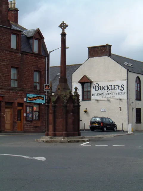 Turriff Town, Aberdeenshire8.4 km SW
-
Gorrachie Village, Aberdeenshire3.5 km W
-
Netherbrae Village, Aberdeenshire3.5 km NE
Nearby attractions & nature
Everything nearby-
Hill of Brackans Mountain, Aberdeenshire3.8 km S
-
Hill of Fishrie Mountain, Aberdeenshire5.2 km E
-
Hill of Foulzie Mountain, Aberdeenshire5.4 km NW
-
Hill of Draidland Mountain, Aberdeenshire5.4 km N
-
Hill of Wrae Mountain, Aberdeenshire6.2 km SW
-
Hill of Troup Mountain, Aberdeenshire6.5 km NE
-
Gamrie Bay Natural site, Aberdeenshire7.2 km N
-
Comfort Law Mountain, Aberdeenshire7.8 km NW
Sources & licences
Data last updated: