Mull of Kintyre Lighthouse
Located in Argyll and Bute, Scotland Coordinates: 55°18′37″ N 5°48′12″ W
- Local time
- UTC+00:00
- Europe/London · UTC+00:00
- Elevation
- 37 m
- above sea level
- Airports
- CAL Campbeltown Airport16 km
- ILY Islay Airport50 km
About Mull of Kintyre Lighthouse
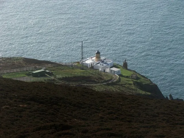
Mull of Kintyre Lighthouse is a landmark. Location: Argyll and Bute, Scotland.
The Mull of Kintyre Lighthouse on Mull of Kintyre was the second lighthouse commissioned in Scotland by the Commissioners of the Northern Lights. It was designed and built by Thomas Smith and completed in 1788. Smith had previously designed the light at Kinnaird Head, but Mull of Kintyre was a far more substantial project, in a far more remote location. In 1782, a series of storms hit Scotland that resulted in ship wrecks and detrimental financial impacts on the merchant class.
Source: Wikipedia · CC BY-SA 4.0
At a glance
- Built
- 1788
- Heritage designation
- category A listed building
- Height
- 12 m
Source: Wikidata
Photos of Mull of Kintyre Lighthouse
-

Störfix · CC BY-SA 3.0 de -

thejackrustles · CC BY-SA 2.0 -

Odd Wellies · CC BY 2.0 -

Odd Wellies · CC BY 2.0 -

Rude Health · CC BY-SA 2.0


Climate of Mull of Kintyre Lighthouse
Best months for sightseeingBest months for sightseeing: June–August.
This month · November
A wet month
Day 10° · Night 5° · Rain 143 mm
- Hottest month
- August (day 18°)
- Coldest month
- February (night 3°)
- Wettest month
- January (152 mm)
- Driest month
- May (62 mm)
Bars: average monthly low and high temperature. Below: precipitation. Monthly averages for 1970–2000 at about 18 km resolution, adjusted for elevation. Highlighted months are mild and relatively dry. Source: WorldClim 2.1 (CC BY 4.0).
Show values as a table
| Month | Jan | Feb | Mar | Apr | May | Jun | Jul | Aug | Sep | Oct | Nov | Dec |
|---|---|---|---|---|---|---|---|---|---|---|---|---|
| Average high (°C) | 8° | 8° | 9° | 11° | 14° | 16° | 18° | 18° | 16° | 13° | 10° | 9° |
| Average low (°C) | 3° | 3° | 4° | 5° | 7° | 10° | 11° | 12° | 10° | 8° | 5° | 4° |
| Precipitation (mm) | 152 | 102 | 116 | 74 | 62 | 71 | 84 | 98 | 118 | 142 | 143 | 143 |
How to get to Mull of Kintyre Lighthouse
The nearest airport is Campbeltown Airport (CAL), 16 km to the northeast as the crow flies. The nearest large city is Belfast, 80 km to the south.
Airports
- Campbeltown Airport (CAL) Campbeltown 16 kmnortheast
- Islay Airport (ILY) Isle of Islay, Argyll and Bute 50 kmnorthwest
- George Best Belfast City Airport (BHD) Belfast 77 kmsouth
Nearby large cities
- Belfast Population: 348K 80 kmsouth
- Glasgow Population: 626.4K 115 kmnortheast
- Edinburgh Population: 515K 179 kmnortheast
- Dundee Population: 148.2K 219 kmnortheast
- Dublin Population: 1M 222 kmsouth
Straight-line distances; road distances are longer. Airport data: OurAirports.
Day trips from Mull of Kintyre Lighthouse
Within 100 km: 80 historic and cultural sites, 1,475 natural sites, 623 lakes, rivers and coasts.
0–25 km92 places
- Sheep Island Island 15 kmE
- Sanda Island Island 14 kmE
- Island Davaar Island 21 kmNE
- Glunimore Island Island 16 kmE
25–60 km458 places
- Isle of Arran Island 48 kmNE
- West Maiden Island 43 kmS
- Texa Island Island 41 kmNW
- The Skerries Island 53 kmW
60–100 km1,628 places
- Great Cumbrae Island Island 76 kmNE
- Colonsay Island 88 kmN
- Ayr Beach Beach 75 kmE
- Troon Beach Beach 77 kmE
Straight-line distances.
Nearby attractions & nature
Everything nearby-
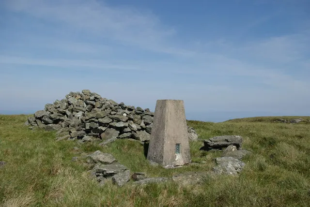 Beinn na Lice Mountain, Argyll and Bute1.5 km E
-
Torr Mhor Mountain, Argyll and Bute1.3 km SE
-
Mull of Kintyre Natural site, Argyll and Bute1.3 km S
-
Corr Bhan Mountain, Argyll and Bute2.3 km NE
-
A' Chruach Mountain, Argyll and Bute3.4 km NE
-
Dun Ban Mountain, Argyll and Bute5.3 km N
-
Remuil Hill Mountain, Argyll and Bute5.5 km NE
-
Strone Glen Natural site, Scotland5.5 km E
Nearest towns and villages
-
Carskey Village, Argyll and Bute6.8 km E
-
High Keil Village, Argyll and Bute9.2 km E
-
 Campbeltown Village, Argyll and Bute18 km NE
-
Southend Village, Argyll and Bute11 km E
More sights in Argyll and Bute
-
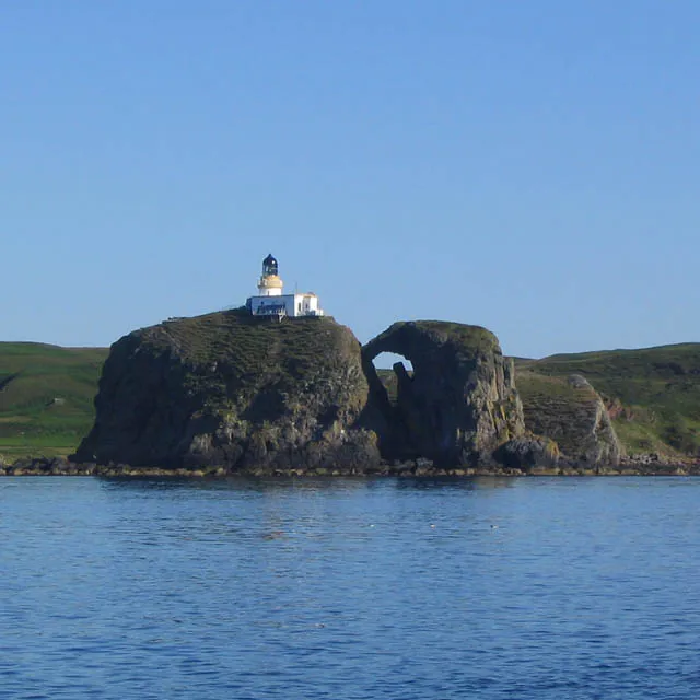 Sanda Island Lighthouse Landmark, Argyll and Bute15 km E
-
Lorne & Lowland Parish Church Attraction, Argyll and Bute18 km NE
-
Springbank Evangelical Church Attraction, Argyll and Bute18 km NE
-
Tangy Loch Castle Historic site, Argyll and Bute22 km NE
-
Saddell Abbey Historic site, Argyll and Bute31 km NE
-
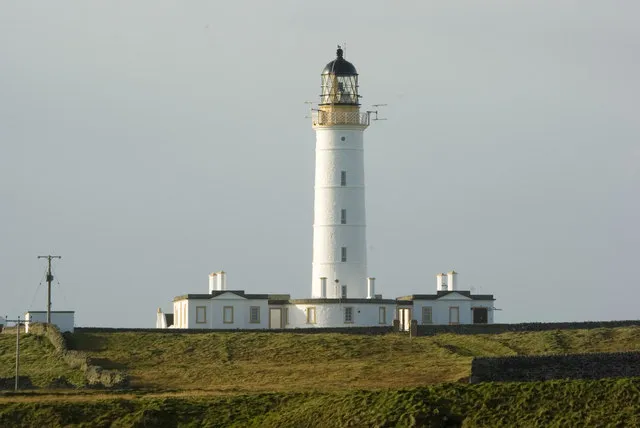 Orsay Lighthouse Landmark, Argyll and Bute60 km NW
Sources & licences
Data last updated: · 2 independent sources