- Elevation
- 3 m
- above sea level
- Local time
- UTC+00:00
- Europe/London · UTC+00:00
- Airports
- ILY Islay Airport65 km
- CAL Campbeltown Airport79 km
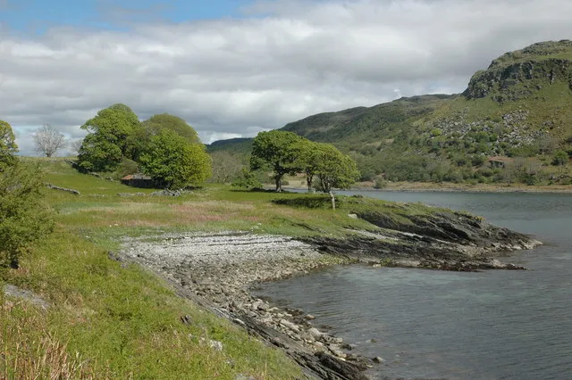
About Rèisa Mhic Phaidean
Rèisa Mhic Phaidean is an island. Location: Argyll and Bute, Scotland. The best months to visit are June–August. The nearest airport is Islay Airport (65 km). Nearby sights include Coiresa and Druim Beithe.
Climate of Rèisa Mhic Phaidean
Best months for sightseeingBest months for sightseeing: June–August.
This month · November
A wet month
Day 11° · Night 6° · Rain 184 mm
- Hottest month
- August (day 18°)
- Coldest month
- February (night 4°)
- Wettest month
- January (201 mm)
- Driest month
- May (77 mm)
Bars: average monthly low and high temperature. Below: precipitation. Monthly averages for 1970–2000 at about 18 km resolution, adjusted for elevation. Highlighted months are mild and relatively dry. Source: WorldClim 2.1 (CC BY 4.0).
Show values as a table
| Month | Jan | Feb | Mar | Apr | May | Jun | Jul | Aug | Sep | Oct | Nov | Dec |
|---|---|---|---|---|---|---|---|---|---|---|---|---|
| Average high (°C) | 8° | 8° | 9° | 11° | 15° | 16° | 18° | 18° | 16° | 13° | 11° | 8° |
| Average low (°C) | 4° | 4° | 5° | 6° | 8° | 11° | 12° | 12° | 11° | 8° | 6° | 4° |
| Precipitation (mm) | 201 | 122 | 151 | 92 | 77 | 85 | 105 | 125 | 164 | 180 | 184 | 186 |
How to get to Rèisa Mhic Phaidean
The nearest airport is Islay Airport (ILY), 65 km to the southwest as the crow flies. For international flights: Glasgow Airport (GLA) (80 km). The nearest large city is Glasgow, 91 km to the east.
Airports
- Islay Airport (ILY) Isle of Islay, Argyll and Bute 65 kmsouthwest
- Campbeltown Airport (CAL) Campbeltown 79 kmsouth
- Glasgow Airport (GLA) Glasgow 80 kmeast
Nearby large cities
- Glasgow Population: 626.4K 91 kmeast
- Edinburgh Population: 515K 153 kmeast
- Dundee Population: 148.2K 168 kmeast
- Belfast Population: 348K 174 kmsouth
- Aberdeen Population: 198.6K 243 kmnortheast
Straight-line distances; road distances are longer. Airport data: OurAirports.
Day trips from Rèisa Mhic Phaidean
Within 100 km: 90 historic and cultural sites, 2,937 natural sites, 1,261 lakes, rivers and coasts.
0–25 km557 places
- Scarba Island 7 kmNW
- Cala Island 15 kmS
- Torsa Island Island 12 kmN
- Shuna Island 8 kmN
25–60 km1,587 places
- Colonsay Island 38 kmW
- Kiloran Beach Beach 35 kmW
- Oronsay Island 43 kmW
- Eriska Island 45 kmN
60–100 km2,144 places
- Isle of Arran Island 65 kmS
- Great Cumbrae Island Island 61 kmSE
- Eigg Island 90 kmN
- Ayr Beach Beach 98 kmSE
Straight-line distances.
Nearest towns and villages
-
Aird Village, Argyll and Bute1.6 km E
-
Kinuachdrachd Village, Argyll and Bute5.2 km SW
-
Ardfern Village, Argyll and Bute6.6 km NE
-
Lunga Village, Argyll and Bute7.2 km NE
-
Blackmill Bay Village, Argyll and Bute7.6 km N
-
Crinan Village, Argyll and Bute7.7 km SE
Nearby attractions & nature
Everything nearby-
Coiresa Island, Argyll and Bute0.6 km SW
-
Druim Beithe Mountain, Argyll and Bute1.9 km SE
-
Sron Mhadadh Mountain, Argyll and Bute2 km E
-
Eilean Ona Island, Argyll and Bute1.7 km NE
-
Druim an Achanarnaich Mountain, Argyll and Bute2.7 km NE
-
Druim a' Chaisteil Mountain, Argyll and Bute2.2 km NE
-
Rèisa an t-Sruith Island, Argyll and Bute2.2 km SW
-
 Island Macaskin Island, Argyll and Bute4 km E
Sources & licences
Data last updated: