Annan
Local name: Inbhir Anann
Located in Dumfries and Galloway, Scotland Coordinates: 54°59′18″ N 3°15′23″ W
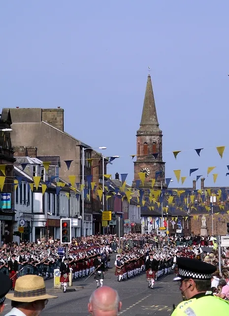
- Population
- 8,760
- 8.8K
- Elevation
- 20 m
- above sea level
- Local time
- UTC+00:00
- Europe/London · UTC+00:00
- Airports
- NCL Newcastle International Airport100 km
- PIK Glasgow Prestwick Airport102 km
About Annan
Annan is a town. Location: Dumfries and Galloway, Scotland. Population: 8,760. Elevation: 20 m.
Annan ( AN-ən; Scottish Gaelic: Inbhir Anainn) is a historic market town and royal burgh in Dumfries and Galloway, south-west Scotland. It is 15 miles (24 km) from Dumfries by rail, in the region of Dumfries and Galloway on the Solway Firth in the south of Scotland. Eastriggs is about 3 miles (5 km) to the east, while Gretna and the English border is about 8 miles (13 km) to the east. It had a population of 8,695 in 2022.
Source: Wikipedia · CC BY-SA 4.0
Photos of Annan
-

James Johnstone · CC BY 2.0 -

James Johnstone from Ecclefechan, Scotland · CC BY 2.0 -

caroline legg · CC BY 2.0 -

caroline legg · CC BY 2.0 -

Rosser1954 · CC BY-SA 4.0


Travel notes for Annan
From Wikivoyage
Annan is a market town in Dumfries and Galloway in southwest Scotland, with a population of 8700 in 2022. Many town buildings are a warm red sandstone, but the main visitor attraction is the First World War munitions complex that made "the devil's porridge".
Understand+
This agricultural area was the powerbase of the de Brus family, with Robert the Bruce (1274-1329) winning an early victory nearby over the English-backed Balliol on his path to the crown of Scotland. The town grew up at the navigable limit of the River Annan, which flows into Solway Firth, and the poet Robert Burns worked here for a time as an exciseman. The philosopher and writer Thomas Carlyle (1795-1881) went to school here and was utterly miserable.
During the First World War there was a huge multi-site munitions complex around Annan, Gretna and Longtown in Cumbria. Britain's military firepower depended upon improvised processes involving "The Devil's Porridge", Boy Scouts collecting conkers, and the future President of Israel.
Visitor information is posted on the Council website.
Get in+
By train:
Trains run from Carlisle via Gretna to Annan (22 mins) and Dumfries every hour or two M-Sa, every couple of hours Sunday. Some of them continue north from Dumfries via Sanquhar and Kilmarnock to Glasgow Central, but it's usually quicker to take the fast London - Glasgow train and change at Carlisle.
1 Annan railway station is 400 yards south of High Street. There's no ticket office or machines here, so get aboard and buy from the conductor. Annan's old locomotive turntable is still in service in the National Railway Museum in York.
By road:
Annan is bypassed to the north by the A75 Carlisle to Stranraer road with links into town at either end. Near Gretna the A75 joins the A74(M) motorway, which becomes M6 as it crosses into England.
National Cycle Route 7 passes through Annan on its way from Inverness to Sunderland, with a footbridge over the river to carry it to the south of the town.
By bus:
Stagecoach Cumbria Bus 79 runs from Carlisle via Longtown and Gretna to Annan, taking an hour. These run M-Sa every hour, Sunday every two hours, and continue west via Ruthwell to Dumfries.
Bus 179 also runs hourly between Carlisle, Longtown, Gretna, and Annan where it terminates. This is a longer route, taking 70 min, but it's quicker than waiting for the next 79.
2 Annan bus station is on Butts Street just off High Street. See Dumfries for connections towards Stranraer, and Carlisle for elsewhere, eg the X95 to Edinburgh.
Source: Wikivoyage · CC BY-SA 4.0 · abridged
Climate of Annan
Best months for sightseeingBest months for sightseeing: June–August.
This month · November
A cold month
Day 9° · Night 3° · Rain 98 mm
- Hottest month
- July (day 19°)
- Coldest month
- January (night 1°)
- Wettest month
- December (103 mm)
- Driest month
- April (53 mm)
Bars: average monthly low and high temperature. Below: precipitation. Monthly averages for 1970–2000 at about 18 km resolution, adjusted for elevation. Highlighted months are mild and relatively dry. Source: WorldClim 2.1 (CC BY 4.0).
Show values as a table
| Month | Jan | Feb | Mar | Apr | May | Jun | Jul | Aug | Sep | Oct | Nov | Dec |
|---|---|---|---|---|---|---|---|---|---|---|---|---|
| Average high (°C) | 7° | 7° | 9° | 11° | 15° | 17° | 19° | 19° | 16° | 13° | 9° | 7° |
| Average low (°C) | 1° | 1° | 3° | 4° | 6° | 9° | 11° | 11° | 9° | 6° | 3° | 2° |
| Precipitation (mm) | 100 | 75 | 78 | 53 | 55 | 61 | 70 | 78 | 84 | 102 | 98 | 103 |
How to get to Annan
The nearest airport is Newcastle International Airport (NCL), 100 km to the east as the crow flies. The nearest large city is Newcastle upon Tyne, 105 km to the east.
Airports
- Newcastle International Airport (NCL) Newcastle upon Tyne, Tyne and Wear 100 kmeast
- Glasgow Prestwick Airport (PIK) Prestwick, South Ayrshire 102 kmnorthwest
- Edinburgh Airport (EDI) Ingliston, Edinburgh 107 kmnorth
Nearby large cities
- Newcastle upon Tyne Population: 300.1K 105 kmeast
- Edinburgh Population: 515K 107 kmnorth
- Glasgow Population: 626.4K 116 kmnorthwest
- Sunderland Population: 170.1K 120 kmeast
- Blackpool Population: 145K 131 kmsouth
Straight-line distances; road distances are longer. Airport data: OurAirports.
Day trips from Annan
Within 100 km: 571 historic and cultural sites, 3,210 natural sites, 697 lakes, rivers and coasts.
0–25 km180 places
- Powillimount Beach Beach 23 kmSW
- Kirkland Scar Island 6 kmSE
- Cottage Island Island 12 kmNW
- Dormont Island Island 13 kmNW
25–60 km1,768 places
- St. Bees Beach Seafront Beach 60 kmS
- Hestan Island Island 40 kmSW
- Green Island Island 54 kmW
- Cherry Holm Island 53 kmS
60–100 km2,530 places
- High Moor Mountain 86 kmS
- Roanhead Beach Beach 92 kmS
- Tuft Rock Island 72 kmS
- Walney Island Island 98 kmS
Straight-line distances.
Nearby attractions & nature
Everything nearby-
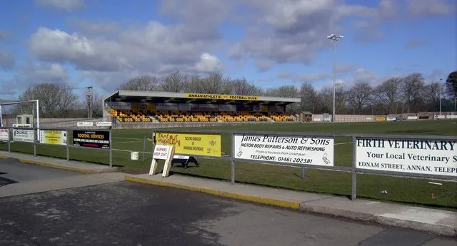 Galabank Landmark, Dumfries and Galloway0.7 km NW
-
River Annan River, Scotland2.7 km S
-
Jockstown Hill Mountain, Dumfries and Galloway5.1 km N
-
Woodcock Air Mountain, Dumfries and Galloway6.1 km NW
-
Brown Moor Mountain, Dumfries and Galloway6.3 km N
-
Bowness on Solway Landmark, Bowness4.9 km SE
-
Repentance Hill Mountain, Dumfries and Galloway7 km NW
-
Mein Water River, Scotland5.3 km N
Other cities and towns in Dumfries and Galloway
-
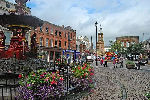 Dumfries City, Dumfries and Galloway24 km W
-
Locharbriggs Town, Dumfries and Galloway25 km NW
-
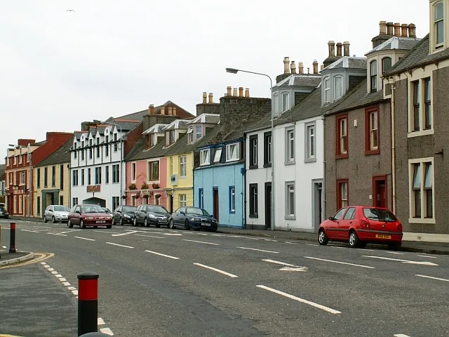 Stranraer Town, Dumfries and Galloway114 km W
Sources & licences
Data last updated: · 2 independent sources