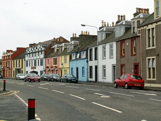
- Population
- 10,510
- 10.5K
- Elevation
- 12 m
- above sea level
- Local time
- UTC+00:00
- Europe/London · UTC+00:00
- Airports
- BHD George Best Belfast City Airport63 km
- PIK Glasgow Prestwick Airport73 km
About Stranraer
Stranraer is a town. Location: Dumfries and Galloway, Scotland. Population: 10,510. Elevation: 12 m.
Stranraer (Scottish Gaelic: An t-Sròn Reamhar [ən̪ˠˌt̪ʰɾɔːn ˈɾãũ.əɾ]; Scots: Stranrawer), also known as the Toon or the Cleyhole, is a town in Dumfries and Galloway, Scotland, on Loch Ryan and the northern side of the isthmus joining the Rhins of Galloway to the mainland. Stranraer is Dumfries and Galloway's second-largest town, with a population of 9,751 in 2022. Stranraer is the administrative centre for the Wigtownshire area of Dumfries and Galloway.
Source: Wikipedia · CC BY-SA 4.0
Photos of Stranraer
-

Andy Farrington · CC BY-SA 2.0 -

Billy McCrorie · CC BY-SA 2.0 -

Billy McCrorie · CC BY-SA 2.0 -
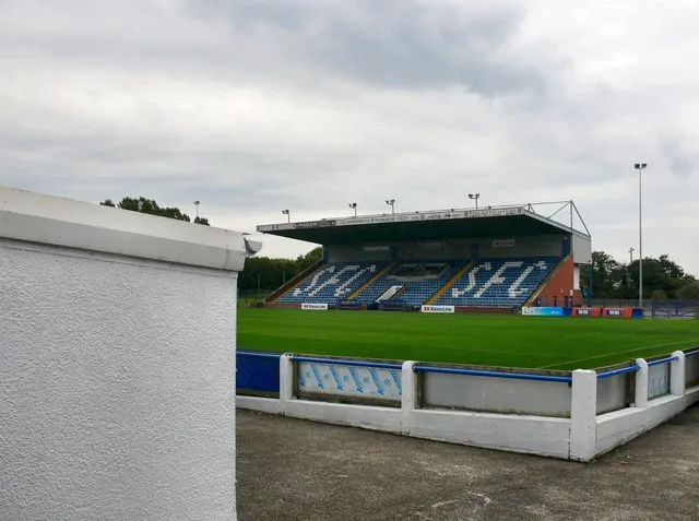
Stair Park Andy Farrington · CC BY-SA 2.0


Travel notes for Stranraer
From Wikivoyage
Stranraer is a town in Dumfries and Galloway near the tip of southwest Scotland. It's a port with ferries to Northern Ireland, though nowadays these all sail from Cairnryan a few miles north. The town itself (population 9700 in 2022) has little of interest, but it's a good base for exploring the scenic Rhins of Galloway, the peninsula stretching north and south of Stranraer. The north and central part of the Rhins are described here.
An alternative visitor base 17 miles south is the village of Drummore: see that page for the south Rhins, which include Logan gardens and fishpond, and the Mull of Galloway.
Understand+
The North Channel between Scotland and Ireland narrows here into the Straits of Moyle, 22 miles (35 km) across. It's deep: the Beaufort Dyke goes down to 1000 ft (300 m), carved out by glaciers and swept clear of in-fill by the currents. Shipping traditionally plied between little ports such as Donaghadee in Ulster and Portpatrick on Galloway. The channel is pinched to 12 miles further north off the Mull of Kintyre, but that is a long way from anywhere else, and St Columba sailed across that way to put distance between himself and his Ulster enemies.
The small ports lacked shelter, and from the 19th century vessels grew larger, so a Victorian port developed at Stranraer as it did at Belfast. The railway from Glasgow created a fast link from central Scotland. Cairnryan a few miles north of Stranraer has deep water and during the Second World War was developed as a back-up military harbour, in case others such as Liverpool or Greenock were bombed out. Its postwar military role was to handle surplus explosive ordnance, chemicals and other nasties, which were dumped in the Beaufort Dyke. In the late 20th century, large ro-ro ferries outgrew Stranraer, and Cairnryan became the chief port. Stranraer continues with fishing and freight but has become a backwater.
From time to time there's talk of a bridge or tunnel across the North Channel. Modern engineering has made great strides across equally daunting stretches of water, but this one seems impractical with present-day technology. The latest revival of the idea was the "Boris bridge" spanning from Ulster to Mull of Kintyre. The guestimate cost was £20 billion, but others put it at over £300 billion. Nothing happened and the idea was dropped.
Get in+
By boat:
Ferries from Northern Ireland sail to Cairnryan a few miles north of Stranraer.
1 Loch Ryan Port is north of Cairnryan village and about 8 miles from Stranraer. Stena Line ferries sail here from Belfast, with 4-6 per day taking 2 hr 15 min. Buses from Belfast either connect with or cross on these ferries and continue to Ayr, Glasgow and Edinburgh. There's a car hire desk at the Loch Ryan terminal.
2 Cairnryan harbour is four miles north of Stranraer. P&O Ferries sail from Larne, with six a day taking 2 hours. There is no linked inter-city bus for these, so either catch a local bus (below) or take a taxi.
By train:
From Glasgow Central there are four or five connections daily via Kilmarnock to Ayr, where you change for the train via Girvan, taking 2 hr 50 min to Stranraer. It doesn't run via Cairnryan so for the ferries change to the bus at Ayr.
3 Stranraer railway station is on the town harbour quay, right where the ferries aren't. It's half a mile walk into town centre, with buses and taxis. There's a staffed ticket office but no machines, and the toilets are only open during ticket office hours. There is step-free access to the single platform.
By bus:
Scottish Citylink / Ulsterbus 923 runs four times daily from Glasgow Buchanan Station and Ayr to the Stena terminal at Loch Ryan then to Stranraer town. It's billed as a through-service to Belfast but doesn't board the ferry, so you lump your luggage off it to get on the ferry, then onto the Ulsterbus at the other end for the short ride to Belfast Grand Central.
Hannon's coach does join the ferry on its way between Glasgow and Belfast but has no local pick up / drop off.
Buses no longer run from London direct to Stranraer, you have to travel to Glasgow and join the Citylink.
Source: Wikivoyage · CC BY-SA 4.0 · abridged
Climate of Stranraer
Best months for sightseeingBest months for sightseeing: June–August.
This month · November
A wet month
Day 9° · Night 4° · Rain 124 mm
- Hottest month
- July (day 18°)
- Coldest month
- February (night 1°)
- Wettest month
- October (127 mm)
- Driest month
- May (58 mm)
Bars: average monthly low and high temperature. Below: precipitation. Monthly averages for 1970–2000 at about 18 km resolution, adjusted for elevation. Highlighted months are mild and relatively dry. Source: WorldClim 2.1 (CC BY 4.0).
Show values as a table
| Month | Jan | Feb | Mar | Apr | May | Jun | Jul | Aug | Sep | Oct | Nov | Dec |
|---|---|---|---|---|---|---|---|---|---|---|---|---|
| Average high (°C) | 7° | 7° | 9° | 11° | 14° | 17° | 18° | 18° | 16° | 13° | 9° | 8° |
| Average low (°C) | 2° | 1° | 2° | 4° | 6° | 9° | 11° | 11° | 9° | 7° | 4° | 2° |
| Precipitation (mm) | 124 | 86 | 95 | 67 | 58 | 72 | 77 | 97 | 104 | 127 | 124 | 120 |
How to get to Stranraer
The nearest airport is George Best Belfast City Airport (BHD), 63 km to the southwest as the crow flies. For international flights: Glasgow Prestwick Airport (PIK) (73 km). The nearest large city is Belfast, 67 km to the southwest.
Airports
- George Best Belfast City Airport (BHD) Belfast 63 kmsouthwest
- Glasgow Prestwick Airport (PIK) Prestwick, South Ayrshire 73 kmnortheast
- Campbeltown Airport (CAL) Campbeltown 73 kmnorthwest
Nearby large cities
- Belfast Population: 348K 67 kmsouthwest
- Glasgow Population: 626.4K 118 kmnortheast
- Edinburgh Population: 515K 165 kmnortheast
- Blackpool Population: 145K 176 kmsoutheast
- Dublin Population: 1M 192 kmsouthwest
Straight-line distances; road distances are longer. Airport data: OurAirports.
Day trips from Stranraer
Within 100 km: 85 historic and cultural sites, 1,297 natural sites, 432 lakes, rivers and coasts.
0–25 km165 places
- Isle of Lochnaw Island 7 kmW
- Gargrie Island Island 25 kmE
- Scart Islands Island 25 kmE
- Castle Island Island 24 kmE
25–60 km527 places
- West Maiden Island 46 kmW
- Sheep Island Island 56 kmNW
- Sanda Island Island 55 kmNW
- Reagh Island Island 59 kmSW
60–100 km1,122 places
- Isle of Arran Island 79 kmN
- Great Cumbrae Island Island 97 kmN
- Powillimount Beach Beach 93 kmE
- Ayr Beach Beach 67 kmN
Straight-line distances.
Nearby attractions & nature
Everything nearby-
Stair Park Landmark, Dumfries and Galloway1 km E
-
Macneilie Hill Mountain, Dumfries and Galloway4.1 km NE
-
Cairn Pat Mountain, Dumfries and Galloway4.5 km S
-
Craigenlee Fell Mountain, Dumfries and Galloway5.1 km SW
-
Loch Ryan Natural site, Scotland3.5 km N
-
Bean Hill Mountain, Dumfries and Galloway5.9 km S
-
Black Loch Lake, Dumfries and Galloway5.3 km E
-
Heron Isle Island, Dumfries and Galloway5.4 km E
Other cities and towns in Dumfries and Galloway
-
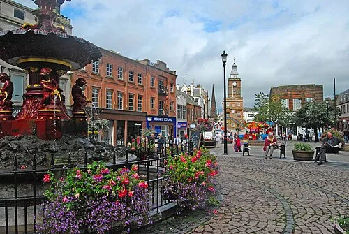 Dumfries City, Dumfries and Galloway93 km E
-
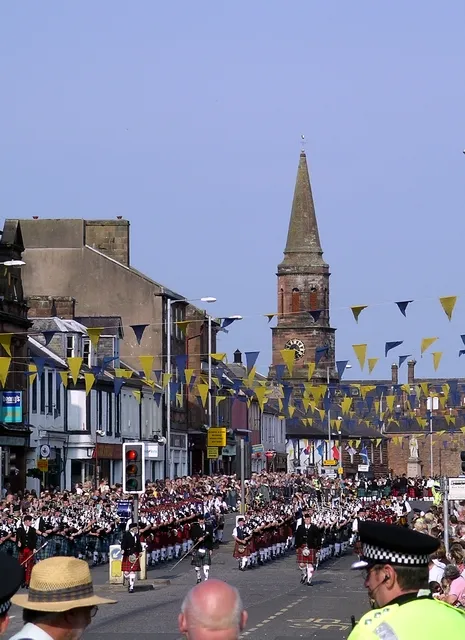 Annan Town, Dumfries and Galloway114 km E
-
Locharbriggs Town, Dumfries and Galloway95 km E
Sources & licences
Data last updated: · 2 independent sources