- Elevation
- 144 m
- above sea level
- Local time
- UTC+00:00
- Europe/London · UTC+00:00
- Airports
- EDI Edinburgh Airport71 km
- PIK Glasgow Prestwick Airport76 km
About Oakrigg
Oakrigg is a mountain. Location: Dumfries and Galloway, Scotland. Elevation: 144 m. The best months to visit are June–August. The nearest airport is Edinburgh Airport (71 km). Nearby sights include Frenchland Burn and Breckonside Hill.
Photos of Oakrigg
-
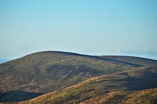
Loch Fell Iangpark · CC BY-SA 4.0

Climate of Oakrigg
Best months for sightseeingBest months for sightseeing: June–August.
This month · November
A wet month
Day 9° · Night 3° · Rain 139 mm
- Hottest month
- July (day 19°)
- Coldest month
- January (night 1°)
- Wettest month
- December (147 mm)
- Driest month
- April (70 mm)
Bars: average monthly low and high temperature. Below: precipitation. Monthly averages for 1970–2000 at about 18 km resolution, adjusted for elevation. Highlighted months are mild and relatively dry. Source: WorldClim 2.1 (CC BY 4.0).
Show values as a table
| Month | Jan | Feb | Mar | Apr | May | Jun | Jul | Aug | Sep | Oct | Nov | Dec |
|---|---|---|---|---|---|---|---|---|---|---|---|---|
| Average high (°C) | 6° | 7° | 8° | 11° | 14° | 17° | 19° | 18° | 15° | 12° | 9° | 7° |
| Average low (°C) | 1° | 1° | 2° | 3° | 5° | 8° | 10° | 10° | 8° | 6° | 3° | 1° |
| Precipitation (mm) | 146 | 107 | 114 | 70 | 72 | 75 | 85 | 100 | 117 | 145 | 139 | 147 |
How to get to Oakrigg
The nearest airport is Edinburgh Airport (EDI), 71 km to the north as the crow flies. The nearest large city is Edinburgh, 73 km to the north.
Airports
- Edinburgh Airport (EDI) Ingliston, Edinburgh 71 kmnorth
- Glasgow Prestwick Airport (PIK) Prestwick, South Ayrshire 76 kmwest
- Glasgow Airport (GLA) Glasgow 89 kmnorthwest
Nearby large cities
- Edinburgh Population: 515K 73 kmnorth
- Glasgow Population: 626.4K 81 kmnorthwest
- Newcastle upon Tyne Population: 300.1K 122 kmeast
- Dundee Population: 148.2K 132 kmnorth
- Sunderland Population: 170.1K 138 kmeast
Straight-line distances; road distances are longer. Airport data: OurAirports.
Day trips from Oakrigg
Within 100 km: 562 historic and cultural sites, 3,040 natural sites, 768 lakes, rivers and coasts.
0–25 km451 places
- Henderland Island Island 22 kmS
- Townfoot Loch Lake 18 kmSW
- Talla Reservoir Lake 19 kmN
- Loch Skeen Lake 15 kmNE
25–60 km1,402 places
- Powillimount Beach Beach 48 kmS
- Hestan Island Island 59 kmSW
- Green Island Island 53 kmSW
- Kirkland Scar Island 43 kmS
60–100 km2,517 places
- St. Bees Beach Seafront Beach 92 kmS
- Ayr Beach Beach 79 kmW
- Troon Beach Beach 82 kmW
- Burntisland Beach Beach 84 kmN
Straight-line distances.
Nearest towns and villages
-
 Moffat Village, Dumfries and Galloway2.6 km N
-
Beattock Village, Dumfries and Galloway1.7 km SW
-
Stanshielrig Village, Dumfries and Galloway3.5 km SW
-
Roundstonefoot Village, Dumfries and Galloway7 km NE
-
Lochwood Mains Village, Dumfries and Galloway7.1 km S
-
Newton Village, Dumfries and Galloway8.4 km S
Nearby attractions & nature
Everything nearby-
Frenchland Burn River, Scotland0.5 km NW
-
Breckonside Hill Mountain, Dumfries and Galloway2.7 km E
-
Beattock Hill Mountain, Dumfries and Galloway3.2 km W
-
Big Hill Mountain, Dumfries and Galloway3.3 km E
-
Gallow Hill Mountain, Dumfries and Galloway3.7 km N
-
Moffat Water River, Scotland1.5 km W
-
Evan Water River, Scotland1.5 km S
-
Yadburgh Hill Mountain, Dumfries and Galloway4.1 km E
More nature in United Kingdom
-
Loch Fell Mountain, Dumfries and Galloway7.7 km E
-
Priestgill Head Mountain, Dumfries and Galloway4.6 km E
-
Longbedholm Hill Mountain, Dumfries and Galloway4.7 km NW
-
Hind Hill Mountain, Dumfries and Galloway4.8 km N
-
Broadfield Height Mountain, Dumfries and Galloway5.4 km SE
-
Scaw'd Fell Mountain, Dumfries and Galloway5.4 km E
Sources & licences
Data last updated: