- Elevation
- 132 m
- above sea level
- Local time
- UTC+00:00
- Europe/London · UTC+00:00
- Airports
- EDI Edinburgh Airport30 km
- DND Dundee Airport59 km
About Winton Hill
Winton Hill is a mountain. Location: East Lothian, Scotland. Elevation: 132 m. The best months to visit are June–September. The nearest airport is Edinburgh Airport (30 km). Nearby sights include Birns Water and Carberry Hill.
Climate of Winton Hill
Best months for sightseeingBest months for sightseeing: June–September.
This month · November
A cold month
Day 8° · Night 2° · Rain 70 mm
- Hottest month
- July (day 18°)
- Coldest month
- January (night 0°)
- Wettest month
- October (76 mm)
- Driest month
- April (46 mm)
Bars: average monthly low and high temperature. Below: precipitation. Monthly averages for 1970–2000 at about 18 km resolution, adjusted for elevation. Highlighted months are mild and relatively dry. Source: WorldClim 2.1 (CC BY 4.0).
Show values as a table
| Month | Jan | Feb | Mar | Apr | May | Jun | Jul | Aug | Sep | Oct | Nov | Dec |
|---|---|---|---|---|---|---|---|---|---|---|---|---|
| Average high (°C) | 6° | 6° | 8° | 10° | 14° | 16° | 18° | 18° | 15° | 12° | 8° | 6° |
| Average low (°C) | 0° | 0° | 1° | 3° | 5° | 8° | 10° | 10° | 8° | 5° | 2° | 1° |
| Precipitation (mm) | 70 | 50 | 58 | 46 | 54 | 58 | 64 | 70 | 70 | 76 | 70 | 66 |
Other places to visit in this season: June July August September
How to get to Winton Hill
The nearest airport is Edinburgh Airport (EDI), 30 km to the west as the crow flies. The nearest large city is Edinburgh, 19 km to the west.
Airports
- Edinburgh Airport (EDI) Ingliston, Edinburgh 30 kmwest
- Dundee Airport (DND) Dundee 59 kmnorth
- Glasgow Airport (GLA) Glasgow 96 kmwest
Nearby large cities
- Edinburgh Population: 515K 19 kmwest
- Dundee Population: 148.2K 60 kmnorth
- Glasgow Population: 626.4K 85 kmwest
- Newcastle upon Tyne Population: 300.1K 134 kmsoutheast
- Aberdeen Population: 198.6K 144 kmnorth
Straight-line distances; road distances are longer. Airport data: OurAirports.
Day trips from Winton Hill
Within 100 km: 368 historic and cultural sites, 2,441 natural sites, 579 lakes, rivers and coasts.
0–25 km215 places
- Portobello Beach Beach 13 kmW
- Gullane Beach Beach 13 kmN
- Seacliff Beach Beach 22 kmNE
- Lamb Island Island 18 kmNE
25–60 km1,030 places
- Burntisland Beach Beach 25 kmNW
- Cramond beach Beach 26 kmW
- Mugdrum Island Island 52 kmNW
- Isle of May Island 36 kmNE
60–100 km2,143 places
- Cocklawburn Beach Beach 63 kmE
- Cheswick Sands Beach 65 kmE
- Longhoughton Beach Beach 99 kmSE
- South Wamses Island 86 kmE
Straight-line distances.
Nearest towns and villages
-
Macmerry Village, East Lothian1.4 km N
-
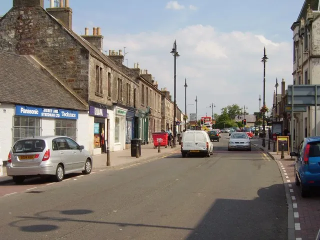 Tranent Town, East Lothian3.8 km NW
-
Pencaitland Village, East Lothian2.3 km S
-
Ormiston Village, East Lothian3 km SW
-
Boggs Holdings Village, East Lothian1 km SE
-
New Winton Village, East Lothian1.2 km W
Nearby attractions & nature
Everything nearby-
Birns Water River, Scotland4.4 km E
-
Carberry Hill Mountain, East Lothian6.4 km W
-
Morrison’s Haven Natural site, East Lothian6.7 km W
-
Gosford Park Natural site, East Lothian7.1 km N
-
Dodridge Law Mountain, Midlothian8.1 km S
-
Byres Hill Mountain, East Lothian8.3 km NE
-
Garleton Hills Mountain, East Lothian8.8 km NE
-
Barney Hill Mountain, East Lothian9.1 km NE
More nature in United Kingdom
-
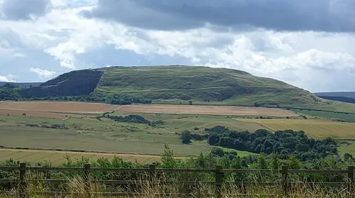 Traprain Law Mountain, East Lothian15 km E
-
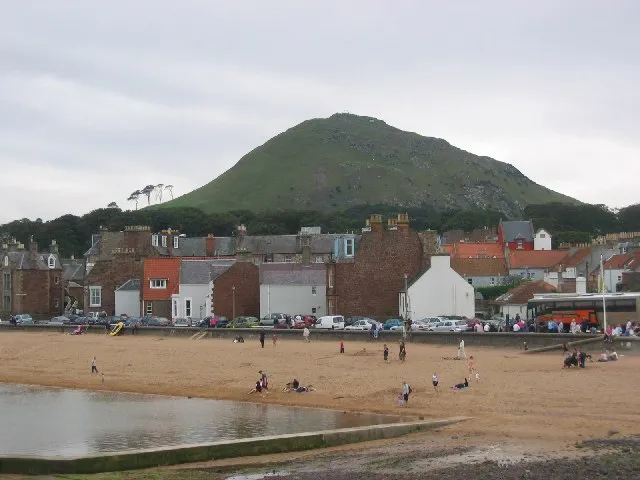 Berwick Law Mountain, East Lothian18 km NE
-
Lammer Law Mountain, East Lothian12 km SE
-
Kilduff Hill Mountain, East Lothian10 km NE
-
Highside Hill Mountain, East Lothian11 km SE
-
Gosford Bay Natural site, East Lothian7.6 km N
Sources & licences
Data last updated: