- Elevation
- 9 m
- above sea level
- Local time
- UTC+00:00
- Europe/London · UTC+00:00
- Airports
- DND Dundee Airport12 km
- EDI Edinburgh Airport55 km
About Motray Water
Motray Water is a river. Location: Fife, Scotland. The best months to visit are June–September. The nearest airport is Dundee Airport (12 km). Nearby sights include Lucklaw Hill and Airdit Hill.
Climate of Motray Water
Best months for sightseeingBest months for sightseeing: June–September.
This month · November
A cold month
Day 9° · Night 3° · Rain 60 mm
- Hottest month
- July (day 19°)
- Coldest month
- January (night 1°)
- Wettest month
- January (73 mm)
- Driest month
- April (44 mm)
Bars: average monthly low and high temperature. Below: precipitation. Monthly averages for 1970–2000 at about 18 km resolution, adjusted for elevation. Highlighted months are mild and relatively dry. Source: WorldClim 2.1 (CC BY 4.0).
Show values as a table
| Month | Jan | Feb | Mar | Apr | May | Jun | Jul | Aug | Sep | Oct | Nov | Dec |
|---|---|---|---|---|---|---|---|---|---|---|---|---|
| Average high (°C) | 6° | 7° | 9° | 11° | 14° | 17° | 19° | 19° | 16° | 13° | 9° | 7° |
| Average low (°C) | 1° | 1° | 2° | 3° | 6° | 9° | 11° | 10° | 8° | 6° | 3° | 1° |
| Precipitation (mm) | 73 | 48 | 51 | 44 | 51 | 52 | 51 | 52 | 63 | 69 | 60 | 67 |
Other places to visit in this season: June July August September
How to get to Motray Water
The nearest airport is Dundee Airport (DND), 12 km to the northwest as the crow flies. For international flights: Edinburgh Airport (EDI) (55 km). The nearest large city is Dundee, 12 km to the north.
Airports
- Dundee Airport (DND) Dundee 12 kmnorthwest
- Edinburgh Airport (EDI) Ingliston, Edinburgh 55 kmsouthwest
- Aberdeen International Airport (ABZ) Aberdeen 102 kmnortheast
Nearby large cities
- Dundee Population: 148.2K 12 kmnorth
- Edinburgh Population: 515K 50 kmsouth
- Aberdeen Population: 198.6K 99 kmnortheast
- Glasgow Population: 626.4K 101 kmsouthwest
- Newcastle upon Tyne Population: 300.1K 175 kmsoutheast
Straight-line distances; road distances are longer. Airport data: OurAirports.
Day trips from Motray Water
Within 100 km: 195 historic and cultural sites, 2,615 natural sites, 489 lakes, rivers and coasts.
0–25 km147 places
- Mugdrum Island Island 22 kmW
- Monikie Reservoirs Lake 20 kmN
- Lindores Loch Lake 18 kmW
- Craigowl Hill Mountain 21 kmN
25–60 km836 places
- Burntisland Beach Beach 39 kmSW
- Cramond beach Beach 50 kmSW
- Portobello Beach Beach 48 kmS
- Gullane Beach Beach 37 kmS
60–100 km2,316 places
- Cocklawburn Beach Beach 92 kmSE
- Cheswick Sands Beach 94 kmSE
- Ellens Isle Island 96 kmW
- Garbh Innis Island 95 kmW
Straight-line distances.
Nearest towns and villages
-
Guardbridge Village, Fife0.8 km E
-
Leuchars Village, Fife2 km NE
-
Balmullo Village, Fife2.1 km NW
-
Strathkinness Village, Fife3.8 km SE
-
Edenside Neighbourhood, Fife1.6 km SE
-
Kincaple Village, Fife2.3 km SE
Nearby attractions & nature
Everything nearby-
Lucklaw Hill Mountain, Fife3.2 km NW
-
Airdit Hill Mountain, Fife3.7 km W
-
Clatto Hill Mountain, Fife4.1 km S
-
Saint Andrews Bay Natural site, Fife4.1 km E
-
River Eden River, Fife4.1 km E
-
Craigfoodie Hill Mountain, Fife4.2 km W
-
Craigsanquhar Mountain, Fife4.9 km W
-
Forret Hill Mountain, Fife5.4 km W
More lakes, rivers and coasts in United Kingdom
-
Lindores Loch Lake, Fife18 km W
-
Isle of May Island, Fife29 km SE
-
River Leven River, Fife20 km S
-
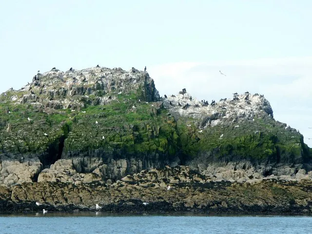 Carcraig Island, Fife44 km SW
-
Mugdrum Island Island, Fife22 km W
-
River Ore River, Fife23 km SW
Sources & licences
Data last updated: