High Knightswood
Located in Glasgow City, Scotland Coordinates: 55°53′57″ N 4°20′26″ W
- Elevation
- 34 m
- above sea level
- Local time
- UTC+00:00
- Europe/London · UTC+00:00
- Airports
- GLA Glasgow Airport7 km
- PIK Glasgow Prestwick Airport47 km
About High Knightswood
High Knightswood is a neighbourhood. Location: Glasgow City, Scotland. The best months to visit are June–August. The nearest airport is Glasgow Airport (7 km). Nearby sights include Cairn Hill and Dawsholm Park.
Photos of High Knightswood
-
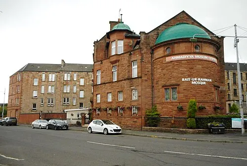
Bait-ur-Rahman Richard Sutcliffe · CC BY-SA 2.0 -
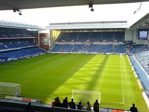
Glasgow Rangers Archibald99 · Public domain -
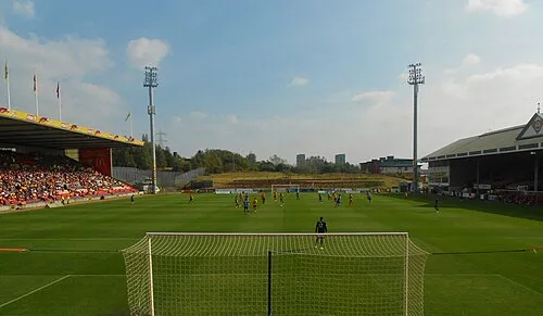
Firhill Stadium Andrew Hendo · CC BY-SA 3.0 -
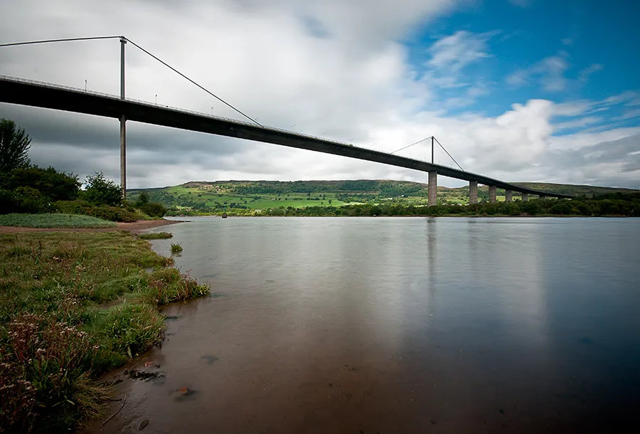
Erskine Bridge Baaker2009 from Dumbarton · CC BY 2.0


Climate of High Knightswood
Best months for sightseeingBest months for sightseeing: June–August.
This month · November
A wet month
Day 9° · Night 3° · Rain 148 mm
- Hottest month
- July (day 18°)
- Coldest month
- January (night 1°)
- Wettest month
- January (161 mm)
- Driest month
- April (69 mm)
Bars: average monthly low and high temperature. Below: precipitation. Monthly averages for 1970–2000 at about 18 km resolution, adjusted for elevation. Highlighted months are mild and relatively dry. Source: WorldClim 2.1 (CC BY 4.0).
Show values as a table
| Month | Jan | Feb | Mar | Apr | May | Jun | Jul | Aug | Sep | Oct | Nov | Dec |
|---|---|---|---|---|---|---|---|---|---|---|---|---|
| Average high (°C) | 7° | 7° | 9° | 11° | 15° | 17° | 18° | 18° | 16° | 12° | 9° | 7° |
| Average low (°C) | 1° | 1° | 2° | 4° | 6° | 9° | 11° | 11° | 9° | 6° | 3° | 2° |
| Precipitation (mm) | 161 | 111 | 121 | 69 | 73 | 70 | 80 | 96 | 129 | 152 | 148 | 147 |
How to get to High Knightswood
The nearest airport is Glasgow Airport (GLA), 7 km to the southwest as the crow flies. The nearest large city is Glasgow, 6 km to the southeast.
Airports
- Glasgow Airport (GLA) Glasgow 7 kmsouthwest
- Glasgow Prestwick Airport (PIK) Prestwick, South Ayrshire 47 kmsouth
- Edinburgh Airport (EDI) Ingliston, Edinburgh 61 kmeast
Nearby large cities
- Glasgow Population: 626.4K 6 kmsoutheast
- Edinburgh Population: 515K 72 kmeast
- Dundee Population: 148.2K 106 kmnortheast
- Belfast Population: 348K 177 kmsouthwest
- Aberdeen Population: 198.6K 196 kmnortheast
Straight-line distances; road distances are longer. Airport data: OurAirports.
Day trips from High Knightswood
Within 100 km: 174 historic and cultural sites, 3,759 natural sites, 1,161 lakes, rivers and coasts.
0–25 km213 places
- Inchcailloch Island 24 kmNW
- Aber Isle Island 22 kmNW
- Clairinsh Island 24 kmNW
- Creinch Island 24 kmNW
25–60 km1,249 places
- Great Cumbrae Island Island 39 kmW
- Ayr Beach Beach 52 kmS
- Troon Beach Beach 45 kmSW
- Hunterston Sands Beach 40 kmSW
60–100 km3,632 places
- Isle of Arran Island 66 kmSW
- Burntisland Beach Beach 72 kmE
- Cramond beach Beach 66 kmE
- Portobello Beach Beach 77 kmE
Straight-line distances.
Nearby attractions & nature
Everything nearby-
Cairn Hill Mountain, East Dunbartonshire1.1 km NE
-
Dawsholm Park Natural site, Scotland1.5 km E
-
Glasgow Rangers Landmark, Glasgow City5.5 km S
-
Firhill Stadium Landmark, Glasgow City4.9 km SE
-
Scotstoun Light Landmark, Renfrewshire2.9 km SW
-
Shieldhall Light (historical) Landmark, Glasgow City3.4 km S
Other cities and towns in Glasgow City
-
 Govan Village, Glasgow City4.4 km SE
-
 Maryhill Village, Glasgow City3.3 km E
-
Jordanhill Neighbourhood, Glasgow City1.8 km S
-
Knightswood Neighbourhood, Glasgow City1.9 km SW
-
Dawsholm Neighbourhood, Glasgow City2 km E
-
Acre Neighbourhood, Glasgow City2.2 km E
Sources & licences
Data last updated: