- Population
- 6,840
- 6.8K
- Elevation
- 22 m
- above sea level
- Local time
- UTC+00:00
- Europe/London · UTC+00:00
- Airports
- INV Inverness Airport50 km
- WIC Wick John O'Groats Airport83 km
About Lossiemouth
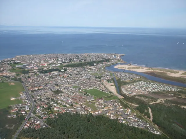
Lossiemouth is a town. Location: Moray, Scotland. Population: 6,840. Elevation: 22 m.
Lossiemouth (Scottish Gaelic: Inbhir Losaidh) is a coastal town in Moray, Scotland. Originally the port belonging to Elgin, it became an important fishing town. Although there has been over 1,000 years of settlement in the area, the present day town was formed over the past 250 years and consists of four separate communities that eventually merged into one. From 1890 to 1975, it was a police burgh as Lossiemouth and Branderburgh.
Source: Wikipedia · CC BY-SA 4.0
Photos of Lossiemouth
-

Geo. Paterson · CC BY-SA 3.0 -
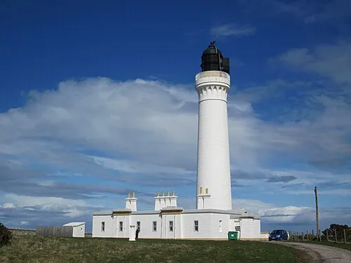
Covesea Skerries Lighthouse Vadder Pemm at de.wikipedia · Public domain


Travel notes for Lossiemouth
From Wikivoyage
Lossiemouth is a village on the coast of Moray in North East Scotland, with a population in 2016 of 7870. It developed as a fishing port in the 18th and 19th centuries, but the harbour is small and that industry has gone. Its main business now is as a service town for RAF Lossiemouth, the base for Britain's Quick Reaction Alert Interceptors.
So this unassuming little place now stands on the frontline of NATO's air defences. Russian bomber planes, some of them supersonic, regularly hurtle across the Norwegian and North Seas towards the UK. They are intercepted while still in international air space by Typhoon FGR4 fighters from RAF Lossiemouth. Everyone shows off their prowess and alertness, exchanges pleasantries and goes home safe. And yet another gambit has been played out across the great chessboard that stretches over quiet fields and icy seas and forests and onion domes.
Get in+
Elgin is the nearest railway station, with trains every couple of hours between Aberdeen and Inverness.
Stagecoach Bus 33 runs from Elgin to Lossiemouth, taking 20 min direct (anti-clockwise 33A) or 40 min via the RAF base (clockwise 33C). The direct route is along A941 which becomes Clifton Rd to the harbour, across town on Queen St then Stotfield Rd, then south on B9135 past the RAF base, rejoining A941 back to Elgin. Buses are every 30 min M-Sa and hourly on Sunday.
By road follow A96 to Elgin then A941 north.
Source: Wikivoyage · CC BY-SA 4.0 · abridged
Climate of Lossiemouth
Best months for sightseeingBest months for sightseeing: June–September.
This month · November
A cold month
Day 9° · Night 3° · Rain 67 mm
- Hottest month
- August (day 18°)
- Coldest month
- February (night 0°)
- Wettest month
- October (67 mm)
- Driest month
- April (40 mm)
Bars: average monthly low and high temperature. Below: precipitation. Monthly averages for 1970–2000 at about 18 km resolution, adjusted for elevation. Highlighted months are mild and relatively dry. Source: WorldClim 2.1 (CC BY 4.0).
Show values as a table
| Month | Jan | Feb | Mar | Apr | May | Jun | Jul | Aug | Sep | Oct | Nov | Dec |
|---|---|---|---|---|---|---|---|---|---|---|---|---|
| Average high (°C) | 6° | 7° | 9° | 10° | 13° | 16° | 18° | 18° | 16° | 13° | 9° | 7° |
| Average low (°C) | 0° | 0° | 2° | 3° | 6° | 8° | 10° | 10° | 8° | 5° | 3° | 1° |
| Precipitation (mm) | 61 | 45 | 54 | 40 | 46 | 51 | 55 | 61 | 65 | 67 | 67 | 59 |
Other places to visit in this season: June July August September
How to get to Lossiemouth
The nearest airport is Inverness Airport (INV), 50 km to the southwest as the crow flies. For international flights: Aberdeen International Airport (ABZ) (87 km). The nearest large city is Aberdeen, 96 km to the southeast.
Airports
- Inverness Airport (INV) Inverness, Highland 50 kmsouthwest
- Wick John O'Groats Airport (WIC) Wick 83 kmnorth
- Aberdeen International Airport (ABZ) Aberdeen 87 kmsoutheast
Nearby large cities
- Aberdeen Population: 198.6K 96 kmsoutheast
- Dundee Population: 148.2K 141 kmsouth
- Edinburgh Population: 515K 197 kmsouth
- Glasgow Population: 626.4K 215 kmsouth
- Newcastle upon Tyne Population: 300.1K 323 kmsouth
Straight-line distances; road distances are longer. Airport data: OurAirports.
Day trips from Lossiemouth
Within 100 km: 67 historic and cultural sites, 2,417 natural sites, 497 lakes, rivers and coasts.
0–25 km72 places
- Findlays Seat Mountain 18 kmS
- Lossiemouth East Beach Beach 1 kmSE
- Island of Dundurcas Island 21 kmS
- Haugh Island Island 19 kmSE
25–60 km647 places
- Sunnyside Beach Beach 30 kmE
- Eilean nan Clach Island 59 kmSW
- Isle of Moy Island 59 kmSW
- Innis Mhòr Island 42 kmW
60–100 km2,262 places
- Balbithan Island Island 78 kmSE
- Newburgh Seals Beach Beach 90 kmSE
- Aberdeen Beach Beach 96 kmSE
- Moy Island Island 77 kmW
Straight-line distances.
Nearby attractions & nature
Everything nearby-
Stotfield Head Natural site, Moray1.1 km SE
-
Lossiemouth East Beach Beach, Moray0.4 km SE
-
River Lossie River, Moray0.8 km S
-
Spey Bay Natural site, United Kingdom1 km E
-
Covesea Skerries Lighthouse Landmark, Moray3.3 km W
-
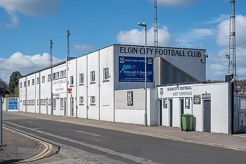 Borough Briggs Landmark, Moray8.1 km S
-
Binn Hill Mountain, Moray8.7 km SE
-
Palace of Spynie Historic site, Moray6.1 km S
Sources & licences
Data last updated: · 2 independent sources