- Elevation
- 579 m
- above sea level
- Local time
- UTC+00:00
- Europe/London · UTC+00:00
- Airports
- DND Dundee Airport48 km
- ABZ Aberdeen International Airport87 km
About Bad an Loin
Bad an Loin is a mountain. Location: Perth and Kinross, Scotland. Elevation: 579 m. The best months to visit are July–August. The nearest airport is Dundee Airport (48 km). Nearby sights include Glen Shee and Carn an Daimh.
Photos of Bad an Loin
-
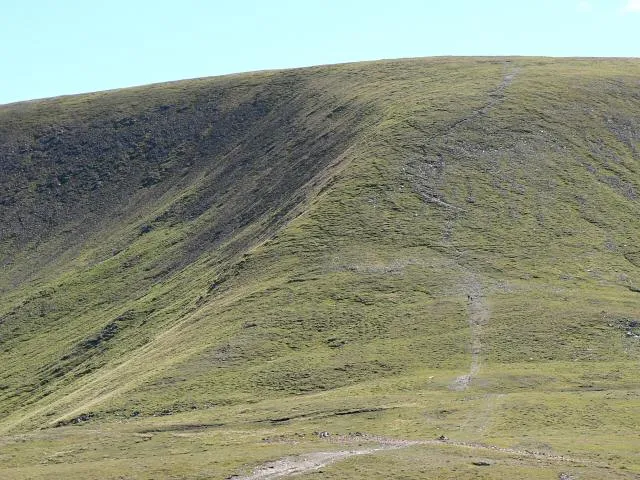
Glas Maol Rob Burke · CC BY-SA 2.0 -
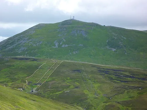
The Cairnwell Wdgwdgwdg · CC BY-SA 3.0 -
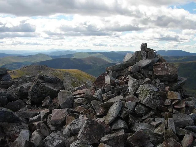
Creag Leacach Lis Burke · CC BY-SA 2.0


Climate of Bad an Loin
Best months for sightseeingBest months for sightseeing: July–August.
This month · November
A wet month
Day 5° · Night -1° · Rain 107 mm
- Hottest month
- July (day 16°)
- Coldest month
- January (night -3°)
- Wettest month
- January (137 mm)
- Driest month
- April (63 mm)
Bars: average monthly low and high temperature. Below: precipitation. Monthly averages for 1970–2000 at about 18 km resolution, adjusted for elevation. Highlighted months are mild and relatively dry. Source: WorldClim 2.1 (CC BY 4.0).
Show values as a table
| Month | Jan | Feb | Mar | Apr | May | Jun | Jul | Aug | Sep | Oct | Nov | Dec |
|---|---|---|---|---|---|---|---|---|---|---|---|---|
| Average high (°C) | 3° | 3° | 5° | 8° | 12° | 14° | 16° | 16° | 12° | 9° | 5° | 4° |
| Average low (°C) | -3° | -3° | -2° | 0° | 2° | 5° | 7° | 7° | 5° | 2° | -1° | -2° |
| Precipitation (mm) | 137 | 86 | 95 | 63 | 70 | 66 | 66 | 74 | 97 | 119 | 107 | 110 |
How to get to Bad an Loin
The nearest airport is Dundee Airport (DND), 48 km to the southeast as the crow flies. For international flights: Aberdeen International Airport (ABZ) (87 km). The nearest large city is Dundee, 49 km to the southeast.
Airports
- Dundee Airport (DND) Dundee 48 kmsoutheast
- Aberdeen International Airport (ABZ) Aberdeen 87 kmnortheast
- Inverness Airport (INV) Inverness, Highland 88 kmnorthwest
Nearby large cities
- Dundee Population: 148.2K 49 kmsoutheast
- Aberdeen Population: 198.6K 89 kmnortheast
- Edinburgh Population: 515K 98 kmsouth
- Glasgow Population: 626.4K 118 kmsouthwest
- Newcastle upon Tyne Population: 300.1K 235 kmsoutheast
Straight-line distances; road distances are longer. Airport data: OurAirports.
Day trips from Bad an Loin
Within 100 km: 145 historic and cultural sites, 3,491 natural sites, 663 lakes, rivers and coasts.
0–25 km469 places
- Lamb Island Island 25 kmSW
- Tomdachoille Island Island 22 kmSW
- Big Island Island 25 kmSW
- Loch Wharral Lake 24 kmE
25–60 km1,455 places
- Mugdrum Island Island 54 kmS
- Moncreiffe Island Island 48 kmS
- Isle of Spar Island 43 kmSW
- Eilean nan Ubh Island 41 kmSW
60–100 km2,375 places
- Balbithan Island Island 82 kmNE
- Findlays Seat Mountain 84 kmN
- Aberdeen Beach Beach 91 kmNE
- Burntisland Beach Beach 86 kmS
Straight-line distances.
Nearest towns and villages
-
Spittal of Glenshee Village, Perth and Kinross1.6 km SW
-
Glenshee Village Village, Perth and Kinross2.6 km S
-
Finegand Village, Perth and Kinross5 km SE
-
Clackavoid Village, Perth and Kinross7.7 km SE
-
Lair Village, Perth and Kinross7.8 km S
-
Little Forter Village, Angus8.5 km SE
Nearby attractions & nature
Everything nearby-
Glen Shee Natural site, Perth and Kinross0.7 km SE
-
Carn an Daimh Mountain, Perth and Kinross1.6 km E
-
Gleann Beag Natural site, Perth and Kinross1.6 km NE
-
Carn Chomh-Stri Mountain, Perth and Kinross2.1 km NE
-
Ben Gulabin Mountain, Perth and Kinross2.4 km NW
-
Creag Bhinnein Mountain, Perth and Kinross2.4 km S
-
Shee Water River, Perth and Kinross1 km S
-
Creag Leacach Mountain, Perth and Kinross5.1 km NE
More nature in United Kingdom
-
The Cairnwell Mountain, Perth and Kinross6.7 km N
-
Meall Uaine Mountain, Perth and Kinross3.5 km S
-
Creag an Dubh Shluic Mountain, Perth and Kinross3.6 km SW
-
Creag Lamhaich Mountain, Perth and Kinross3.8 km NW
-
Creag na Bruaich Mountain, Perth and Kinross4.2 km SE
-
Carn Mor Mountain, Perth and Kinross4.4 km N
Sources & licences
Data last updated: