- Elevation
- 349 m
- above sea level
- Local time
- UTC+00:00
- Europe/London · UTC+00:00
- Airports
- DND Dundee Airport34 km
- EDI Edinburgh Airport79 km
About Hill of Cally
Hill of Cally is a mountain. Location: Perth and Kinross, Scotland. Elevation: 349 m. The best months to visit are June–August. The nearest airport is Dundee Airport (34 km). Nearby sights include Hill of Ashmore and Hill of Persie.
Climate of Hill of Cally
Best months for sightseeingBest months for sightseeing: June–August.
This month · November
A cold month
Day 7° · Night 1° · Rain 79 mm
- Hottest month
- July (day 17°)
- Coldest month
- January (night -2°)
- Wettest month
- January (100 mm)
- Driest month
- April (48 mm)
Bars: average monthly low and high temperature. Below: precipitation. Monthly averages for 1970–2000 at about 18 km resolution, adjusted for elevation. Highlighted months are mild and relatively dry. Source: WorldClim 2.1 (CC BY 4.0).
Show values as a table
| Month | Jan | Feb | Mar | Apr | May | Jun | Jul | Aug | Sep | Oct | Nov | Dec |
|---|---|---|---|---|---|---|---|---|---|---|---|---|
| Average high (°C) | 4° | 5° | 7° | 9° | 13° | 16° | 17° | 17° | 14° | 11° | 7° | 5° |
| Average low (°C) | -2° | -2° | 0° | 1° | 4° | 7° | 9° | 9° | 6° | 4° | 1° | -1° |
| Precipitation (mm) | 100 | 63 | 69 | 48 | 57 | 56 | 58 | 61 | 75 | 89 | 79 | 83 |
How to get to Hill of Cally
The nearest airport is Dundee Airport (DND), 34 km to the southeast as the crow flies. For international flights: Edinburgh Airport (EDI) (79 km). The nearest large city is Dundee, 35 km to the southeast.
Airports
- Dundee Airport (DND) Dundee 34 kmsoutheast
- Edinburgh Airport (EDI) Ingliston, Edinburgh 79 kmsouth
- Aberdeen International Airport (ABZ) Aberdeen 96 kmnortheast
Nearby large cities
- Dundee Population: 148.2K 35 kmsoutheast
- Edinburgh Population: 515K 80 kmsouth
- Aberdeen Population: 198.6K 97 kmnortheast
- Glasgow Population: 626.4K 103 kmsouthwest
- Newcastle upon Tyne Population: 300.1K 220 kmsoutheast
Straight-line distances; road distances are longer. Airport data: OurAirports.
Day trips from Hill of Cally
Within 100 km: 152 historic and cultural sites, 3,513 natural sites, 689 lakes, rivers and coasts.
0–25 km352 places
- Island of Clunie Island 9 kmS
- Stanners Island Island 17 kmE
- Lamb Island Island 14 kmW
- Dowally Island Island 14 kmSW
25–60 km1,488 places
- Mugdrum Island Island 36 kmS
- St Serf's Island Island 53 kmS
- Moncreiffe Island Island 31 kmS
- Roy's Folly Island 52 kmS
60–100 km2,514 places
- Balbithan Island Island 92 kmNE
- Aberdeen Beach Beach 99 kmNE
- Burntisland Beach Beach 68 kmS
- Cramond beach Beach 76 kmS
Straight-line distances.
Nearest towns and villages
-
Netherton Village, Perth and Kinross1.8 km SE
-
Blackcraig Village, Perth and Kinross2.1 km W
-
Bridge of Cally Village, Perth and Kinross2.1 km SE
-
Ballintuim Village, Perth and Kinross3.2 km NW
-
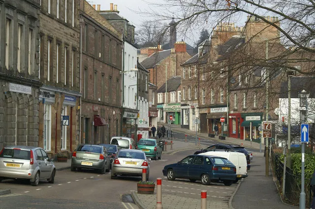 Blairgowrie and Rattray Town, Perth and Kinross9.4 km SE
-
 Kinloch Village, Perth and Kinross8.8 km S
Nearby attractions & nature
Everything nearby-
Hill of Ashmore Mountain, Perth and Kinross2.5 km E
-
Hill of Persie Mountain, Perth and Kinross2.9 km N
-
Knock of Balmyle Mountain, Perth and Kinross3.2 km NW
-
Hill of Kingseat Mountain, Perth and Kinross3.2 km NE
-
Blackcraig Hill Mountain, Perth and Kinross3.6 km W
-
River Ardle River, Perth and Kinross3.6 km SE
-
Cnoc Eirionnaich Mountain, Perth and Kinross4.4 km N
-
Drumderg Mountain, Perth and Kinross5.5 km NE
Sources & licences
Data last updated: