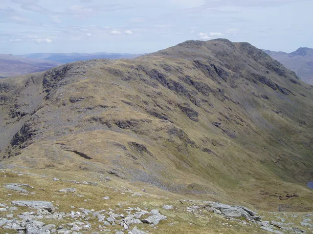
- Elevation
- 978 m
- above sea level
- Local time
- UTC+00:00
- Europe/London · UTC+00:00
- Airports
- GLA Glasgow Airport61 km
- EDI Edinburgh Airport98 km
About Beinn Dubhchraig
Beinn Dubhchraig is a mountain. Location: Stirling, Scotland. Elevation: 978 m.
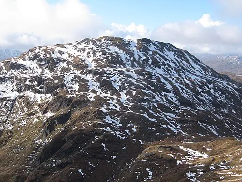
Beinn Dubhchraig (Scottish Gaelic: Beinn Dubhchreig) is a mountain in the Scottish Highlands, west of Crianlarich in the northern part of Loch Lomond and the Trossachs National Park. It is a Munro with a height of 978 metres (3,209 ft). It is overshadowed by its neighbour Ben Lui, although it is well seen from the main A82 road. Its name means "mountain of the black rock", referring to the steep and rocky face on the southwest slopes above Loch Oss, which offer scrambling routes to the summit.
Source: Wikipedia · CC BY-SA 4.0
At a glance
- Topographic prominence
- 199 m
Source: Wikidata
Photos of Beinn Dubhchraig
-

John Knight from Clackmannanshire, Scotland · CC BY 2.0 -

Alan O'Dowd · CC BY-SA 2.0 -

Steven Brown · CC BY-SA 2.0 -

Mick Knapton at English Wikipedia · CC BY-SA 3.0 -
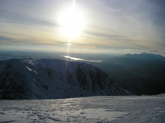
Beinn a' Chleibh Kathryn Mair · CC BY-SA 2.0


Climate of Beinn Dubhchraig
This month · November
A wet month
Day 3° · Night -2° · Rain 252 mm
- Hottest month
- July (day 12°)
- Coldest month
- February (night -4°)
- Wettest month
- January (288 mm)
- Driest month
- June (113 mm)
Bars: average monthly low and high temperature. Below: precipitation. Monthly averages for 1970–2000 at about 18 km resolution, adjusted for elevation. Highlighted months are mild and relatively dry. Source: WorldClim 2.1 (CC BY 4.0).
Show values as a table
| Month | Jan | Feb | Mar | Apr | May | Jun | Jul | Aug | Sep | Oct | Nov | Dec |
|---|---|---|---|---|---|---|---|---|---|---|---|---|
| Average high (°C) | 0° | 1° | 2° | 5° | 8° | 10° | 12° | 12° | 9° | 6° | 3° | 1° |
| Average low (°C) | -4° | -4° | -3° | -2° | 1° | 3° | 5° | 5° | 4° | 1° | -2° | -4° |
| Precipitation (mm) | 288 | 187 | 206 | 121 | 121 | 113 | 129 | 155 | 215 | 251 | 252 | 260 |
How to get to Beinn Dubhchraig
The nearest airport is Glasgow Airport (GLA), 61 km to the south as the crow flies. The nearest large city is Glasgow, 66 km to the southeast.
Airports
- Glasgow Airport (GLA) Glasgow 61 kmsouth
- Edinburgh Airport (EDI) Ingliston, Edinburgh 98 kmsoutheast
- Glasgow Prestwick Airport (PIK) Prestwick, South Ayrshire 100 kmsouth
Nearby large cities
- Glasgow Population: 626.4K 66 kmsoutheast
- Edinburgh Population: 515K 108 kmsoutheast
- Dundee Population: 148.2K 109 kmeast
- Aberdeen Population: 198.6K 182 kmnortheast
- Belfast Population: 348K 213 kmsouth
Straight-line distances; road distances are longer. Airport data: OurAirports.
Day trips from Beinn Dubhchraig
Within 100 km: 127 historic and cultural sites, 4,332 natural sites, 1,299 lakes, rivers and coasts.
0–25 km421 places
- Inishail Island 21 kmW
- Fraoch Eilean Island 19 kmW
- Island I Vow Island 13 kmS
- Inveruglas Isle Island 16 kmS
25–60 km2,018 places
- Eriska Island 44 kmW
- Torsa Island Island 56 kmW
- Shuna Island Island 46 kmNW
- Shuna Island 56 kmW
60–100 km3,319 places
- Isle of Arran Island 94 kmS
- Great Cumbrae Island Island 70 kmS
- Colonsay Island 98 kmW
- Troon Beach Beach 95 kmS
Straight-line distances.
Nearest towns and villages
-
Tyndrum Village, Stirling5.4 km N
-
Clifton Village, Stirling5.6 km N
-
Auchtertyre Village, Stirling5.9 km NE
-
 Inverarnan Village, Stirling7.1 km S
-
Crianlarich Village, Stirling7.6 km E
-
Inverardran Village, Stirling8.4 km E
Nearby attractions & nature
Everything nearby-
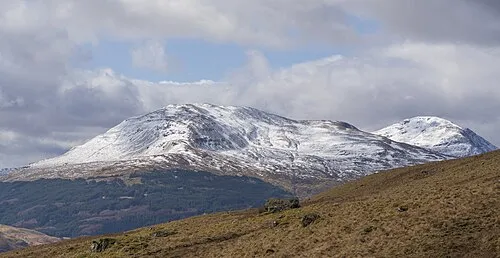 Ben Oss Mountain, Stirling2 km W
-
Loch Oss Lake, Stirling0.8 km W
-
Ben Oss North Top Mountain, Stirling1.7 km W
-
Cruachan Cruinn Mountain, Stirling2.7 km SE
-
Ben Lui Mountain, Stirling4.2 km W
-
Creagan Soilleir Mountain, Stirling3.2 km E
-
Creag nan Caorann Mountain, Stirling3.5 km S
-
Lochan Uaine Lake, Stirling3.3 km S
More nature in United Kingdom
-
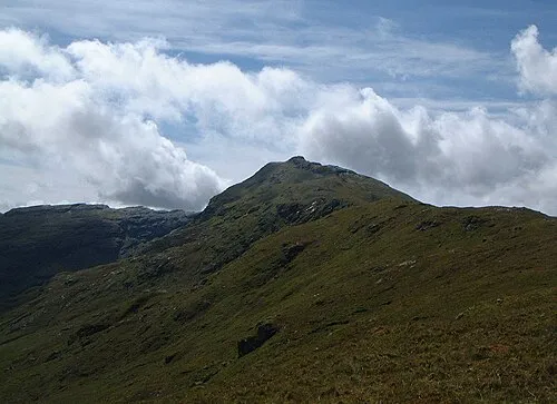 An Caisteal Mountain, Stirling9.4 km SE
-
 Beinn Chabhair Mountain, Stirling9.6 km SE
-
Glen Falloch Natural site, Stirling5.5 km SE
-
Fiarach Mountain, Stirling3.8 km E
-
Ben Lui NW Top Mountain, Stirling4.3 km W
-
Beinn Chuirn South Top Mountain, Stirling4.5 km NW
Sources & licences
Data last updated: · 2 independent sources