- Population
- 5,320
- 5.3K
- Elevation
- 13 m
- above sea level
- Local time
- UTC+00:00
- Europe/London · UTC+00:00
- Airports
- EDI Edinburgh Airport42 km
- GLA Glasgow Airport44 km
About Bridge of Allan
Bridge of Allan is a town. Location: Stirling, Scotland. Population: 5,320. Elevation: 13 m.
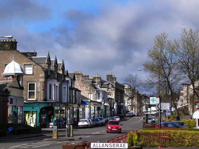
Bridge of Allan (Scots: Brig Allan, Scottish Gaelic: Drochaid Ailein), also known colloquially as Bofa, is a former spa town in the Stirling council area in Scotland, just north of the city of Stirling. Overlooked by the National Wallace Monument, it lies on the Allan Water, a northern tributary of the River Forth, built largely on the well-wooded slopes of the Westerton and Airthrey estates, sheltered by the Ochil Hills from the north and east winds.
Source: Wikipedia · CC BY-SA 4.0
Photos of Bridge of Allan
-

Director General of the Ordnance Survey, Southampton, UK · Public domain -

Drkirstyross · CC BY-SA 4.0 -

Drkirstyross · CC BY-SA 4.0 -

Dumyat · CC BY-SA 3.0 -

Stephencdickson · CC BY-SA 4.0


Travel notes for Bridge of Allan
From Wikivoyage
Bridge of Allan is a small Victorian Spa town in Stirlingshire in central Scotland, with a population of 5250 in 2021. Nestled beneath the iconic Wallace Monument, it's part of the city of Stirling. Demarcated by the meandering River Forth, Bridge of Allan grew up where the main road north crossed the small river Allan Water. There was a brief spell of copper mining in the 18th century, but in the 19th the village morphed into a spa resort, boosted by the railways and celebrity visitors, and the great monument to Wallace's victory was built. In the 20th century, the University of Stirling was developed on the town's doorstep, on the grounds of Airthrey Estate.
Understand+
In 1297 William Wallace held much of the north and Dundee was his next target, when the English under the Earl of Surrey marched north against him. At Stirling, Surrey dithered over crossing the River Forth, while the Scots got ready to meet him. He was urged to ford the river further upstream, which he could have done quickly outflanking the Scots. Instead he began to advance over the bridge, a ricketty narrow wooden structure that could only fit two horsemen abreast - the manouevre was bound to take hours. The Scots bided their time till 2000 had crossed then set on and slew them. Surrey could still have held his position at Stirling but bolted south to Berwick, and Scotland was in the hands of Wallace.
Wallace was never crowned king, but ruled as "Guardian of Scotland" until his betrayal, capture and execution in 1305 by the English. A war of succession broke out in Scotland: King Edward II tried to place a puppet king on their throne, and occupied Stirling Castle, but in 1314 the Scots under Robert the Bruce besieged the castle and defeated the English army a few miles south at Bannockburn. Scotland's independence was recognised in 1320 in the Declaration of Arbroath.
These two great victories are icons of Scottish lore and identity to this day - which gives the game away, that they were never so successful in battle again. There was a long period of peace until 1502 when, not leaving well enough alone, the two nations signed the Treaty of Perpetual Peace. Hostilities soon resumed and in 1513 Scotland suffered a catastrophic defeat at Flodden in Northumberland, with King James IV killed. They regrouped and came again, but suffered another crushing defeat near Carlisle in 1542. Never again could Scotland by itself pose a military threat to England. But if, say, France were to join as an ally, as in the Jacobite rebellions, surely they'd fare better?
Visitor information:
Discover Bridge of Allan is volunteer-run local information.
Get in+
By road:
Follow M9 to its terminus at Junction 11 then return south on A9. For the University, bypass Stirling to the east on A91 then turn onto Alloa Rd past the monument. From Stirling simply follow A9 north.
By rail:
Trains take four minutes from Stirling, and continue north to Dunblane; they run every 30 min and originate either from Glasgow Queen Street or from Edinburgh via Falkirk. Trains heading further north towards Aberdeen or Inverness seldom stop here, change at Stirling or Dunblane.
1 Bridge of Allan railway station has EV charging and free parking, but is just a platform halt with ticket machines. There is level access to Platform 1 (towards Stirling) and a ramp to Platform 2.
By bus:
Long distance coaches don't stop here, change in Stirling.
McGill's Bus 54 runs every 20 min between Stirling, Bridge of Allan village and the University. The Uni-link bus to the University doesn't come into Bridge of Allan.
Citylink 909 runs from Edinburgh every two hours via the airport, Bo'ness, Grangemouth, and Falkirk to Stirling, with two per day continuing to the University.
Stagecoach Bus 15 runs every two hours from Crieff via Dunblane, and continues to Stirling. Docherty's Bus 20 runs from Auchterarder.
Source: Wikivoyage · CC BY-SA 4.0 · abridged
Climate of Bridge of Allan
Best months for sightseeingBest months for sightseeing: June–August.
This month · November
A wet month
Day 9° · Night 3° · Rain 129 mm
- Hottest month
- July (day 19°)
- Coldest month
- January (night 1°)
- Wettest month
- January (145 mm)
- Driest month
- April (60 mm)
Bars: average monthly low and high temperature. Below: precipitation. Monthly averages for 1970–2000 at about 18 km resolution, adjusted for elevation. Highlighted months are mild and relatively dry. Source: WorldClim 2.1 (CC BY 4.0).
Show values as a table
| Month | Jan | Feb | Mar | Apr | May | Jun | Jul | Aug | Sep | Oct | Nov | Dec |
|---|---|---|---|---|---|---|---|---|---|---|---|---|
| Average high (°C) | 7° | 7° | 9° | 12° | 15° | 17° | 19° | 19° | 16° | 12° | 9° | 7° |
| Average low (°C) | 1° | 1° | 2° | 4° | 6° | 9° | 11° | 11° | 9° | 6° | 3° | 2° |
| Precipitation (mm) | 145 | 98 | 106 | 60 | 67 | 64 | 71 | 83 | 112 | 133 | 129 | 132 |
How to get to Bridge of Allan
The nearest airport is Edinburgh Airport (EDI), 42 km to the southeast as the crow flies. The nearest large city is Glasgow, 38 km to the southwest.
Airports
- Edinburgh Airport (EDI) Ingliston, Edinburgh 42 kmsoutheast
- Glasgow Airport (GLA) Glasgow 44 kmsouthwest
- Dundee Airport (DND) Dundee 66 kmnortheast
Nearby large cities
- Glasgow Population: 626.4K 38 kmsouthwest
- Edinburgh Population: 515K 52 kmsoutheast
- Dundee Population: 148.2K 70 kmnortheast
- Aberdeen Population: 198.6K 158 kmnortheast
- Newcastle upon Tyne Population: 300.1K 197 kmsoutheast
Straight-line distances; road distances are longer. Airport data: OurAirports.
Day trips from Bridge of Allan
Within 100 km: 190 historic and cultural sites, 3,900 natural sites, 950 lakes, rivers and coasts.
0–25 km217 places
- Inch Island 10 kmSE
- Speirs Island Island 20 kmS
- Dog Isle Island 23 kmW
- Dargill Island Island 24 kmN
25–60 km1,468 places
- Burntisland Beach Beach 46 kmE
- Cramond beach Beach 45 kmSE
- Portobello Beach Beach 57 kmSE
- Mugdrum Island Island 48 kmNE
60–100 km3,355 places
- Great Cumbrae Island Island 74 kmSW
- Ayr Beach Beach 89 kmSW
- Troon Beach Beach 82 kmSW
- Hunterston Sands Beach 76 kmSW
Straight-line distances.
Nearby attractions & nature
Everything nearby-
Gallow Hill Mountain, Stirling1.6 km NW
-
Black Hill Mountain, Stirling1.8 km E
-
Abbey Craig Mountain, Stirling2.4 km SE
-
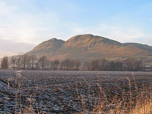 Dumyat Mountain, Stirling4.3 km E
-
Allan Water River, Stirling2.4 km S
-
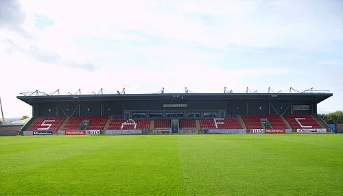 Forthbank Stadium Landmark, Stirling4.4 km SE
-
Stone Hill Mountain, Stirling3.2 km NE
-
Craigforth Mountain, Stirling3.3 km SW
Sources & licences
Data last updated: · 2 independent sources