Burnmouth Bay
Located in The Scottish Borders, Scotland Coordinates: 55°50′38″ N 2°03′48″ W
- Local time
- UTC+00:00
- Europe/London · UTC+00:00
- Airports
- EDI Edinburgh Airport83 km
- DND Dundee Airport90 km
About Burnmouth Bay
Burnmouth Bay is a natural site. Location: The Scottish Borders, Scotland. The best months to visit are June–September. The nearest airport is Edinburgh Airport (83 km). Nearby sights include Breeches Rock and Hilton Bay.
Climate of Burnmouth Bay
Best months for sightseeingBest months for sightseeing: June–September.
This month · November
A cold month
Day 8° · Night 2° · Rain 70 mm
- Hottest month
- July (day 19°)
- Coldest month
- January (night -1°)
- Wettest month
- October (73 mm)
- Driest month
- April (42 mm)
Bars: average monthly low and high temperature. Below: precipitation. Monthly averages for 1970–2000 at about 18 km resolution, adjusted for elevation. Highlighted months are mild and relatively dry. Source: WorldClim 2.1 (CC BY 4.0).
Show values as a table
| Month | Jan | Feb | Mar | Apr | May | Jun | Jul | Aug | Sep | Oct | Nov | Dec |
|---|---|---|---|---|---|---|---|---|---|---|---|---|
| Average high (°C) | 5° | 6° | 9° | 11° | 14° | 17° | 19° | 19° | 16° | 12° | 8° | 6° |
| Average low (°C) | -1° | -1° | 1° | 3° | 5° | 8° | 10° | 9° | 8° | 5° | 2° | 0° |
| Precipitation (mm) | 68 | 49 | 51 | 42 | 49 | 51 | 56 | 68 | 62 | 73 | 70 | 66 |
Other places to visit in this season: June July August September
How to get to Burnmouth Bay
The nearest airport is Edinburgh Airport (EDI), 83 km to the west as the crow flies. The nearest large city is Edinburgh, 72 km to the west.
Airports
- Edinburgh Airport (EDI) Ingliston, Edinburgh 83 kmwest
- Dundee Airport (DND) Dundee 90 kmnorthwest
- Newcastle International Airport (NCL) Newcastle upon Tyne, Tyne and Wear 93 kmsouth
Nearby large cities
- Edinburgh Population: 515K 72 kmwest
- Dundee Population: 148.2K 90 kmnorthwest
- Newcastle upon Tyne Population: 300.1K 101 kmsouth
- Sunderland Population: 170.1K 113 kmsoutheast
- Glasgow Population: 626.4K 137 kmwest
Straight-line distances; road distances are longer. Airport data: OurAirports.
Day trips from Burnmouth Bay
Within 100 km: 411 historic and cultural sites, 1,402 natural sites, 355 lakes, rivers and coasts.
0–25 km112 places
- Cocklawburn Beach Beach 14 kmSE
- Cheswick Sands Beach 16 kmSE
- Lindisfarne Holy Island Island 25 kmSE
- The Snook Island 23 kmSE
25–60 km597 places
- Gullane Beach Beach 53 kmNW
- Seacliff Beach Beach 43 kmNW
- Longhoughton Beach Beach 55 kmSE
- South Wamses Island 36 kmSE
60–100 km1,459 places
- Burntisland Beach Beach 76 kmW
- Cramond beach Beach 79 kmW
- Portobello Beach Beach 67 kmW
- Saint Mary’s Island Island 94 kmSE
Straight-line distances.
Nearest towns and villages

Nearby attractions & nature
Everything nearby-
Breeches Rock Mountain, The Scottish Borders1.1 km NW
-
Hilton Bay Natural site, Scotland2.1 km SE
-
Ayton Hill Mountain, The Scottish Borders3.1 km SW
-
Ale Water River, Scotland2.4 km W
-
Killiedraught Bay Natural site, United Kingdom4.5 km NW
-
Millerton Hill Mountain, The Scottish Borders5.4 km W
-
Eye Water River, Scotland2.8 km NW
-
Marshall Meadows Bay Natural site, England4.9 km SE
More nature in United Kingdom
-
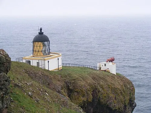 Saint Abbs Head Natural site, The Scottish Borders9.4 km NW
-
Kirk Hill Mountain, The Scottish Borders8.8 km NW
-
Stoneshiel Hill Mountain, The Scottish Borders8.9 km W
-
Hare Law Mountain, The Scottish Borders9.3 km SW
-
St Abb's Head Mountain, The Scottish Borders9.4 km NW
-
Cleaver Rock Mountain, The Scottish Borders9.5 km NW
Sources & licences
Data last updated: