- Elevation
- 321 m
- above sea level
- Local time
- UTC+00:00
- Europe/London · UTC+00:00
- Airports
- EDI Edinburgh Airport37 km
- DND Dundee Airport80 km
About Dyker Law
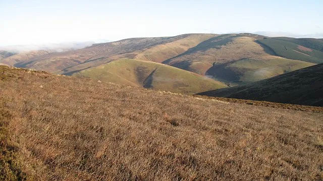
Dyker Law is a mountain. Location: The Scottish Borders, Scotland. Elevation: 321 m. The best months to visit are June–August. The nearest airport is Edinburgh Airport (37 km). Nearby sights include Hoppringle Hill and The Struther.
Climate of Dyker Law
Best months for sightseeingBest months for sightseeing: June–August.
This month · November
A wet month
Day 7° · Night 1° · Rain 106 mm
- Hottest month
- July (day 18°)
- Coldest month
- January (night -1°)
- Wettest month
- October (113 mm)
- Driest month
- April (66 mm)
Bars: average monthly low and high temperature. Below: precipitation. Monthly averages for 1970–2000 at about 18 km resolution, adjusted for elevation. Highlighted months are mild and relatively dry. Source: WorldClim 2.1 (CC BY 4.0).
Show values as a table
| Month | Jan | Feb | Mar | Apr | May | Jun | Jul | Aug | Sep | Oct | Nov | Dec |
|---|---|---|---|---|---|---|---|---|---|---|---|---|
| Average high (°C) | 5° | 5° | 7° | 9° | 13° | 16° | 18° | 17° | 14° | 11° | 7° | 6° |
| Average low (°C) | -1° | -1° | 0° | 2° | 4° | 7° | 9° | 9° | 7° | 4° | 1° | 0° |
| Precipitation (mm) | 112 | 82 | 90 | 66 | 69 | 75 | 80 | 90 | 97 | 113 | 106 | 108 |
How to get to Dyker Law
The nearest airport is Edinburgh Airport (EDI), 37 km to the northwest as the crow flies. The nearest large city is Edinburgh, 29 km to the northwest.
Airports
- Edinburgh Airport (EDI) Ingliston, Edinburgh 37 kmnorthwest
- Dundee Airport (DND) Dundee 80 kmnorth
- Glasgow Airport (GLA) Glasgow 96 kmwest
Nearby large cities
- Edinburgh Population: 515K 29 kmnorthwest
- Dundee Population: 148.2K 82 kmnorth
- Glasgow Population: 626.4K 85 kmwest
- Newcastle upon Tyne Population: 300.1K 119 kmsoutheast
- Sunderland Population: 170.1K 135 kmsoutheast
Straight-line distances; road distances are longer. Airport data: OurAirports.
Day trips from Dyker Law
Within 100 km: 531 historic and cultural sites, 2,291 natural sites, 594 lakes, rivers and coasts.
0–25 km261 places
- The Batta Island 13 kmS
- Roseberry Reservoir Lake 12 kmNW
- Portmore Loch Lake 16 kmW
- Glencorse Reservoir Lake 25 kmNW
25–60 km1,351 places
- Burntisland Beach Beach 41 kmNW
- Cramond beach Beach 36 kmNW
- Portobello Beach Beach 27 kmNW
- Gullane Beach Beach 34 kmN
60–100 km1,804 places
- Cocklawburn Beach Beach 61 kmE
- Cheswick Sands Beach 62 kmE
- Longhoughton Beach Beach 91 kmE
- South Wamses Island 82 kmE
Straight-line distances.
Nearest towns and villages
-
Fountainhall Village, The Scottish Borders1.2 km E
-
Crookston Village, The Scottish Borders1.7 km NE
-
Stow Village, The Scottish Borders6.2 km SE
-
Heriot Village, The Scottish Borders5.2 km N
-
Killochyett Village, The Scottish Borders5.8 km SE
-
 Lauder Village, The Scottish Borders11 km E
Nearby attractions & nature
Everything nearby-
Hoppringle Hill Mountain, The Scottish Borders1.6 km NE
-
The Struther Mountain, The Scottish Borders2.8 km SW
-
Halltree Rings Mountain, The Scottish Borders2.9 km NW
-
Watherston Hill Mountain, The Scottish Borders3 km S
-
Burial / Cairn (possible, period unknown), Clearance Cairn (possible) Historic site, The Scottish Borders1.4 km NE
-
Cortleferry Scooped Settlement (on Hoppringle Hill) Middle Iron Age Historic site, The Scottish Borders1.4 km NE
-
Carsinker Law Mountain, The Scottish Borders3.5 km E
-
Cortleferry Hill Mountain, The Scottish Borders3.6 km NE
More nature in United Kingdom
-
 Windlestraw Law Mountain, The Scottish Borders8 km SW
-
Kittyflat Mountain, The Scottish Borders3.7 km E
-
Craigend Hill Mountain, The Scottish Borders4.4 km SE
-
Rawburn Head Mountain, The Scottish Borders4.5 km SW
-
Dod Law Mountain, The Scottish Borders4.6 km W
-
Crookston North Mains Hill Mountain, The Scottish Borders4.7 km N
Sources & licences
Data last updated: