
- Population
- 1,395
- 1.4K
- Elevation
- 82 m
- above sea level
- Local time
- UTC+00:00
- Europe/London · UTC+00:00
- Airports
- LPL Liverpool John Lennon Airport93 km
- IOM Isle of Man Airport106 km
About Bethel
Bethel is a village. Location: Bodorgan, Anglesey. Population: 1,395. Elevation: 82 m.
Bethel is a village in Gwynedd, Wales. It lies east of Caernarfon on the B4366 road. Bethel Primary School is located in the village. The population of Bethel electoral ward was measured in the 2011 Census, and found to be 1,395. The village population is 1,171 with 87.3% having some form of Welsh identity one of the highest figures in the north of Wales.
Source: Wikipedia · CC BY-SA 4.0
Photos of Bethel
-
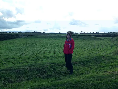
Castell Bryn Gwyn Richard Keatinge · CC BY-SA 3.0 -

Caernarfon Castle Llywelyn2000 · CC BY-SA 4.0 -
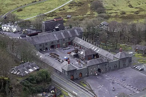
National Slate Museum Talsarnau Times · CC BY-SA 4.0


Climate of Bethel
Best months for sightseeingBest months for sightseeing: June–September.
This month · November
A wet month
Day 11° · Night 5° · Rain 140 mm
- Hottest month
- July (day 19°)
- Coldest month
- February (night 3°)
- Wettest month
- November (140 mm)
- Driest month
- May (67 mm)
Bars: average monthly low and high temperature. Below: precipitation. Monthly averages for 1970–2000 at about 18 km resolution, adjusted for elevation. Highlighted months are mild and relatively dry. Source: WorldClim 2.1 (CC BY 4.0).
Show values as a table
| Month | Jan | Feb | Mar | Apr | May | Jun | Jul | Aug | Sep | Oct | Nov | Dec |
|---|---|---|---|---|---|---|---|---|---|---|---|---|
| Average high (°C) | 8° | 8° | 10° | 12° | 15° | 17° | 19° | 19° | 17° | 14° | 11° | 9° |
| Average low (°C) | 3° | 3° | 4° | 5° | 7° | 10° | 12° | 12° | 10° | 8° | 5° | 4° |
| Precipitation (mm) | 118 | 87 | 103 | 73 | 67 | 73 | 76 | 93 | 104 | 127 | 140 | 130 |
Other places to visit in this season: June July August September
How to get to Bethel
The nearest airport is Liverpool John Lennon Airport (LPL), 93 km to the east as the crow flies. The nearest large city is Birkenhead, 83 km to the east.
Airports
- Liverpool John Lennon Airport (LPL) Liverpool 93 kmeast
- Isle of Man Airport (IOM) Castletown, Rushen 106 kmnorth
- Manchester Airport (MAN) Manchester, Greater Manchester 130 kmeast
Nearby large cities
- Birkenhead Population: 325.3K 83 kmeast
- Liverpool Population: 496.8K 86 kmeast
- St Helens Population: 183.2K 103 kmeast
- Blackpool Population: 145K 106 kmnortheast
- Warrington Population: 172.3K 111 kmeast
Straight-line distances; road distances are longer. Airport data: OurAirports.
Day trips from Bethel
Within 100 km: 301 historic and cultural sites, 1,459 natural sites, 150 lakes, rivers and coasts.
0–25 km262 places
- Anglesey Island 16 kmNW
- Traeth Lligwy Beach 22 kmN
- Puffin Island Island 21 kmNE
- Ynys Moelfre Island 21 kmN
25–60 km654 places
- Whistling Sands Beach 51 kmSW
- Traeth Penllech Beach 45 kmSW
- Porth Towyn Beach Beach 41 kmSW
- Ynys Tywyn Island 27 kmS
60–100 km994 places
- British Isles Island 94 kmN
- Thurstaston Beach Beach 74 kmE
- Formby Beach Beach 86 kmNE
- Ainsdale Beach Beach 91 kmNE
Straight-line distances.
Nearby attractions & nature
Everything nearby-
Pen Dinas Mountain, Llanddeiniolen2.4 km E
-
Bryn Ty-mawr Mountain, Llanddeiniolen2.8 km NE
-
Caernarfon Castle Historic site, Caernarfonshire5.5 km SW
-
Castell Llanddeiniolen Historic site, Llanddeiniolen4.4 km E
-
Castell Bryn Gwyn Historic site, Llanidan6.2 km W
-
Afon Seiont River, Wales4.4 km SW
Other cities and towns in Bodorgan
-
Malltraeth Village, Bodorgan12 km W
-
 Trefdraeth Village, Bodorgan13 km W
-
 Llangadwaladr Village, Bodorgan15 km W
-
Pen-Iôn Village, Bodorgan11 km W
-
Bethel Village, Bodorgan14 km W
-
Hermon Village, Bodorgan14 km W
Sources & licences
Data last updated: · 2 independent sources