- Elevation
- 56 m
- above sea level
- Local time
- UTC+00:00
- Europe/London · UTC+00:00
- Places inside
- 6
- listed under Llandeilo
- Airports
- CWL Cardiff International Airport71 km
- BRS Bristol Airport105 km
About Llandeilo
Llandeilo is a municipality. Location: Carmarthenshire, Wales. Elevation: 56 m. The best months to visit are June–August. The nearest airport is Cardiff International Airport (71 km). Nearby sights include Pantau and Cefnllwydcoed.
Climate of Llandeilo
Best months for sightseeingBest months for sightseeing: June–August.
This month · November
A wet month
Day 11° · Night 5° · Rain 154 mm
- Hottest month
- July (day 20°)
- Coldest month
- February (night 2°)
- Wettest month
- November (154 mm)
- Driest month
- May (75 mm)
Bars: average monthly low and high temperature. Below: precipitation. Monthly averages for 1970–2000 at about 18 km resolution, adjusted for elevation. Highlighted months are mild and relatively dry. Source: WorldClim 2.1 (CC BY 4.0).
Show values as a table
| Month | Jan | Feb | Mar | Apr | May | Jun | Jul | Aug | Sep | Oct | Nov | Dec |
|---|---|---|---|---|---|---|---|---|---|---|---|---|
| Average high (°C) | 8° | 7° | 9° | 12° | 15° | 18° | 20° | 20° | 17° | 14° | 11° | 9° |
| Average low (°C) | 3° | 2° | 4° | 5° | 8° | 11° | 13° | 13° | 11° | 8° | 5° | 4° |
| Precipitation (mm) | 147 | 103 | 112 | 81 | 75 | 84 | 82 | 103 | 114 | 139 | 154 | 152 |
How to get to Llandeilo
The nearest airport is Cardiff International Airport (CWL), 71 km to the southeast as the crow flies. The nearest large city is Swansea, 30 km to the south.
Airports
- Cardiff International Airport (CWL) Cardiff 71 kmsoutheast
- Bristol Airport (BRS) Bristol 105 kmsoutheast
- Exeter International Airport (EXT) Exeter, Devon 134 kmsouth
Nearby large cities
- Swansea Population: 300.4K 30 kmsouth
- Cardiff Population: 372.1K 72 kmsoutheast
- Newport Population: 161.5K 76 kmsoutheast
- Bristol Population: 479K 108 kmsoutheast
- Gloucester Population: 132.4K 120 kmeast
Straight-line distances; road distances are longer. Airport data: OurAirports.
Day trips from Llandeilo
Within 100 km: 831 historic and cultural sites, 2,109 natural sites, 193 lakes, rivers and coasts.
0–25 km289 places
- Ynys Isaf Island 18 kmSW
- Trichrug Mountain 7 kmE
- Mynydd Pen-bre Mountain 24 kmSW
- Mynydd Llanybyther Mountain 19 kmNW
25–60 km1,002 places
- Poppit Sands Beach 54 kmNW
- Mwnt beach Beach 52 kmNW
- Tresaith Beach Beach 46 kmNW
- Llangrannog's Beach Beach 45 kmNW
60–100 km1,842 places
- St Justinian Natural site 91 kmW
- Porth Clais Natural site 89 kmW
- Port Selau Natural site 90 kmW
- Saunton Sands Beach 89 kmS
Straight-line distances.
Places in Llandeilo
6 placesBar: population relative to the most populous place in this list.
Cities & villages1
- Dinefwr Park · Village
Mountains & nature3
- Dynevor Castle · Mountain
- Pen Lan-fawr · Mountain
- The Rookery · Mountain
Heritage & sights1
- Dinefwr Castle · Historic site
Nearby attractions & nature
Everything nearby-
Pantau Mountain, Cyngor Bro Dyffryn Cennen1.8 km E
-
Cefnllwydcoed Mountain, Manordeilo and Salem2.3 km N
-
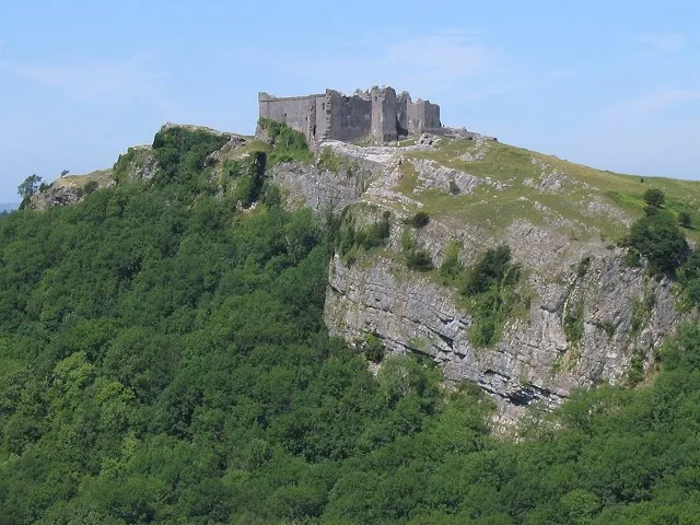 Carreg Cennen Castle Historic site, Cyngor Bro Dyffryn Cennen5.2 km SE
-
Pen Crugcwn Mountain, Manordeilo and Salem3.8 km NW
-
Pen y Lan Mountain, Cyngor Bro Dyffryn Cennen3.9 km SE
-
Pen Maesydderwen Mountain, Llangadog4.3 km E
-
Bryn Castell-gwrychion Mountain, Llangathen4.3 km W
-
Warren Wood Mountain, Llanfihangel Aberbythych4.7 km SW
Other cities and towns in Carmarthenshire
-
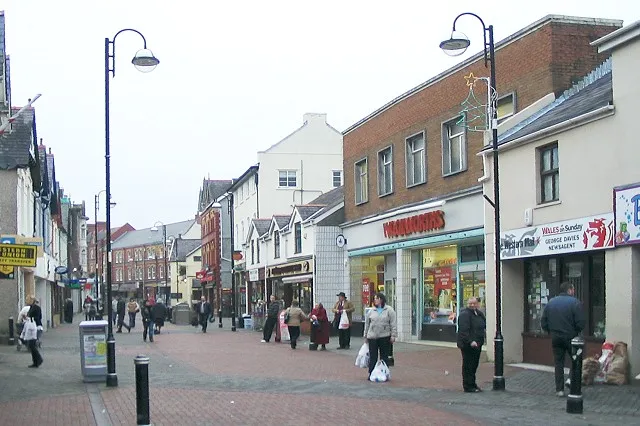 Ammanford Town, Ammanford10 km S
-
Llanfihangel Aberbythych Municipality, Carmarthenshire6.4 km SW
-
Llangadog Municipality, Carmarthenshire8.1 km E
-
Llandybie Municipality, Carmarthenshire8.6 km S
-
Llanfynydd Municipality, Carmarthenshire8.3 km NW
-
Talley Municipality, Carmarthenshire9.3 km N
Sources & licences
Data last updated: