- Elevation
- 302 m
- above sea level
- Local time
- UTC+00:00
- Europe/London · UTC+00:00
- Airports
- CWL Cardiff International Airport74 km
- BRS Bristol Airport100 km
About Mwmffri
Mwmffri is a mountain. Location: Llanfair-ar-y-Bryn, Carmarthenshire. Elevation: 302 m. The best months to visit are June–August. The nearest airport is Cardiff International Airport (74 km). Nearby sights include Allt Ystradwalter and Cefn.
Photos of Mwmffri
-
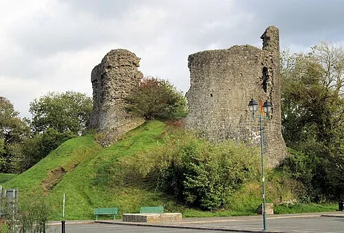
Llandovery Castle Stuart Logan · CC BY-SA 2.0

Climate of Mwmffri
Best months for sightseeingBest months for sightseeing: June–August.
This month · November
A wet month
Day 9° · Night 3° · Rain 182 mm
- Hottest month
- July (day 18°)
- Coldest month
- February (night 1°)
- Wettest month
- December (188 mm)
- Driest month
- May (86 mm)
Bars: average monthly low and high temperature. Below: precipitation. Monthly averages for 1970–2000 at about 18 km resolution, adjusted for elevation. Highlighted months are mild and relatively dry. Source: WorldClim 2.1 (CC BY 4.0).
Show values as a table
| Month | Jan | Feb | Mar | Apr | May | Jun | Jul | Aug | Sep | Oct | Nov | Dec |
|---|---|---|---|---|---|---|---|---|---|---|---|---|
| Average high (°C) | 6° | 6° | 8° | 10° | 14° | 16° | 18° | 18° | 15° | 12° | 9° | 7° |
| Average low (°C) | 1° | 1° | 2° | 3° | 6° | 8° | 11° | 10° | 8° | 6° | 3° | 2° |
| Precipitation (mm) | 182 | 127 | 139 | 98 | 86 | 96 | 92 | 116 | 131 | 162 | 182 | 188 |
How to get to Mwmffri
The nearest airport is Cardiff International Airport (CWL), 74 km to the south as the crow flies. The nearest large city is Swansea, 45 km to the south.
Airports
- Cardiff International Airport (CWL) Cardiff 74 kmsouth
- Bristol Airport (BRS) Bristol 100 kmsoutheast
- Exeter International Airport (EXT) Exeter, Devon 144 kmsouth
Nearby large cities
- Swansea Population: 300.4K 45 kmsouth
- Newport Population: 161.5K 70 kmsoutheast
- Cardiff Population: 372.1K 71 kmsoutheast
- Bristol Population: 479K 100 kmsoutheast
- Gloucester Population: 132.4K 104 kmeast
Straight-line distances; road distances are longer. Airport data: OurAirports.
Day trips from Mwmffri
Within 100 km: 955 historic and cultural sites, 2,411 natural sites, 171 lakes, rivers and coasts.
0–25 km309 places
- Trichrug Mountain 17 kmSW
- Bryn Garw Mountain 25 kmN
- Mynydd Figyn Mountain 22 kmW
- Fan Gyhirych Mountain 19 kmSE
25–60 km1,348 places
- Tresaith Beach Beach 55 kmW
- Llangrannog's Beach Beach 53 kmW
- Ynys Lochtyn Island 53 kmW
- Ynys Isaf Island 39 kmSW
60–100 km1,880 places
- Poppit Sands Beach 66 kmW
- Kilve Beach Beach 98 kmS
- Manorbier Beach Beach 84 kmSW
- Broad Haven South Beach Beach 93 kmSW
Straight-line distances.
Nearest towns and villages
-
 Llandovery Village, Llandovery4.1 km SW
-
Pentre-ty-gwyn Village, Llanfair-ar-y-Bryn1.4 km SE
-
Pentrebach Village, Llanfair-ar-y-Bryn3.3 km SE
-
Cynghordy Village, Llanfair-ar-y-Bryn3.8 km N
-
Llandovery Municipality, Carmarthenshire3.2 km W
-
Llanfair-ar-y-bryn Village, Llanfair-ar-y-Bryn3.9 km N
Nearby attractions & nature
Everything nearby-
Allt Ystradwalter Mountain, Llanfair-ar-y-Bryn1.1 km W
-
Cefn Mountain, Llanfair-ar-y-Bryn2.5 km N
-
Allt Llwyn-y-berllan Mountain, Llanfair-ar-y-Bryn3 km SE
-
Banc Cefngarreg Mountain, Llanfair-ar-y-Bryn3.3 km NE
-
Noethgrug Mountain, Llanfair-ar-y-Bryn3.5 km NE
-
Pen-y-gaer Mountain, Llandovery3.5 km NW
-
Allt Mes Mountain, Llanfair-ar-y-Bryn3.7 km N
-
Cefn Arthen Mountain, Llanfair-ar-y-Bryn4 km SE
Sources & licences
Data last updated: