- Elevation
- 192 m
- above sea level
- Local time
- UTC+00:00
- Europe/London · UTC+00:00
- Airports
- CWL Cardiff International Airport70 km
- BRS Bristol Airport110 km
About Mynydd Pen-bre
Mynydd Pen-bre is a mountain. Location: Trimsaran, Carmarthenshire. Elevation: 192 m. The best months to visit are June–September. The nearest airport is Cardiff International Airport (70 km). Nearby sights include Pen Waun Twmpath and Pen Caerbigyn.
Photos of Mynydd Pen-bre
-
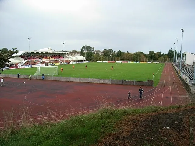
Stebonheath Park David Luther Thomas · CC BY-SA 2.0

Climate of Mynydd Pen-bre
Best months for sightseeingBest months for sightseeing: June–September.
This month · November
A wet month
Day 10° · Night 5° · Rain 132 mm
- Hottest month
- July (day 19°)
- Coldest month
- February (night 2°)
- Wettest month
- November (132 mm)
- Driest month
- May (64 mm)
Bars: average monthly low and high temperature. Below: precipitation. Monthly averages for 1970–2000 at about 18 km resolution, adjusted for elevation. Highlighted months are mild and relatively dry. Source: WorldClim 2.1 (CC BY 4.0).
Show values as a table
| Month | Jan | Feb | Mar | Apr | May | Jun | Jul | Aug | Sep | Oct | Nov | Dec |
|---|---|---|---|---|---|---|---|---|---|---|---|---|
| Average high (°C) | 7° | 7° | 9° | 11° | 14° | 17° | 19° | 19° | 16° | 13° | 10° | 8° |
| Average low (°C) | 2° | 2° | 3° | 4° | 7° | 10° | 12° | 12° | 10° | 8° | 5° | 3° |
| Precipitation (mm) | 120 | 85 | 90 | 68 | 64 | 74 | 73 | 92 | 98 | 121 | 132 | 125 |
Other places to visit in this season: June July August September
How to get to Mynydd Pen-bre
The nearest airport is Cardiff International Airport (CWL), 70 km to the southeast as the crow flies. The nearest large city is Swansea, 22 km to the southeast.
Airports
- Cardiff International Airport (CWL) Cardiff 70 kmsoutheast
- Bristol Airport (BRS) Bristol 110 kmeast
- Exeter International Airport (EXT) Exeter, Devon 123 kmsoutheast
Nearby large cities
- Swansea Population: 300.4K 22 kmsoutheast
- Cardiff Population: 372.1K 76 kmeast
- Newport Population: 161.5K 85 kmeast
- Bristol Population: 479K 116 kmeast
- Exeter Population: 130.7K 120 kmsoutheast
Straight-line distances; road distances are longer. Airport data: OurAirports.
Day trips from Mynydd Pen-bre
Within 100 km: 657 historic and cultural sites, 1,724 natural sites, 178 lakes, rivers and coasts.
0–25 km223 places
- Worms Head Island 18 kmSW
- Outer Head Island 19 kmSW
- Ynys Isaf Island 10 kmN
- Low Neck Island 18 kmSW
25–60 km779 places
- Poppit Sands Beach 55 kmNW
- Manorbier Beach Beach 42 kmW
- Broad Haven South Beach Beach 50 kmW
- Mwnt beach Beach 55 kmNW
60–100 km1,557 places
- St Justinian Natural site 78 kmW
- Porth Clais Natural site 75 kmW
- Port Selau Natural site 77 kmW
- Saunton Sands Beach 69 kmS
Straight-line distances.
Nearest towns and villages
-
Trimsaran Village, Trimsaran1.8 km W
-
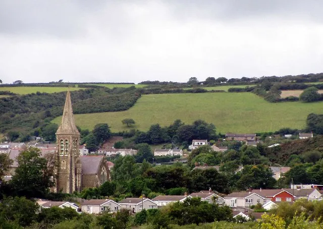 Burry Port Town, Pembrey and Burry Port Town4.2 km SW
-
Carway Village, Llangyndeyrn2.4 km N
-
Pen-y-mynydd Village, Trimsaran0.8 km SW
-
Heol-ddu Village, Trimsaran1 km SW
-
Llanelli Town, Llanelli5.4 km SE
Nearby attractions & nature
Everything nearby-
Pen Waun Twmpath Mountain, Pembrey and Burry Port Town2.1 km S
-
Pen Caerbigyn Mountain, Llanelli Rural3 km NE
-
Waun Tympath Historic site, Pembrey and Burry Port Town1.8 km S
-
Mynydd Sylen Mountain, Llannon5.8 km NE
-
Clochywie Hill Mountain, Llanelli Rural6 km E
-
Bryncoch Mountain, Llangyndeyrn6.2 km N
-
Pen Cornhwrdd Mountain, Llangennech7.8 km E
-
Allt Cunedda Mountain, St. Ishmael7.8 km NW
Sources & licences
Data last updated: