
- Elevation
- 73 m
- above sea level
- Local time
- UTC+00:00
- Europe/London · UTC+00:00
- Airports
- CWL Cardiff International Airport115 km
- BRS Bristol Airport149 km
About Tresaith
Tresaith is a village. Location: Penbryn, Ceredigion. Elevation: 73 m.
Tresaith (until the mid-20th century, Traethsaith) is a coastal village in Ceredigion, Wales, between Aberporth and Llangranog. It is linked to the former by a two-mile section of the Ceredigion Coast Path, part of the Wales Coast Path. Tresaith is within the Ceredigion Heritage Coast which offers extensive walking and views. There is an abundance of wildlife and flora. Many kinds of seabirds can be spotted and regular sightings of grey seals and dolphins are made.
Source: Wikipedia · CC BY-SA 4.0
Photos of Tresaith
-
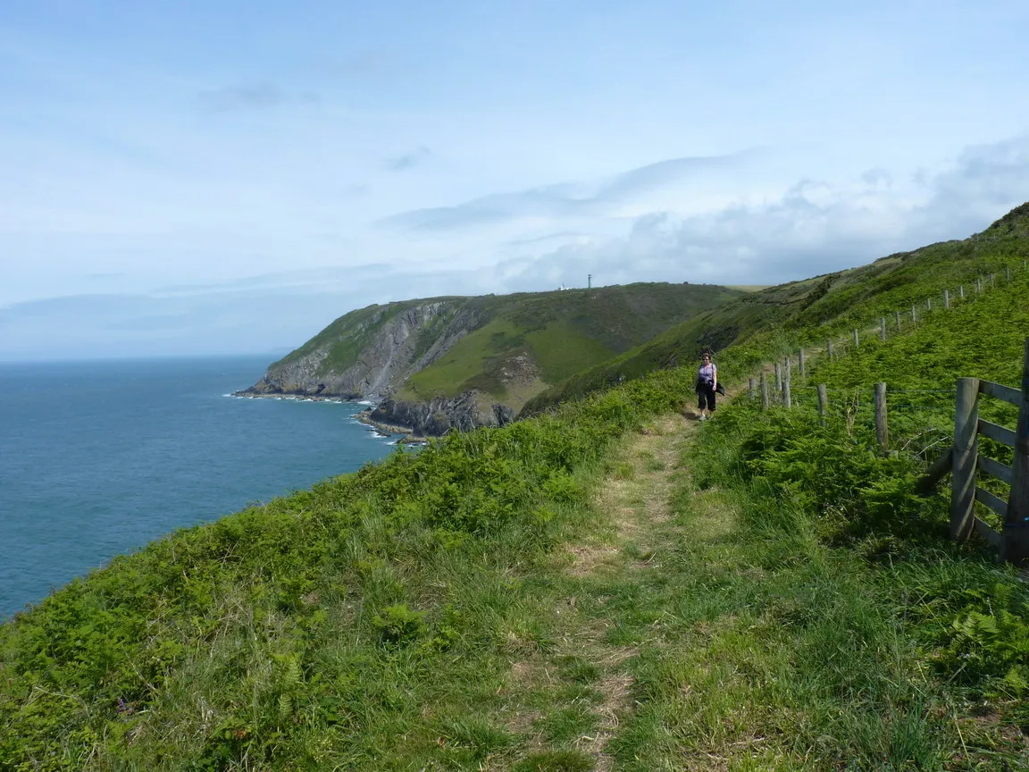
Pencribach Richard Law · CC BY-SA 2.0

Climate of Tresaith
Best months for sightseeingBest months for sightseeing: June–September.
This month · November
A wet month
Day 11° · Night 6° · Rain 124 mm
- Hottest month
- August (day 18°)
- Coldest month
- February (night 3°)
- Wettest month
- November (124 mm)
- Driest month
- May (64 mm)
Bars: average monthly low and high temperature. Below: precipitation. Monthly averages for 1970–2000 at about 18 km resolution, adjusted for elevation. Highlighted months are mild and relatively dry. Source: WorldClim 2.1 (CC BY 4.0).
Show values as a table
| Month | Jan | Feb | Mar | Apr | May | Jun | Jul | Aug | Sep | Oct | Nov | Dec |
|---|---|---|---|---|---|---|---|---|---|---|---|---|
| Average high (°C) | 8° | 8° | 9° | 11° | 14° | 16° | 18° | 18° | 17° | 14° | 11° | 9° |
| Average low (°C) | 3° | 3° | 4° | 5° | 8° | 10° | 12° | 12° | 11° | 9° | 6° | 4° |
| Precipitation (mm) | 113 | 80 | 87 | 65 | 64 | 74 | 70 | 91 | 94 | 117 | 124 | 118 |
Other places to visit in this season: June July August September
How to get to Tresaith
The nearest airport is Cardiff International Airport (CWL), 115 km to the southeast as the crow flies. The nearest large city is Swansea, 69 km to the southeast.
Airports
- Cardiff International Airport (CWL) Cardiff 115 kmsoutheast
- Bristol Airport (BRS) Bristol 149 kmsoutheast
- Exeter International Airport (EXT) Exeter, Devon 173 kmsoutheast
Nearby large cities
- Swansea Population: 300.4K 69 kmsoutheast
- Cardiff Population: 372.1K 117 kmsoutheast
- Newport Population: 161.5K 120 kmsoutheast
- Bristol Population: 479K 152 kmsoutheast
- Telford Population: 155.6K 153 kmnortheast
Straight-line distances; road distances are longer. Airport data: OurAirports.
Day trips from Tresaith
Within 100 km: 470 historic and cultural sites, 1,806 natural sites, 166 lakes, rivers and coasts.
0–25 km140 places
- Poppit Sands Beach 13 kmW
- Mwnt beach Beach 9 kmW
- Tresaith Beach Beach 1 kmNW
- Llangrannog's Beach Beach 4 kmNE
25–60 km778 places
- Manorbier Beach Beach 58 kmS
- Caerfai Beach Beach 59 kmSW
- Caldey Island Island 57 kmS
- Saint Margaret’s Island Island 56 kmS
60–100 km1,524 places
- St Justinian Natural site 62 kmSW
- Porth Clais Natural site 61 kmSW
- Port Selau Natural site 61 kmSW
- Broad Haven South Beach Beach 65 kmSW
Straight-line distances.
Nearby attractions & nature
Everything nearby-
Tresaith Beach Beach, Penbryn0.7 km NW
-
Gaer Pwntan Mountain, Penbryn2 km SE
-
Gaer Lwyd Mountain, Penbryn2.2 km NE
-
Blaenporth Castle Historic site, Aberporth2.9 km SW
-
Pencribach Natural site, Wales4.4 km NW
-
Cribach Bay Natural site, Ceredigion3.2 km W
Sources & licences
Data last updated: · 2 independent sources