- Elevation
- 10 m
- above sea level
- Local time
- UTC+00:00
- Europe/London · UTC+00:00
- Places inside
- 3
- listed under Marshfield
- Airports
- CWL Cardiff International Airport25 km
- BRS Bristol Airport30 km
About Marshfield
Marshfield is a municipality. Location: City of Newport, Wales. Elevation: 10 m. The best months to visit are June–August. The nearest airport is Cardiff International Airport (25 km). Nearby sights include The Mount and Caer Castell.
Photos of Marshfield
-
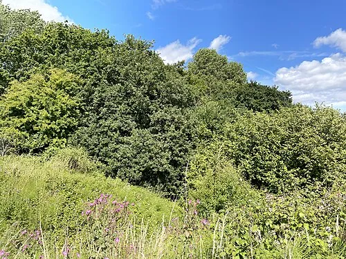
Caer Castell Seth Whales · CC BY-SA 4.0 -
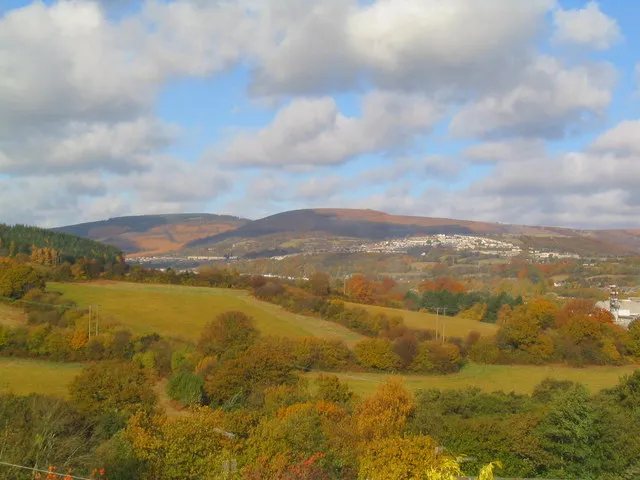
Rhiwderin Camp Graham Price · CC BY-SA 2.0 -
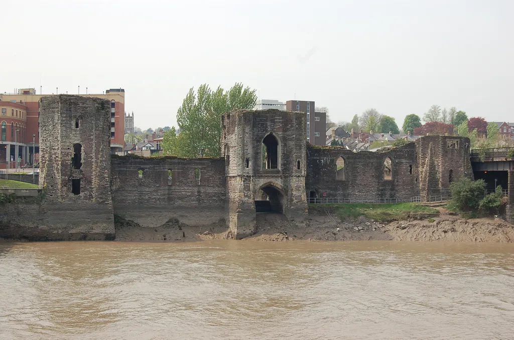
Newport Castle The original uploader was Owain at English Wikipedia · CC BY-SA 2.5 -
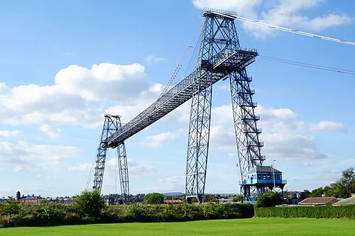
Newport Transporter Bridge WelshDave · CC BY-SA 4.0


Climate of Marshfield
Best months for sightseeingBest months for sightseeing: June–August.
This month · November
A wet month
Day 11° · Night 5° · Rain 115 mm
- Hottest month
- July (day 21°)
- Coldest month
- February (night 2°)
- Wettest month
- January (116 mm)
- Driest month
- July (59 mm)
Bars: average monthly low and high temperature. Below: precipitation. Monthly averages for 1970–2000 at about 18 km resolution, adjusted for elevation. Highlighted months are mild and relatively dry. Source: WorldClim 2.1 (CC BY 4.0).
Show values as a table
| Month | Jan | Feb | Mar | Apr | May | Jun | Jul | Aug | Sep | Oct | Nov | Dec |
|---|---|---|---|---|---|---|---|---|---|---|---|---|
| Average high (°C) | 8° | 8° | 10° | 13° | 16° | 19° | 21° | 21° | 18° | 14° | 11° | 9° |
| Average low (°C) | 3° | 2° | 4° | 5° | 8° | 11° | 13° | 13° | 11° | 8° | 5° | 4° |
| Precipitation (mm) | 116 | 84 | 89 | 64 | 67 | 68 | 59 | 86 | 97 | 105 | 115 | 116 |
How to get to Marshfield
The nearest airport is Cardiff International Airport (CWL), 25 km to the southwest as the crow flies. The nearest large city is Newport, 7 km to the northeast.
Airports
- Cardiff International Airport (CWL) Cardiff 25 kmsouthwest
- Bristol Airport (BRS) Bristol 30 kmsoutheast
- Exeter International Airport (EXT) Exeter, Devon 92 kmsouth
Nearby large cities
- Newport Population: 161.5K 7 kmnortheast
- Cardiff Population: 372.1K 10 kmsouthwest
- Bristol Population: 479K 34 kmeast
- Bath Population: 101.6K 52 kmeast
- Swansea Population: 300.4K 61 kmwest
Straight-line distances; road distances are longer. Airport data: OurAirports.
Day trips from Marshfield
Within 100 km: 846 historic and cultural sites, 1,907 natural sites, 148 lakes, rivers and coasts.
0–25 km266 places
- Steep Holm Island 22 kmS
- Flat Holm Island 18 kmS
- Barry Island Island 21 kmSW
- Sully Island Island 18 kmSW
25–60 km830 places
- Kilve Beach Beach 40 kmS
- Stert Island Island 34 kmS
- Denny Island Island 38 kmSE
- Fenning Island Island 36 kmS
60–100 km1,805 places
- Saunton Sands Beach 94 kmSW
- Charmouth Beach Beach 90 kmS
- Putsborough Beach Beach 91 kmSW
- Worms Head Island 87 kmW
Straight-line distances.
Places in Marshfield
3 placesBar: population relative to the most populous place in this list.
Cities & villages1
- Castleton · Village
Heritage & sights1
- Wentloog Castle · Historic site
Nearby attractions & nature
Everything nearby-
The Mount Mountain, Michaelstone-y-Fedw2.3 km N
-
Caer Castell Historic site, Rumney4 km SW
-
Pen Ffynnon-oer Mountain, Coedkernew4 km N
-
Tredegar House Country Park Natural site, Coedkernew3.9 km NE
-
Rhiwderin Camp Historic site, Graig5.2 km N
-
Newport Transporter Bridge Landmark, Liswerry6.8 km NE
-
Castell Glas Historic site, Gaer5.3 km NE
-
Rogerstone Castle Historic site, Rogerstone5.4 km N
Other cities and towns in City of Newport
-
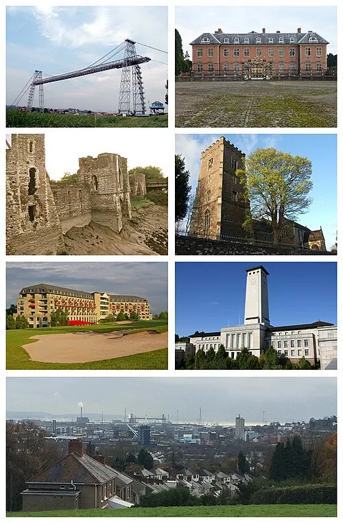 Newport City, Stow Hill7.4 km NE
-
Rogerstone Municipality, City of Newport6.8 km N
-
Ringland Municipality, City of Newport11 km NE
-
Graig Municipality, City of Newport4.9 km N
-
Gaer Municipality, City of Newport5.2 km NE
-
Allt-yr-Yn Municipality, City of Newport6.8 km NE
Sources & licences
Data last updated: