- Elevation
- 180 m
- above sea level
- Local time
- UTC+00:00
- Europe/London · UTC+00:00
- Airports
- LPL Liverpool John Lennon Airport101 km
- IOM Isle of Man Airport129 km
About Bryniau Ystumcegid
Bryniau Ystumcegid is a mountain. Location: Dolbenmaen, Gwynedd. Elevation: 180 m. The best months to visit are June–September. The nearest airport is Liverpool John Lennon Airport (101 km). Nearby sights include Bryn Braich-y-saint and Dolbenmaen Castle.
Photos of Bryniau Ystumcegid
-
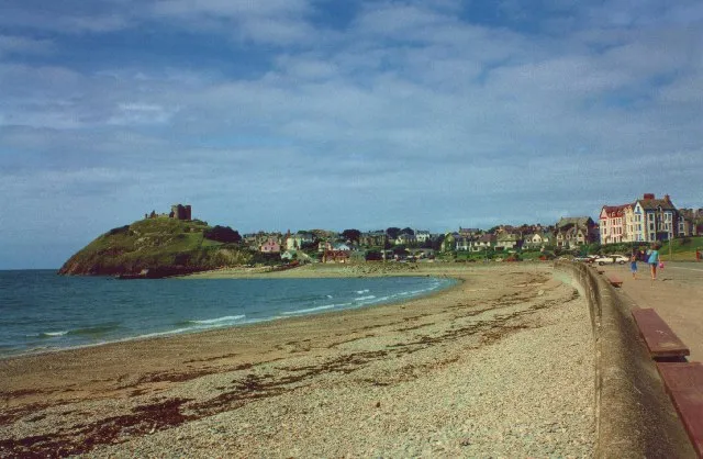
Criccieth Beach Bob Embleton · CC BY-SA 2.0 -
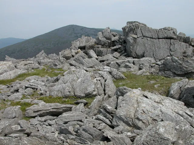
Mynydd Graig Goch Philip Halling · CC BY-SA 2.0 -
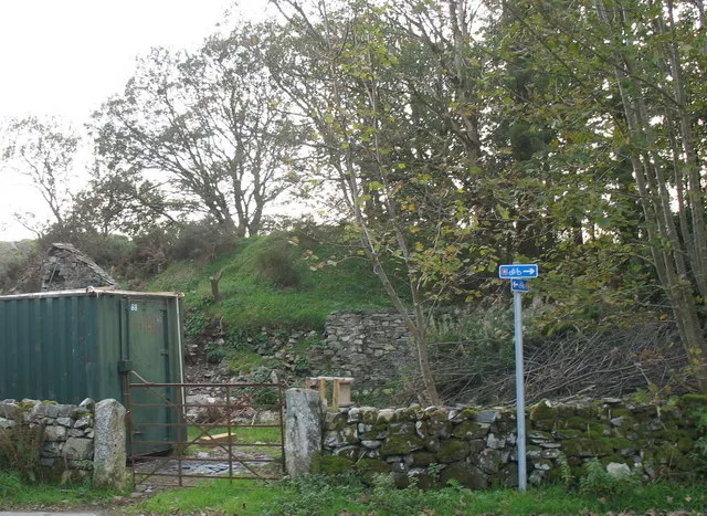
Dolbenmaen Castle Eric Jones · CC BY-SA 2.0 -
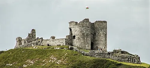
Criccieth Castle Barry Skeates from newbury, UK · CC BY 2.0


Climate of Bryniau Ystumcegid
Best months for sightseeingBest months for sightseeing: June–September.
This month · November
A wet month
Day 10° · Night 5° · Rain 129 mm
- Hottest month
- July (day 18°)
- Coldest month
- February (night 2°)
- Wettest month
- November (129 mm)
- Driest month
- May (62 mm)
Bars: average monthly low and high temperature. Below: precipitation. Monthly averages for 1970–2000 at about 18 km resolution, adjusted for elevation. Highlighted months are mild and relatively dry. Source: WorldClim 2.1 (CC BY 4.0).
Show values as a table
| Month | Jan | Feb | Mar | Apr | May | Jun | Jul | Aug | Sep | Oct | Nov | Dec |
|---|---|---|---|---|---|---|---|---|---|---|---|---|
| Average high (°C) | 7° | 7° | 9° | 11° | 14° | 17° | 18° | 18° | 16° | 13° | 10° | 8° |
| Average low (°C) | 2° | 2° | 3° | 4° | 7° | 9° | 11° | 11° | 10° | 8° | 5° | 3° |
| Precipitation (mm) | 108 | 80 | 94 | 67 | 62 | 70 | 72 | 89 | 97 | 119 | 129 | 119 |
Other places to visit in this season: June July August September
How to get to Bryniau Ystumcegid
The nearest airport is Liverpool John Lennon Airport (LPL), 101 km to the northeast as the crow flies. The nearest large city is Birkenhead, 95 km to the northeast.
Airports
- Liverpool John Lennon Airport (LPL) Liverpool 101 kmnortheast
- Isle of Man Airport (IOM) Castletown, Rushen 129 kmnorth
- Manchester Airport (MAN) Manchester, Greater Manchester 137 kmeast
Nearby large cities
- Birkenhead Population: 325.3K 95 kmnortheast
- Liverpool Population: 496.8K 98 kmnortheast
- St Helens Population: 183.2K 114 kmnortheast
- Warrington Population: 172.3K 120 kmnortheast
- Telford Population: 155.6K 124 kmeast
Straight-line distances; road distances are longer. Airport data: OurAirports.
Day trips from Bryniau Ystumcegid
Within 100 km: 387 historic and cultural sites, 1,781 natural sites, 158 lakes, rivers and coasts.
0–25 km289 places
- Ynys Tywyn Island 7 kmSE
- Saint Tudwals Island West Island 24 kmSW
- Saint Tudwals Islands Island 24 kmSW
- Saint Tudwals Island East Island 23 kmSW
25–60 km853 places
- Anglesey Island 37 kmN
- Whistling Sands Beach 36 kmW
- Traeth Penllech Beach 31 kmW
- Porth Towyn Beach Beach 28 kmW
60–100 km1,184 places
- Poppit Sands Beach 99 kmS
- Mwnt beach Beach 95 kmS
- Tresaith Beach Beach 93 kmS
- Llangrannog's Beach Beach 90 kmS
Straight-line distances.
Nearest towns and villages
-
 Criccieth Village, Criccieth3.7 km S
-
Garndolbenmaen Village, Dolbenmaen2.5 km NW
-
Dolbenmaen Village, Dolbenmaen1.3 km N
-
Golan Village, Dolbenmaen2 km E
-
Llanfihangel-y-pennant Village, Dolbenmaen2.3 km NE
-
Pentrefelin Village, Dolbenmaen2.8 km SE
Nearby attractions & nature
Everything nearby-
Bryn Braich-y-saint Mountain, Dolbenmaen1.6 km SE
-
Dolbenmaen Castle Historic site, Dolbenmaen1.2 km N
-
Craig-y-garn Mountain, Dolbenmaen2.6 km N
-
Moel y Gadair Mountain, Dolbenmaen3.1 km SE
-
Criccieth Beach Beach, Criccieth3.8 km S
-
Craig y Gesail Mountain, Dolbenmaen3.9 km E
-
Moel Isallt Mountain, Dolbenmaen4.1 km NE
-
Criccieth Castle Mountain, Criccieth4.2 km S
More nature in United Kingdom
-
Mynydd Graig Goch Mountain, Dolbenmaen6.7 km N
-
Y Fedw Mountain, Dolbenmaen5.2 km E
-
Foel yr Erw Mountain, Dolbenmaen5.4 km E
-
Mynydd Cennin Mountain, Dolbenmaen5.7 km NW
-
Ffridd Bach Mountain, Dolbenmaen7.2 km E
-
Pen y Garn Mountain, Dolbenmaen7.6 km E
Sources & licences
Data last updated: