- Elevation
- 1 m
- above sea level
- Local time
- UTC+00:00
- Europe/London · UTC+00:00
- Airports
- CWL Cardiff International Airport133 km
- NQY Cornwall Airport Newquay142 km
About Westdale Bay
Westdale Bay is a natural site. Location: Dale, Pembrokeshire. The best months to visit are June–September. The nearest airport is Cardiff International Airport (133 km). Nearby sights include Dale Castle and Great Castle Head.
Photos of Westdale Bay
-
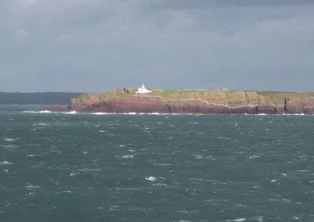
Skokholm Island Nigel Cox · CC BY-SA 2.0 -
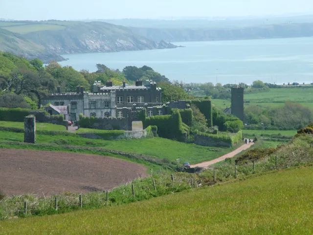
Dale Castle Dara Jasumani · CC BY-SA 2.0


Climate of Westdale Bay
Best months for sightseeingBest months for sightseeing: June–September.
This month · November
A wet month
Day 11° · Night 7° · Rain 107 mm
- Hottest month
- August (day 19°)
- Coldest month
- February (night 4°)
- Wettest month
- November (107 mm)
- Driest month
- May (47 mm)
Bars: average monthly low and high temperature. Below: precipitation. Monthly averages for 1970–2000 at about 18 km resolution, adjusted for elevation. Highlighted months are mild and relatively dry. Source: WorldClim 2.1 (CC BY 4.0).
Show values as a table
| Month | Jan | Feb | Mar | Apr | May | Jun | Jul | Aug | Sep | Oct | Nov | Dec |
|---|---|---|---|---|---|---|---|---|---|---|---|---|
| Average high (°C) | 9° | 8° | 9° | 11° | 14° | 16° | 18° | 19° | 17° | 14° | 11° | 10° |
| Average low (°C) | 5° | 4° | 5° | 6° | 8° | 11° | 13° | 13° | 12° | 10° | 7° | 6° |
| Precipitation (mm) | 93 | 69 | 68 | 53 | 47 | 57 | 50 | 74 | 73 | 99 | 107 | 98 |
Other places to visit in this season: June July August September
How to get to Westdale Bay
The nearest airport is Cardiff International Airport (CWL), 133 km to the east as the crow flies. The nearest large city is Swansea, 87 km to the east.
Airports
- Cardiff International Airport (CWL) Cardiff 133 kmeast
- Cornwall Airport Newquay (NQY) Newquay 142 kmsouth
- Exeter International Airport (EXT) Exeter, Devon 165 kmsoutheast
Nearby large cities
- Swansea Population: 300.4K 87 kmeast
- Cardiff Population: 372.1K 141 kmeast
- Newport Population: 161.5K 152 kmeast
- Exeter Population: 130.7K 160 kmsoutheast
- Plymouth Population: 260.2K 166 kmsoutheast
Straight-line distances; road distances are longer. Airport data: OurAirports.
Day trips from Westdale Bay
Within 100 km: 246 historic and cultural sites, 570 natural sites, 109 lakes, rivers and coasts.
0–25 km154 places
- St Justinian Natural site 21 kmNW
- Porth Clais Natural site 19 kmN
- Port Selau Natural site 21 kmN
- Broad Haven South Beach Beach 22 kmSE
25–60 km231 places
- Poppit Sands Beach 56 kmNE
- Manorbier Beach Beach 28 kmE
- North Bishop Island 26 kmNW
- The Smalls Island 33 kmW
60–100 km540 places
- Saunton Sands Beach 95 kmSE
- Mouthmill Beach Beach 94 kmSE
- Putsborough Beach Beach 92 kmSE
- Mwnt beach Beach 61 kmNE
Straight-line distances.
Nearest towns and villages
-
Dale Village, Dale1.1 km E
-
St Ann's Head Village, Dale2.8 km S
-
Marloes Village, Marloes and St. Brides2.5 km N
-
Marloes and St. Brides Municipality, Pembrokeshire4 km N
-
Saint Ishmael’s Village, St. Ishmael's3.9 km NE
-
St. Ishmael's Municipality, Pembrokeshire4.3 km NE
Nearby attractions & nature
Everything nearby-
Dale Castle Historic site, Dale0.7 km E
-
Great Castle Head Historic site, Dale0.2 km SE
-
Welshman's Bay Natural site, United Kingdom1.3 km S
-
Brunt Farm Hill Mountain, Dale2.1 km SE
-
Frenchman's Bay Natural site, Dale2.2 km S
-
Marloes Beacon Mountain, Marloes and St. Brides2.9 km NW
-
Castlebeach Bay Natural site, Dale2.6 km E
-
Watwick Bay Natural site, United Kingdom2.7 km SE
Sources & licences
Data last updated: