Rudbaxton Rath
Located in Rudbaxton, Pembrokeshire Coordinates: 51°49′55″ N 4°55′31″ W
- Local time
- UTC+00:00
- Europe/London · UTC+00:00
- Elevation
- 70 m
- above sea level
- Airports
- CWL Cardiff International Airport120 km
- NQY Cornwall Airport Newquay155 km
About Rudbaxton Rath
Rudbaxton Rath is a historic site. Location: Rudbaxton, Pembrokeshire.
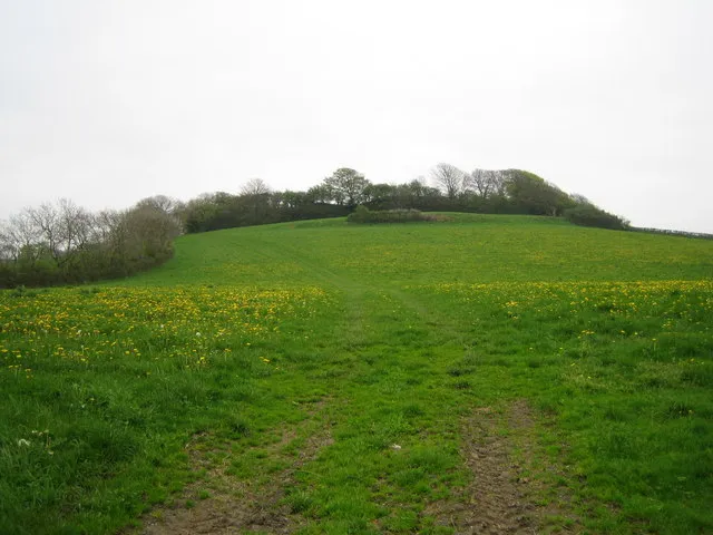
Rudbaxton Rath is a ring-shaped enclosure together with a ringed keep in the parish of Rudbaxton, Pembrokeshire, Wales. It is situated roughly 1.54 km northeast of Crundale and about 2.39 km east of Haverfordwest Aerodrome. It is the remains of an Iron Age defensive ringfort, hillfort or castle, probably made of timber. At the site are the remains of light earthwork. The nearly circular interior area is surrounded by a counterscarp and measures around 100 metres north to south by 95 metres east to west.
Source: Wikipedia · CC BY-SA 4.0
At a glance
- Heritage designation
- National Monument of Wales
Source: Wikidata
Photos of Rudbaxton Rath
-
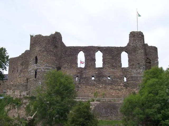
Haverfordwest Castle Cered · CC BY-SA 2.0 -
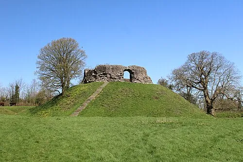
Wiston Castle Lucy Sheers · CC BY-SA 4.0 -
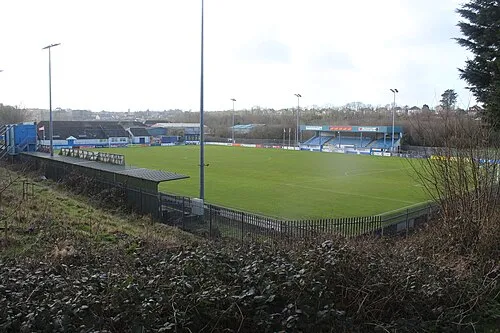
Bridge Meadow Stadium M J Roscoe · CC BY-SA 2.0


Climate of Rudbaxton Rath
Best months for sightseeingBest months for sightseeing: June–September.
This month · November
A wet month
Day 11° · Night 7° · Rain 111 mm
- Hottest month
- August (day 19°)
- Coldest month
- February (night 4°)
- Wettest month
- November (111 mm)
- Driest month
- May (55 mm)
Bars: average monthly low and high temperature. Below: precipitation. Monthly averages for 1970–2000 at about 18 km resolution, adjusted for elevation. Highlighted months are mild and relatively dry. Source: WorldClim 2.1 (CC BY 4.0).
Show values as a table
| Month | Jan | Feb | Mar | Apr | May | Jun | Jul | Aug | Sep | Oct | Nov | Dec |
|---|---|---|---|---|---|---|---|---|---|---|---|---|
| Average high (°C) | 8° | 8° | 9° | 12° | 14° | 17° | 19° | 19° | 17° | 14° | 11° | 9° |
| Average low (°C) | 4° | 4° | 4° | 5° | 8° | 10° | 13° | 13° | 11° | 9° | 7° | 5° |
| Precipitation (mm) | 97 | 71 | 75 | 59 | 55 | 65 | 58 | 81 | 81 | 106 | 111 | 102 |
Other places to visit in this season: June July August September
How to get to Rudbaxton Rath
The nearest airport is Cardiff International Airport (CWL), 120 km to the southeast as the crow flies. The nearest large city is Swansea, 72 km to the east.
Airports
- Cardiff International Airport (CWL) Cardiff 120 kmsoutheast
- Cornwall Airport Newquay (NQY) Newquay 155 kmsouth
- Bristol Airport (BRS) Bristol 161 kmeast
Nearby large cities
- Swansea Population: 300.4K 72 kmeast
- Cardiff Population: 372.1K 127 kmeast
- Newport Population: 161.5K 136 kmeast
- Exeter Population: 130.7K 157 kmsoutheast
- Bristol Population: 479K 167 kmeast
Straight-line distances; road distances are longer. Airport data: OurAirports.
Day trips from Rudbaxton Rath
Within 100 km: 291 historic and cultural sites, 862 natural sites, 118 lakes, rivers and coasts.
0–25 km252 places
- Porth Clais Natural site 25 kmW
- Manorbier Beach Beach 23 kmS
- Broad Haven South Beach Beach 25 kmS
- Caerfai Beach Beach 23 kmW
25–60 km332 places
- St Justinian Natural site 27 kmW
- Port Selau Natural site 27 kmW
- Poppit Sands Beach 34 kmNE
- Porthlisky Beach Beach 26 kmW
60–100 km687 places
- Saunton Sands Beach 95 kmSE
- Mouthmill Beach Beach 97 kmS
- Putsborough Beach Beach 91 kmSE
- Rat Island Island 78 kmS
Straight-line distances.
Nearby attractions & nature
Everything nearby-
Wiston Castle Historic site, Wiston3.8 km E
-
Great Rudbaxton Mount Historic site, Rudbaxton3 km NW
-
Bridge Meadow Stadium Landmark, Haverfordwest3.9 km SW
-
Haverfordwest Castle Historic site, Haverfordwest4.5 km SW
-
Haverfordwest County Landmark, Haverfordwest4 km SW
-
Quay Street Landmark, Haverfordwest4.5 km SW
-
Camrose Castle Historic site, Camrose6 km W
-
Wiston Castle Mountain, Wiston3.5 km E
Nearest towns and villages
-
Crundale Village, Rudbaxton1.8 km SW
-
Poyston Cross Village, Rudbaxton0.9 km NW
-
Haverfordwest City, Haverfordwest4.5 km SW
-
New Bridge Village, Wiston1 km NE
Sources & licences
Data last updated: · 2 independent sources