- Local time
- UTC+00:00
- Europe/London · UTC+00:00
- Elevation
- 244 m
- above sea level
- Airports
- LPL Liverpool John Lennon Airport96 km
- BHX Birmingham Airport102 km
About Gwenthriew Enclosure
Gwenthriew Enclosure is a historic site. Location: Kerry, Powys. The best months to visit are June–August. The nearest airport is Liverpool John Lennon Airport (96 km). Nearby sights include Tomen Madoc Motte and The Moat; Kerry.
At a glance
- Heritage designation
- scheduled monument, National Monument of Wales
Source: Wikidata
Photos of Gwenthriew Enclosure
-
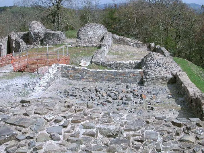
Dolforwyn Castle user Llywelyn2000 · CC BY-SA 3.0 -
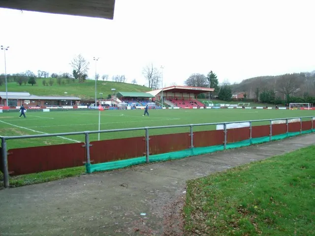
Latham Park David Luther Thomas · CC BY-SA 2.0


Climate of Gwenthriew Enclosure
Best months for sightseeingBest months for sightseeing: June–August.
This month · November
A wet month
Day 9° · Night 3° · Rain 112 mm
- Hottest month
- July (day 19°)
- Coldest month
- February (night 0°)
- Wettest month
- December (118 mm)
- Driest month
- July (61 mm)
Bars: average monthly low and high temperature. Below: precipitation. Monthly averages for 1970–2000 at about 18 km resolution, adjusted for elevation. Highlighted months are mild and relatively dry. Source: WorldClim 2.1 (CC BY 4.0).
Show values as a table
| Month | Jan | Feb | Mar | Apr | May | Jun | Jul | Aug | Sep | Oct | Nov | Dec |
|---|---|---|---|---|---|---|---|---|---|---|---|---|
| Average high (°C) | 6° | 6° | 8° | 11° | 15° | 17° | 19° | 19° | 16° | 13° | 9° | 7° |
| Average low (°C) | 0° | 0° | 2° | 3° | 5° | 8° | 10° | 10° | 8° | 6° | 3° | 1° |
| Precipitation (mm) | 114 | 81 | 89 | 67 | 62 | 70 | 61 | 79 | 88 | 100 | 112 | 118 |
How to get to Gwenthriew Enclosure
The nearest airport is Liverpool John Lennon Airport (LPL), 96 km to the north as the crow flies. The nearest large city is Telford, 57 km to the east.
Airports
- Liverpool John Lennon Airport (LPL) Liverpool 96 kmnorth
- Birmingham Airport (BHX) Birmingham, West Midlands 102 kmeast
- Manchester Airport (MAN) Manchester, Greater Manchester 114 kmnortheast
Nearby large cities
- Telford Population: 155.6K 57 kmeast
- Wolverhampton Population: 263.7K 76 kmeast
- Worcester Population: 101.7K 78 kmsoutheast
- Dudley Population: 199.1K 79 kmeast
- West Bromwich Population: 103.1K 85 kmeast
Straight-line distances; road distances are longer. Airport data: OurAirports.
Day trips from Gwenthriew Enclosure
Within 100 km: 912 historic and cultural sites, 2,740 natural sites, 178 lakes, rivers and coasts.
0–25 km411 places
- Rhydd Hywel Mountain 17 kmSW
- Beacon Hill Mountain 14 kmS
- Stiperstones Mountain 22 kmE
- Pegwn Mawr Mountain 17 kmSW
25–60 km1,578 places
- The Island Island 45 kmSE
- Ynys Goediog Island 58 kmNW
- Lake Vyrnwy Lake 37 kmNW
- Pen-y-gareg Reservoir Lake 35 kmSW
60–100 km1,841 places
- Tresaith Beach Beach 96 kmSW
- Llangrannog's Beach Beach 92 kmSW
- Thurstaston Beach Beach 92 kmN
- Ynys Tywyn Island 76 kmNW
Straight-line distances.
Nearby attractions & nature
Everything nearby-
Tomen Madoc Motte Historic site, Kerry1.3 km W
-
The Moat; Kerry Historic site, Kerry1.9 km SW
-
Weston Mountain, Kerry1.7 km W
-
Glan Hafren Ringwork Historic site, Newtown and Llanllwchaiarn2.9 km NW
-
Dolforwyn Castle Historic site, Llandyssil4.2 km N
-
Newtown Mediumwave Transmitter Landmark, Newtown and Llanllwchaiarn2.6 km W
-
Penygelli Mountain, Kerry2.1 km E
-
Gro Tump Motte Historic site, Newtown and Llanllwchaiarn3.8 km W
Nearest towns and villages
Sources & licences
Data last updated: · 2 independent sources