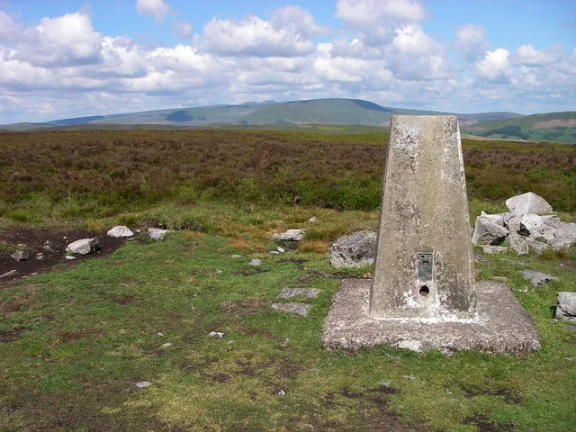
- Elevation
- 557 m
- above sea level
- Local time
- UTC+00:00
- Europe/London · UTC+00:00
- Airports
- CWL Cardiff International Airport47 km
- BRS Bristol Airport64 km
About Mynydd Llangynidr
Mynydd Llangynidr is a mountain. Location: Llangynidr, Powys. Elevation: 557 m.
Mynydd Llangynidr is a mountain in the Brecon Beacons National Park largely in the county of Powys, south Wales. Its southern slopes extend into the northernmost parts of the county borough of Blaenau Gwent. It is named from the village of Llangynidr which sits in the valley of the River Usk to the north of it. It is essentially an undulating plateau rising in the west to a height of 557m at Garn Fawr at OS grid ref SO 123151. A secondary high point is achieved at a point marked by a trig point at SO 147159.
Source: Wikipedia · CC BY-SA 4.0
At a glance
- Topographic prominence
- 102 m
Source: Wikidata
Photos of Mynydd Llangynidr
-

Alan Hughes · CC BY-SA 2.0 -

Alan Hughes · CC BY-SA 2.0 -
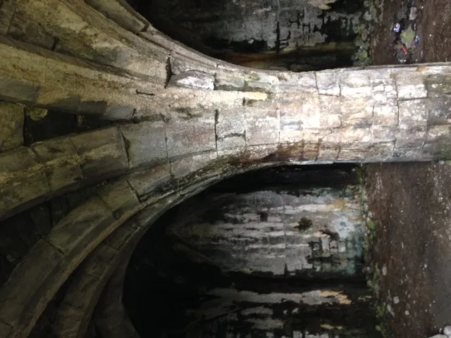
Morlais Castle Gibbinskaren · CC BY-SA 4.0


Climate of Mynydd Llangynidr
Best months for sightseeingBest months for sightseeing: July–August.
This month · November
A wet month
Day 7° · Night 2° · Rain 155 mm
- Hottest month
- July (day 18°)
- Coldest month
- February (night -1°)
- Wettest month
- December (161 mm)
- Driest month
- July (76 mm)
Bars: average monthly low and high temperature. Below: precipitation. Monthly averages for 1970–2000 at about 18 km resolution, adjusted for elevation. Highlighted months are mild and relatively dry. Source: WorldClim 2.1 (CC BY 4.0).
Show values as a table
| Month | Jan | Feb | Mar | Apr | May | Jun | Jul | Aug | Sep | Oct | Nov | Dec |
|---|---|---|---|---|---|---|---|---|---|---|---|---|
| Average high (°C) | 4° | 4° | 7° | 9° | 13° | 16° | 18° | 17° | 15° | 11° | 7° | 5° |
| Average low (°C) | -1° | -1° | 0° | 1° | 4° | 7° | 10° | 10° | 8° | 5° | 2° | 1° |
| Precipitation (mm) | 160 | 114 | 121 | 87 | 85 | 86 | 76 | 105 | 121 | 137 | 155 | 161 |
How to get to Mynydd Llangynidr
The nearest airport is Cardiff International Airport (CWL), 47 km to the south as the crow flies. The nearest large city is Newport, 34 km to the southeast.
Airports
- Cardiff International Airport (CWL) Cardiff 47 kmsouth
- Bristol Airport (BRS) Bristol 64 kmsoutheast
- Exeter International Airport (EXT) Exeter, Devon 121 kmsouth
Nearby large cities
- Newport Population: 161.5K 34 kmsoutheast
- Cardiff Population: 372.1K 39 kmsouth
- Swansea Population: 300.4K 48 kmsouthwest
- Bristol Population: 479K 64 kmsoutheast
- Gloucester Population: 132.4K 74 kmeast
Straight-line distances; road distances are longer. Airport data: OurAirports.
Day trips from Mynydd Llangynidr
Within 100 km: 981 historic and cultural sites, 2,273 natural sites, 159 lakes, rivers and coasts.
0–25 km229 places
- Llangorse Lake Lake 13 kmN
- Talybont Reservoir Lake 5 kmN
- Pen y Fan Mountain 11 kmNW
- Sugar Loaf Mountain 19 kmE
25–60 km1,326 places
- Steep Holm Island 55 kmS
- Flat Holm Island 51 kmS
- Barry Island Island 47 kmS
- Sully Island Island 48 kmS
60–100 km1,858 places
- Putsborough Beach Beach 98 kmSW
- Kilve Beach Beach 70 kmS
- Mwnt beach Beach 98 kmW
- Tresaith Beach Beach 90 kmNW
Straight-line distances.
Nearest towns and villages
-
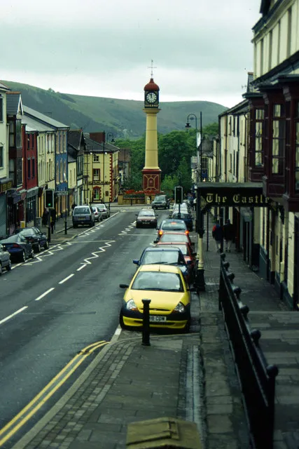 Tredegar Town, Tredegar6.9 km SE
-
Rhymney Town, Rhymney6.7 km S
-
Trefil Village, Tredegar3 km SE
-
Wern Village, Llangynidr4.3 km NE
-
Pont Sticill Village, Vaynor3.9 km SW
-
Tafarnaubach Neighbourhood, Tredegar4.3 km SE
Nearby attractions & nature
Everything nearby-
Cefn yr Ystrad Mountain, Llangynidr0.7 km W
-
Cwar yr Ystrad Mountain, Llangynidr1 km W
-
Twyn Ceiliog Mountain, Llangynidr1.3 km SE
-
Bryniau Gleision Mountain, Talybont-on-Usk2.4 km NW
-
Pant y Creigiau Mountain, Talybont-on-Usk4.3 km NW
-
Allt Forgan Mountain, Talybont-on-Usk4.7 km NW
-
Bryn Melyn Mountain, Llangynidr4.8 km N
-
Allt Lwyd Mountain, Talybont-on-Usk5.2 km N
Sources & licences
Data last updated: · 2 independent sources