- Elevation
- 552 m
- above sea level
- Local time
- UTC+00:00
- Europe/London · UTC+00:00
- Airports
- CWL Cardiff International Airport46 km
- BRS Bristol Airport63 km
About Twyn Ceiliog
Twyn Ceiliog is a mountain. Location: Llangynidr, Powys. Elevation: 552 m. The best months to visit are July–August. The nearest airport is Cardiff International Airport (46 km). Nearby sights include Mynydd Llangynidr and Cefn yr Ystrad.
Photos of Twyn Ceiliog
-
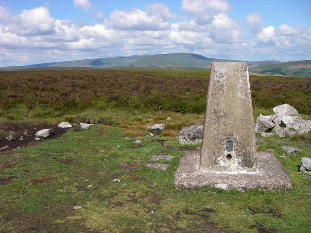
Mynydd Llangynidr Alan Bowring · CC BY-SA 2.0 -
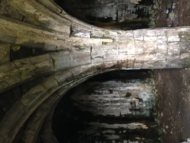
Morlais Castle Gibbinskaren · CC BY-SA 4.0


Climate of Twyn Ceiliog
Best months for sightseeingBest months for sightseeing: July–August.
This month · November
A wet month
Day 7° · Night 2° · Rain 155 mm
- Hottest month
- July (day 18°)
- Coldest month
- February (night -1°)
- Wettest month
- December (161 mm)
- Driest month
- July (76 mm)
Bars: average monthly low and high temperature. Below: precipitation. Monthly averages for 1970–2000 at about 18 km resolution, adjusted for elevation. Highlighted months are mild and relatively dry. Source: WorldClim 2.1 (CC BY 4.0).
Show values as a table
| Month | Jan | Feb | Mar | Apr | May | Jun | Jul | Aug | Sep | Oct | Nov | Dec |
|---|---|---|---|---|---|---|---|---|---|---|---|---|
| Average high (°C) | 4° | 4° | 7° | 9° | 13° | 16° | 18° | 17° | 15° | 11° | 7° | 5° |
| Average low (°C) | -1° | -1° | 0° | 1° | 4° | 7° | 10° | 10° | 8° | 5° | 2° | 1° |
| Precipitation (mm) | 160 | 114 | 121 | 87 | 85 | 86 | 76 | 105 | 121 | 137 | 155 | 161 |
How to get to Twyn Ceiliog
The nearest airport is Cardiff International Airport (CWL), 46 km to the south as the crow flies. The nearest large city is Newport, 32 km to the southeast.
Airports
- Cardiff International Airport (CWL) Cardiff 46 kmsouth
- Bristol Airport (BRS) Bristol 63 kmsoutheast
- Exeter International Airport (EXT) Exeter, Devon 119 kmsouth
Nearby large cities
- Newport Population: 161.5K 32 kmsoutheast
- Cardiff Population: 372.1K 37 kmsouth
- Swansea Population: 300.4K 48 kmsouthwest
- Bristol Population: 479K 63 kmsoutheast
- Gloucester Population: 132.4K 74 kmeast
Straight-line distances; road distances are longer. Airport data: OurAirports.
Day trips from Twyn Ceiliog
Within 100 km: 979 historic and cultural sites, 2,259 natural sites, 160 lakes, rivers and coasts.
0–25 km227 places
- Llangorse Lake Lake 14 kmN
- Talybont Reservoir Lake 6 kmN
- Pen y Fan Mountain 12 kmNW
- Sugar Loaf Mountain 18 kmE
25–60 km1,306 places
- Steep Holm Island 54 kmS
- Flat Holm Island 49 kmS
- Barry Island Island 46 kmS
- Sully Island Island 46 kmS
60–100 km1,865 places
- Putsborough Beach Beach 97 kmSW
- Kilve Beach Beach 69 kmS
- Mwnt beach Beach 99 kmW
- Tresaith Beach Beach 91 kmNW
Straight-line distances.
Nearest towns and villages
-
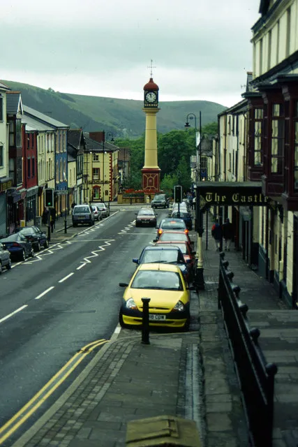 Tredegar Town, Tredegar5.7 km SE
-
Rhymney Town, Rhymney5.4 km S
-
Trefil Village, Tredegar2.2 km E
-
Tafarnaubach Neighbourhood, Tredegar3.1 km SE
-
Princetown Neighbourhood, Rhymney3.1 km SE
-
Llechryd Village, Rhymney3.4 km S
Nearby attractions & nature
Everything nearby-
Mynydd Llangynidr Mountain, Llangynidr1.3 km NW
-
Cefn yr Ystrad Mountain, Llangynidr1.5 km NW
-
Cwar yr Ystrad Mountain, Llangynidr2.1 km NW
-
Bryniau Gleision Mountain, Talybont-on-Usk3.7 km NW
-
Rhymney Hill Mountain, Tredegar4.7 km SE
-
Bryn-serth Mountain, Beaufort5.3 km E
-
Pant y Creigiau Mountain, Talybont-on-Usk5.5 km NW
-
Morlais Hill Mountain, Pant5.7 km SW
Sources & licences
Data last updated: