- Local time
- UTC+00:00
- Europe/London · UTC+00:00
- Elevation
- 91 m
- above sea level
- Airports
- LPL Liverpool John Lennon Airport35 km
- MAN Manchester Airport60 km
About Erddig Motte and Bailey Castle
Erddig Motte and Bailey Castle is a historic site. Location: Marchwiel, Wrexham. The best months to visit are June–August. The nearest airport is Liverpool John Lennon Airport (35 km). Nearby sights include Racecourse Ground and Hafod y Bwch.
Photos of Erddig Motte and Bailey Castle
-
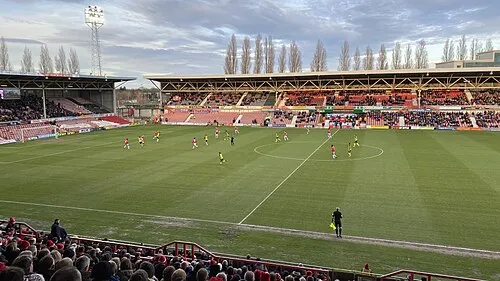
Racecourse Ground John Lord from Edinburgh, Scotland · CC BY 2.0

Climate of Erddig Motte and Bailey Castle
Best months for sightseeingBest months for sightseeing: June–August.
This month · November
A wet month
Day 10° · Night 4° · Rain 100 mm
- Hottest month
- July (day 20°)
- Coldest month
- February (night 1°)
- Wettest month
- November (100 mm)
- Driest month
- July (60 mm)
Bars: average monthly low and high temperature. Below: precipitation. Monthly averages for 1970–2000 at about 18 km resolution, adjusted for elevation. Highlighted months are mild and relatively dry. Source: WorldClim 2.1 (CC BY 4.0).
Show values as a table
| Month | Jan | Feb | Mar | Apr | May | Jun | Jul | Aug | Sep | Oct | Nov | Dec |
|---|---|---|---|---|---|---|---|---|---|---|---|---|
| Average high (°C) | 7° | 7° | 9° | 12° | 15° | 18° | 20° | 20° | 17° | 13° | 10° | 8° |
| Average low (°C) | 2° | 1° | 3° | 4° | 6° | 9° | 11° | 11° | 9° | 6° | 4° | 2° |
| Precipitation (mm) | 85 | 64 | 75 | 63 | 62 | 68 | 60 | 76 | 84 | 89 | 100 | 94 |
How to get to Erddig Motte and Bailey Castle
The nearest airport is Liverpool John Lennon Airport (LPL), 35 km to the north as the crow flies. The nearest large city is Birkenhead, 40 km to the north.
Airports
- Liverpool John Lennon Airport (LPL) Liverpool 35 kmnorth
- Manchester Airport (MAN) Manchester, Greater Manchester 60 kmnortheast
- Birmingham Airport (BHX) Birmingham, West Midlands 106 kmsoutheast
Nearby large cities
- Birkenhead Population: 325.3K 40 kmnorth
- Liverpool Population: 496.8K 42 kmnorth
- Warrington Population: 172.3K 49 kmnortheast
- St Helens Population: 183.2K 50 kmnorth
- Newcastle-under-Lyme Population: 127.7K 52 kmeast
Straight-line distances; road distances are longer. Airport data: OurAirports.
Day trips from Erddig Motte and Bailey Castle
Within 100 km: 767 historic and cultural sites, 2,245 natural sites, 202 lakes, rivers and coasts.
0–25 km196 places
- Newton Mere Lake 18 kmSE
- Crose Mere Lake 21 kmSE
- Sweat Mere Lake 21 kmSE
- Cyrn-y-Brain Mountain 12 kmW
25–60 km979 places
- Thurstaston Beach Beach 35 kmN
- Formby Beach Beach 60 kmN
- Hilbre Island Island 42 kmN
- Little Eye Island 40 kmN
60–100 km2,039 places
- Anglesey Island 93 kmW
- Traeth Lligwy Beach 92 kmNW
- Ainsdale Beach Beach 64 kmN
- St Anne's Beach Beach 80 kmN
Straight-line distances.
Nearby attractions & nature
Everything nearby-
Racecourse Ground Landmark, Rhosddu2.3 km N
-
Hafod y Bwch Historic site, Esclusham2.1 km SW
-
Bryn Moel Mediumwave Transmitter Landmark, Esclusham1.6 km NW
-
Plas Cadwgan Mound Historic site, Esclusham2.9 km W
-
Bersham Bank Mountain, Esclusham1.6 km W
-
Bryn-y-hafod Mountain, Esclusham2.3 km SW
-
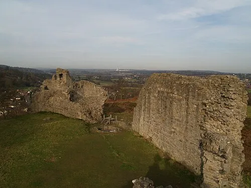 Caergwrle Castle Historic site, Hope8.8 km N
-
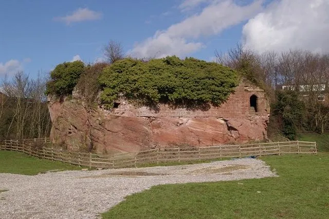 Holt Castle Historic site, Holt9.8 km NE
Nearest towns and villages
-
Wrexham City, Caia Park2 km NE
-
Marchwiel Village, Marchwiel3 km E
-
Sontley Village, Marchwiel1.4 km SE
-
Old Sontley Village, Marchwiel1.8 km S
Sources & licences
Data last updated: