- Population
- 7,514
- 7.5K
- Elevation
- 221 m
- above sea level
- Local time
- UTC+01:00
- Europe/Vienna · UTC+01:00
- Airports
- VIE Vienna International Airport42 km
- BTS M. R. Štefánik Airport76 km
About Walbersdorf
Walbersdorf is a town. Location: Mattersburg, Mattersburg District. Population: 7,514. Elevation: 221 m. The best months to visit are May–September. The nearest airport is Vienna International Airport (42 km). Nearby sights include Marzer Kogel and Gaisgraben Bach.
Climate of Walbersdorf
Best months for sightseeingBest months for sightseeing: May–September.
This month · November
A cold month
Day 8° · Night 1° · Rain 50 mm
- Hottest month
- July (day 26°)
- Coldest month
- January (night -4°)
- Wettest month
- June (82 mm)
- Driest month
- February (27 mm)
Bars: average monthly low and high temperature. Below: precipitation. Monthly averages for 1970–2000 at about 18 km resolution, adjusted for elevation. Highlighted months are mild and relatively dry. Source: WorldClim 2.1 (CC BY 4.0).
Show values as a table
| Month | Jan | Feb | Mar | Apr | May | Jun | Jul | Aug | Sep | Oct | Nov | Dec |
|---|---|---|---|---|---|---|---|---|---|---|---|---|
| Average high (°C) | 3° | 5° | 10° | 15° | 20° | 23° | 26° | 26° | 21° | 15° | 8° | 5° |
| Average low (°C) | -4° | -3° | 1° | 5° | 9° | 12° | 14° | 14° | 10° | 6° | 1° | -2° |
| Precipitation (mm) | 29 | 27 | 40 | 45 | 70 | 82 | 75 | 72 | 60 | 46 | 50 | 35 |
Other places to visit in this season: May June July August September
How to get to Walbersdorf
The nearest airport is Vienna International Airport (VIE), 42 km to the north as the crow flies. The nearest large city is Bratislava, 68 km to the northeast.
Airports
- Vienna International Airport (VIE) Vienna 42 kmnorth
- M. R. Štefánik Airport (BTS) Bratislava 76 kmnortheast
- Graz Airport (GRZ) Feldkirchen bei Graz 112 kmsouthwest
Nearby large cities
- Bratislava Population: 423.7K 68 kmnortheast
- Győr Population: 129.3K 91 kmeast
- Graz Population: 303.3K 105 kmsouthwest
- Székesfehérvár Population: 101.6K 162 kmeast
- Brno Population: 404.3K 162 kmnorth
Straight-line distances; road distances are longer. Airport data: OurAirports.
Day trips from Walbersdorf
Within 100 km: 509 historic and cultural sites, 1,431 natural sites, 418 lakes, rivers and coasts.
0–25 km70 places
- Neufelder See Lake 14 kmN
- St. Margarethener Seebad Lake 16 kmNE
- Weisjackel Mountain 20 kmW
- Stotzing Berg Mountain 19 kmNE
25–60 km1,055 places
- Donauinsel Island 49 kmN
- Vienna Forest Lake Lake 54 kmNW
- Steinsee Lake 46 kmN
- Schellensee Lake 43 kmN
60–100 km1,233 places
- Devínska Kobyla Mountain 66 kmNE
- Mirbach Palace Historic site 68 kmNE
- Bratislava Castle Historic site 68 kmNE
- Most SNP Landmark 67 kmNE
Straight-line distances.
Nearby attractions & nature
Everything nearby-
Marzer Kogel Mountain, Rohrbach bei Mattersburg2.8 km SE
-
Gaisgraben Bach River, Mattersburg3.4 km SW
-
Marzer Bach River, Burgenland2.8 km S
-
Reisnerkogel Mountain, Marz5.4 km SW
-
Krippelberg Mountain, Schattendorf6 km E
-
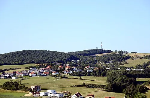 Brenntenriegel Mountain, Sieggraben9.5 km S
-
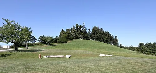 Heuberg Mountain, Forchtenstein9.9 km SW
-
Bihr Kogel Mountain, Wiesen9.1 km W
Sources & licences
Data last updated: