Zickenbach
Located in Güssing, Politischer Bezirk Güssing Coordinates: 47°03′45″ N 16°19′12″ E
- Elevation
- 215 m
- above sea level
- Local time
- UTC+01:00
- Europe/Vienna · UTC+01:00
- Airports
- GRZ Graz Airport67 km
- SOB Hévíz–Balaton Airport76 km
About Zickenbach
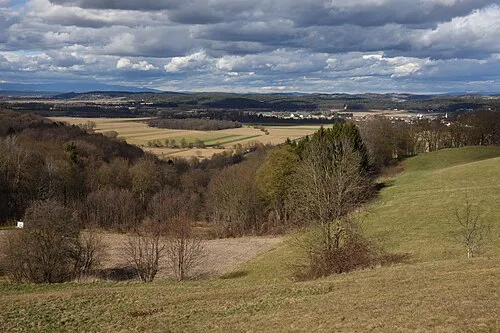
Zickenbach is a river. Location: Güssing, Politischer Bezirk Güssing. The best months to visit are May–September. The nearest airport is Graz Airport (67 km). Nearby sights include Hammelberg and Punitzer Wald.
Climate of Zickenbach
Best months for sightseeingBest months for sightseeing: May–September.
This month · November
A cold month
Day 8° · Night 0° · Rain 59 mm
- Hottest month
- July (day 25°)
- Coldest month
- January (night -4°)
- Wettest month
- June (98 mm)
- Driest month
- January (29 mm)
Bars: average monthly low and high temperature. Below: precipitation. Monthly averages for 1970–2000 at about 18 km resolution, adjusted for elevation. Highlighted months are mild and relatively dry. Source: WorldClim 2.1 (CC BY 4.0).
Show values as a table
| Month | Jan | Feb | Mar | Apr | May | Jun | Jul | Aug | Sep | Oct | Nov | Dec |
|---|---|---|---|---|---|---|---|---|---|---|---|---|
| Average high (°C) | 3° | 6° | 11° | 15° | 21° | 23° | 25° | 25° | 21° | 15° | 8° | 4° |
| Average low (°C) | -4° | -3° | 1° | 4° | 9° | 12° | 14° | 13° | 10° | 5° | 0° | -3° |
| Precipitation (mm) | 29 | 30 | 43 | 51 | 74 | 98 | 97 | 84 | 70 | 59 | 59 | 41 |
Other places to visit in this season: May June July August September
How to get to Zickenbach
The nearest airport is Graz Airport (GRZ), 67 km to the west as the crow flies. The nearest large city is Graz, 67 km to the west.
Airports
- Graz Airport (GRZ) Feldkirchen bei Graz 67 kmwest
- Hévíz–Balaton Airport (SOB) Sármellék 76 kmsoutheast
- Maribor Edvard Rusjan Airport (MBX) Maribor 81 kmsouthwest
Nearby large cities
- Graz Population: 303.3K 67 kmwest
- Győr Population: 129.3K 121 kmnortheast
- Bratislava Population: 423.7K 134 kmnortheast
- Zagreb Population: 663.6K 141 kmsouth
- Székesfehérvár Population: 101.6K 159 kmeast
Straight-line distances; road distances are longer. Airport data: OurAirports.
Day trips from Zickenbach
Within 100 km: 159 historic and cultural sites, 676 natural sites, 312 lakes, rivers and coasts.
0–25 km35 places
- Nesselbachberg Mountain 22 kmSW
- Zuberbach Mountain 23 kmN
- Tischlerberg Mountain 21 kmNW
- Lauten Berg Mountain 20 kmSW
25–60 km370 places
- Ščavnica River 60 kmS
- Waldteiche Lake 44 kmW
- Maierhofkogel Mountain 44 kmW
- Sengerberg Mountain 51 kmW
60–100 km742 places
- Pohorje Mountain 88 kmSW
- Ledava River 69 kmS
- Lake Ptuj Lake 81 kmSW
- Jezero Pernica Lake 69 kmSW
Straight-line distances.
Nearest towns and villages
-
Guessing City, Güssing0.5 km SE
-
Krottendorf bei Güssing Village, Güssing1 km W
-
Sankt Nikolaus im Burgenland Village, Güssing2 km SE
-
Tobaj Village, Tobaj2.8 km NW
-
Steingraben Village, Güssing3.5 km W
-
Glasing Village, Güssing3.5 km SE
Nearby attractions & nature
Everything nearby-
Hammelberg Mountain, Güssing5.2 km SE
-
Punitzer Wald Natural site, Tobaj5.6 km NE
-
Breg Mountain, Eberau9.5 km NE
-
Hohensteinmais Berg Mountain, Kohfidisch9.2 km N
-
Rittschein River, Styria13 km SW
-
Pfisterwald Natural site, Mogersdorf13 km SW
-
 Lafnitztal Natural site, Austria20 km NW
-
Teich Bach River, Mischendorf14 km N
Sources & licences
Data last updated: