Bad Pirawarth
Located in Politischer Bezirk Gänserndorf, Lower Austria Coordinates: 48°26′44″ N 16°35′27″ E
- Population
- 1,661
- 1.7K
- Elevation
- 200 m
- above sea level
- Local time
- UTC+01:00
- Europe/Vienna · UTC+01:00
- Places inside
- 3
- listed under Bad Pirawarth
- Airports
- VIE Vienna International Airport37 km
- BTS M. R. Štefánik Airport55 km
About Bad Pirawarth
Bad Pirawarth is a municipality. Location: Politischer Bezirk Gänserndorf, Lower Austria. Population: 1,661. Elevation: 200 m. The best months to visit are May–September. The nearest airport is Vienna International Airport (37 km). Nearby sights include Klein-Harras-Bach and Blumental.
Photos of Bad Pirawarth
-
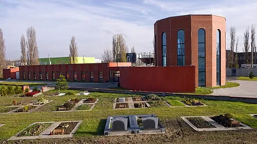
Blumental Peter Gugerell · Public domain

Climate of Bad Pirawarth
Best months for sightseeingBest months for sightseeing: May–September.
This month · November
A cold month
Day 7° · Night 2° · Rain 46 mm
- Hottest month
- July (day 26°)
- Coldest month
- January (night -3°)
- Wettest month
- July (77 mm)
- Driest month
- January (32 mm)
Bars: average monthly low and high temperature. Below: precipitation. Monthly averages for 1970–2000 at about 18 km resolution, adjusted for elevation. Highlighted months are mild and relatively dry. Source: WorldClim 2.1 (CC BY 4.0).
Show values as a table
| Month | Jan | Feb | Mar | Apr | May | Jun | Jul | Aug | Sep | Oct | Nov | Dec |
|---|---|---|---|---|---|---|---|---|---|---|---|---|
| Average high (°C) | 2° | 4° | 10° | 15° | 21° | 23° | 26° | 26° | 20° | 14° | 7° | 3° |
| Average low (°C) | -3° | -2° | 1° | 5° | 10° | 13° | 15° | 14° | 10° | 6° | 2° | -2° |
| Precipitation (mm) | 32 | 33 | 36 | 45 | 62 | 73 | 77 | 64 | 52 | 38 | 46 | 38 |
Other places to visit in this season: May June July August September
How to get to Bad Pirawarth
The nearest airport is Vienna International Airport (VIE), 37 km to the south as the crow flies. The nearest large city is Bratislava, 51 km to the southeast.
Airports
- Vienna International Airport (VIE) Vienna 37 kmsouth
- M. R. Štefánik Airport (BTS) Bratislava 55 kmsoutheast
- Brno-Tuřany Airport (BRQ) Brno 79 kmnorth
Nearby large cities
- Bratislava Population: 423.7K 51 kmsoutheast
- Brno Population: 404.3K 83 kmnorth
- Győr Population: 129.3K 115 kmsoutheast
- Linz Population: 204.8K 171 kmwest
- Graz Population: 303.3K 176 kmsouthwest
Straight-line distances; road distances are longer. Airport data: OurAirports.
Day trips from Bad Pirawarth
Within 100 km: 508 historic and cultural sites, 1,502 natural sites, 439 lakes, rivers and coasts.
0–25 km349 places
- Waldbad Lake 21 kmNW
- Haspelbühel Mountain 18 kmE
- Tradenberg Mountain 18 kmSW
- Streitberg Mountain 20 kmNE
25–60 km1,356 places
- Devínska Kobyla Mountain 41 kmSE
- Záruby Mountain 60 kmE
- Klokoč Mountain 53 kmE
- Chvojnica River 60 kmNE
60–100 km744 places
- Gassner Camel Riding School Natural site 100 kmW
- Ostrov Island 90 kmSE
- Blava River 81 kmE
- Zicksee Lake 77 kmS
Straight-line distances.
Places in Bad Pirawarth
3 placesBar: population relative to the most populous place in this list.
Mountains & nature1
- Atzenberg · Mountain
Nearby attractions & nature
Everything nearby-
Klein-Harras-Bach River, Lower Austria1.5 km E
-
Blumental Natural site, Lower Austria1.9 km W
-
Kuhleitenwald Natural site, Lower Austria2.2 km SW
-
Wachtberg Mountain, Gaweinstal3 km N
-
Wartberg Mountain, Groß-Schweinbarth3.1 km SE
-
Linaberg Mountain, Groß-Schweinbarth3.5 km S
-
Herrschaftswald Natural site, Lower Austria3.6 km SW
-
Mitterberg Mountain, Groß-Schweinbarth5 km S
Sources & licences
Data last updated: