Eulberg
Located in Sitzendorf an der Schmida, Politischer Bezirk Hollabrunn Coordinates: 48°36′38″ N 15°58′01″ E
- Elevation
- 326 m
- above sea level
- Local time
- UTC+01:00
- Europe/Vienna · UTC+01:00
- Airports
- VIE Vienna International Airport71 km
- BRQ Brno-Tuřany Airport80 km
About Eulberg
Eulberg is a mountain. Location: Sitzendorf an der Schmida, Politischer Bezirk Hollabrunn. Elevation: 326 m. The best months to visit are May–September. The nearest airport is Vienna International Airport (71 km). Nearby sights include Mühltal and Kasperlberg.
Photos of Eulberg
-
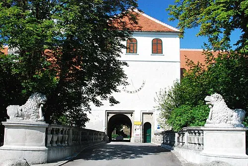
Schloss Ludwigstorff GuentherZ · CC BY 3.0

Climate of Eulberg
Best months for sightseeingBest months for sightseeing: May–September.
This month · November
A cold month
Day 7° · Night 0° · Rain 40 mm
- Hottest month
- August (day 25°)
- Coldest month
- January (night -4°)
- Wettest month
- June (78 mm)
- Driest month
- January (23 mm)
Bars: average monthly low and high temperature. Below: precipitation. Monthly averages for 1970–2000 at about 18 km resolution, adjusted for elevation. Highlighted months are mild and relatively dry. Source: WorldClim 2.1 (CC BY 4.0).
Show values as a table
| Month | Jan | Feb | Mar | Apr | May | Jun | Jul | Aug | Sep | Oct | Nov | Dec |
|---|---|---|---|---|---|---|---|---|---|---|---|---|
| Average high (°C) | 2° | 4° | 9° | 15° | 20° | 22° | 25° | 25° | 20° | 13° | 7° | 3° |
| Average low (°C) | -4° | -3° | 0° | 3° | 8° | 12° | 13° | 13° | 9° | 5° | 0° | -3° |
| Precipitation (mm) | 23 | 25 | 30 | 40 | 58 | 78 | 76 | 60 | 44 | 32 | 40 | 30 |
Other places to visit in this season: May June July August September
How to get to Eulberg
The nearest airport is Vienna International Airport (VIE), 71 km to the southeast as the crow flies. The nearest large city is Brno, 80 km to the northeast.
Airports
- Vienna International Airport (VIE) Vienna 71 kmsoutheast
- Brno-Tuřany Airport (BRQ) Brno 80 kmnortheast
- M. R. Štefánik Airport (BTS) Bratislava 104 kmsoutheast
Nearby large cities
- Brno Population: 404.3K 80 kmnortheast
- Bratislava Population: 423.7K 99 kmsoutheast
- Linz Population: 204.8K 129 kmwest
- Győr Population: 129.3K 161 kmsoutheast
- Graz Population: 303.3K 176 kmsouth
Straight-line distances; road distances are longer. Airport data: OurAirports.
Day trips from Eulberg
Within 100 km: 518 historic and cultural sites, 1,999 natural sites, 478 lakes, rivers and coasts.
0–25 km325 places
- Spielberg Mountain 14 kmSW
- Hausberg Mountain 14 kmS
- Goldberg Mountain 17 kmSW
- Eisenhut Mountain 17 kmSW
25–60 km1,413 places
- Waldsee Lake 28 kmS
- Vienna Forest Lake Lake 49 kmS
- Steinsee Lake 57 kmSE
- Schellensee Lake 60 kmSE
60–100 km1,257 places
- Královský vršek Mountain 94 kmN
- Gassner Camel Riding School Natural site 64 kmSW
- Devínska Kobyla Mountain 89 kmSE
- Chvojnica River 91 kmE
Straight-line distances.
Nearest towns and villages
-
Sitzenhart Village, Sitzendorf an der Schmida0.8 km E
-
Sitzendorf an der Schmida Village, Sitzendorf an der Schmida2.3 km SW
-
Pranhartsberg Village, Sitzendorf an der Schmida1.7 km SE
-
Goggendorf Village, Sitzendorf an der Schmida2.6 km W
-
Obergrabern Village, Grabern2.1 km E
-
Kleinkirchberg Village, Sitzendorf an der Schmida3.1 km SW
Nearby attractions & nature
Everything nearby-
Mühltal Natural site, Lower Austria0.8 km S
-
Kasperlberg Mountain, Sitzendorf an der Schmida1 km NW
-
Geißbühel Mountain, Sitzendorf an der Schmida1.1 km NW
-
Holzberg Mountain, Sitzendorf an der Schmida2.2 km S
-
Goldberg Mountain, Sitzendorf an der Schmida2.2 km NW
-
Dorfberg Mountain, Grabern2.3 km NE
-
Verlorenes Tal Natural site, Lower Austria3 km NW
-
Maiholz Natural site, Lower Austria2.4 km SE
Sources & licences
Data last updated: